 Hiking
 Login
Login
 More
More
 EN
EN
 Premium
Durmeboorden hiking trail
automatic translation
8.8 km • Zele
 official route
4.3423 8 3.6/5
 Addresse starting point (approximate)
Dorpsplein, 9240 Durmen
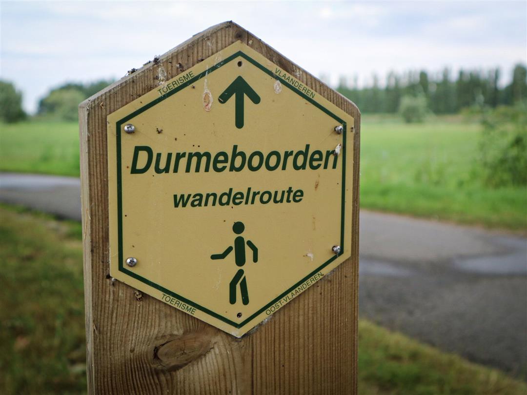
 signage
The route is fully signposted with thematic signs (no nodes).
 Description
Enjoy art and nature along the Durmeboorden in Durmen (Zele) and Sint-Anna (Hamme). Along the entire route there are signs with works by artist André Bogaert. Pictograms on the map indicate the location of the signs.
The Durmeboorden walking route is offered to you by Routen, an initiative of Tourism East Flanders.
automatic translation
Wednesday, July 22, 2026 by Miguel BoriauA nice walk. The scenery can be a bit monotonous at times.
It’s a shame, though, that you have to watch out so carefully for dog poop on the path along the water.
automatic translation
Friday, August 1, 2025 by Unknown Unknownnice walk, but noise pollution highway
automatic translation
Sunday, October 10, 2021 by H.D.very nice walk lots of nature, at the saint jozef chapel no arrow seen but you have to keep right.
automatic translation
Sunday, April 18, 2021 by L.V.18-Apr-2021: wrong signage: thv Durmemeersen the hiker is sent off the dike, via the Bulbier, while the hike continues to follow the dike until near the StJozef chapel. Otherwise a very pleasant hike.
automatic translation
Friday, January 29, 2021 by Peter Van der HaegenQuiet pleasant hike along flat roads. Currently somewhat boggy on parts of the trail.
automatic translation
Sunday, January 3, 2021 by S.B.Nice walk along very quiet roads. The towpath does look very boggy at the moment. Personally, I find the noise of the highway disturbing on some parts.
automatic translation
Monday, August 3, 2020 by GILBERTE DE BLOCKToday , did this beautiful nature walk. Met no one on our way , so ideal for this corona time. Seen so much beautiful nature. With us all the signs were easy to see. Too bad we did the hike in the rain. We will definitely go back when the sun is out, then everything is so much more beautiful. The walk was on quiet roads. Highly recommended.
automatic translation
Thursday, July 9, 2020 by S.M.Very beautiful and especially quiet area.
Along the embankment it is good to pay attention to see the signs among the long grass.
Also very nice walk for the dog.
automatic translation


 Upgrade to Premium Plus
