 Hiking
 Login
Login
 More
More
 EN
EN
 Premium
Koppenberg hiking trail
automatic translation
6.7 km • Oudenaarde
 official route
14.18130 14 4.8/5
 Addresse starting point (approximate)
Oude Steenweg 10, 9681 Maarkedal
 signage
The route is fully signposted with nodes.
 Description
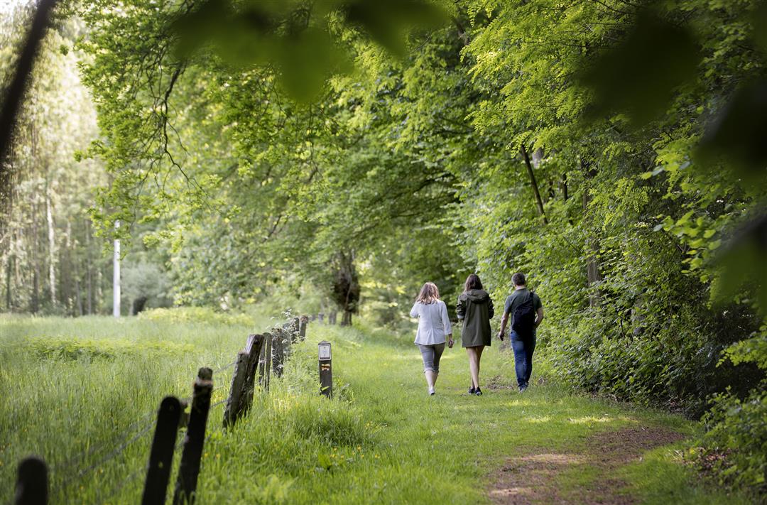
The Flemish Ardennes has invested heavily in its hiking infrastructure and now has more than 850 km of interconnected trails. This hike introduces you to Flanders' Most Beautiful Landscape via our nodes. Have fun!
The Koppenberg hiking trail is offered to you by Routen, an initiative of Tourism East Flanders.
automatic translation
 nodes to follow
0 km
1.3 km
2.3 km
4.7 km
6.7 km
Friday, April 10, 2026 by Ann LobijnA beautiful route
automatic translation
Sunday, March 8, 2026 by Maaike PenezNice route, enjoyable😊
automatic translation
Tuesday, October 21, 2025 by Eric Van hyftenice and dry .., haha
automatic translation
Sunday, August 10, 2025 by Roel Matthysa very nice walk even when the sun is shining.
automatic translation
Thursday, March 23, 2023 by S.V.very nice route with very beautiful scenery! can be a bit muddy, so definitely adapted footwear recommended! have been there on Tuesday, nothing open to drink anything, so best to take everything! koppenberg forest very beautiful in the spring with the wood hyacinths!
automatic translation
Friday, November 11, 2022 by B.C.November 2022. A beautiful sunny autumn walk. Varied: through the forest, "wading" through a thick layer of leaves, soft and springy under your feet, tempered rays of light through a forest of old beeches, and then, always surprising, a majestic vista over those rolling Flemish Ardennes.
automatic translation
Wednesday, June 29, 2022 by C.C.Very nice varied route with nice viewpoints. Too bad the picnic benches are at the beginning and end of the trail. It would be nice if picnic areas were marked on the maps of hiking node. The route remains highly recommended anyway.
automatic translation
Sunday, June 12, 2022 by A.M.Very nice walk through forest and rolling fields with beautiful views. 2km before the end is a fine eatery on the route.
automatic translation
Thursday, June 10, 2021 by R.V.Lovely walking route with some tough sections, beautiful panorama pieces and in between some spots to take a breather. Highly recommended!
automatic translation
Sunday, April 11, 2021 by Kris PeirsNice hiking trail, can be a bit muddy in bad weather. Because the distance is a bit too short for me, I did them twice in a row, in both directions. Don't underestimate altimeters!
automatic translation
Sunday, April 4, 2021 by M.V.Wonderful hike. The silence struck us very much.
automatic translation
Wednesday, March 10, 2021 by Peter Van der HaegenBeautiful hike with lots of variety. Not only the Koppenberg but the adjacent Koppenberg forest are highly recommended. The signage is excellent.
automatic translation
Saturday, November 28, 2020 by G.M.Beautiful walk on and around the Koppenberg and in the Koppenberg forest. Small parking at the indicated address: you have to enter the cul-de-sac. Not buggyproof. Ideal in spring/autumn. In very hot weather it seems to me rather a difficult walk because of the many climbs, although everyone decides that for themselves of course.
automatic translation
Thursday, November 5, 2020 by Koen van LangenhoveBeautiful hike with open vistas interspersed with undulating forest trails. Highly recommended!!!
automatic translation


 Upgrade to Premium Plus
