 Hiking
 Login
Login
 More
More
 EN
EN
 Premium
Brick hiking trail
automatic translation
4.4 km • Boom
2.6338 1 2.5/5
4.4 km
0.0 km
0.0 km
route offered by
Toerisme Provincie Antwerpen
 Addresse starting point (approximate)
Noeveren 68, 2850 Boom
 signage
The route is fully signposted with nodes.
© Toerisme Provincie Antwerpen
 Description
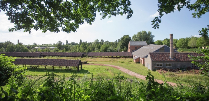
For centuries, brickworks brought prosperity to Boom. Traces of the brick past, workers' houses, clay pits, drying sheds and kilns are clearly visible. The sites on Noeveren are authentic gems of industrial heritage.
Immerse yourself in the fascinating history of brickmaking in the Rupel region - the cradle of the brick industry in the last century. Experience for yourself what life was like here in the golden years, how people lived and the factories ran.
automatic translation
 nodes to follow
0 km
0.9 km
1.5 km
2 km
2.2 km
2.6 km
2.9 km
3.6 km
4.5 km


 Upgrade to Premium Plus
