 Hiking
 Login
Login
 More
More
 EN
EN
 Premium
Villages of the Swallow Valley hiking trail
automatic translation
11.2 km • Zwalm
 official route
8.67918 10 3.8/5
 Addresse starting point (approximate)
Oude Scheldestraat 16, 9630 Zwalm
 signage
The route is fully signposted with nodes.
 Description
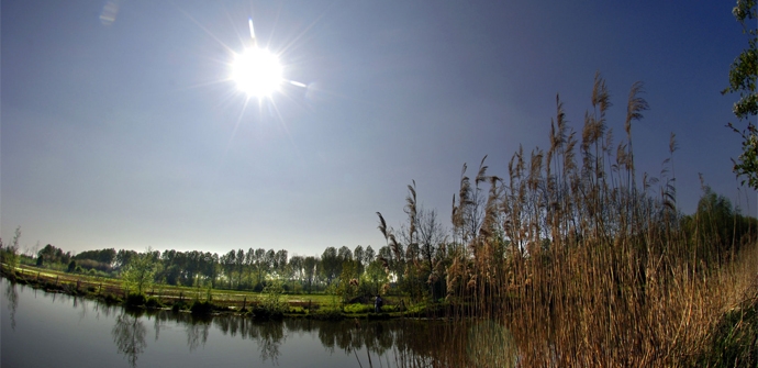
The Flemish Ardennes has invested heavily in its hiking infrastructure and now has more than 850 kilometers of interconnected hiking trails. This hike introduces you to Flanders' Most Beautiful Landscape via our hiking nodes. You can choose to walk the full route or explore one of the shorter loops. Have fun!
The Dorpjes van de Zwalmvallei hiking trail is brought to you byRouten, an initiative of Tourism East Flanders.
automatic translation
 nodes to follow
0 km
0.4 km
1.1 km
2 km
2.8 km
4.2 km
4.3 km
4.9 km
5.3 km
5.8 km
7.3 km
7.9 km
8.7 km
9.9 km
10.6 km
11 km
11.2 km
Saturday, April 26, 2025 by R.V.Sometimes literally goes through woods and fields. The trails can be muddy at times. Lots of variety. R.V. from Damme
automatic translation
Monday, April 21, 2025 by Yves BryseWonderful hike that never bores. Most beautiful we have done there. I don't understand the negative comments. Nothing from traffic or crowds. And the paving, of course you know that in advance if you look at the legend. For us, that was even a plus.
automatic translation
Friday, November 15, 2024 by V.V.Pleasant hike with beautiful views. The hike is mostly paved and therefore ideal in wet weather. There was one unpaved path that was very boggy, but fortunately there was a parallel path there.
automatic translation
Monday, May 29, 2023 by D.R.Didn't see much of the charming villages. Most of this route along concrete roads between fields. Very monotonous.
automatic translation
Sunday, May 28, 2023 by M.D.Hiked with bright sunshine which also made the unpaved roads easily walkable. Nice variation between paved roads and rural areas. Best to park at De Kaaihoeve to start from there. Known walking route so you meet quite a few people. Nice to have a chat!
automatic translation
Monday, January 17, 2022 by Marc VervaetThe hike itself was beautiful in terms of scenery and very quiet on Sunday morning. We left with rain until almost halfway.... This resulted in very muddy passages (between 89 and 93 along the castle, also for MTBers and between 92 and 99). On drier and sunnier days this is highly recommended.
automatic translation
Friday, July 23, 2021 by K.B.Starting point 96 difficult to find. Not located along the road, but in the forest. Started from point 95, due to large parking lot at Provincial Educational Center "De Kaaihoeve". Many unpaved paths are overgrown with nettles and difficult to traverse.
automatic translation
Saturday, January 2, 2021 by Willy De Regge-HeyseVery nice hiking trail, with alternating forest trails and paved road. definitely recommended. good walking shoes required in rainy weather. some trails were quite boggy, but still doable.
automatic translation
Friday, July 10, 2020 by Christian LamontNice hike, first half better than the last. In places the trails are a bit overgrown, but still passable.
automatic translation
Tuesday, March 24, 2020 by G.V.Beautiful route along, for me, familiar roads.
automatic translation


 Upgrade to Premium Plus
