 Hiking
 Login
Login
 More
More
 EN
EN
 Premium
Along mountain and chapel hiking trail
automatic translation
12.4 km • Oudenaarde
 official route
8.12716 15 4.4/5
 Addresse starting point (approximate)
Papelosstraat, 9700 Oudenaarde
 signage
The route is fully signposted with nodes.
 Description
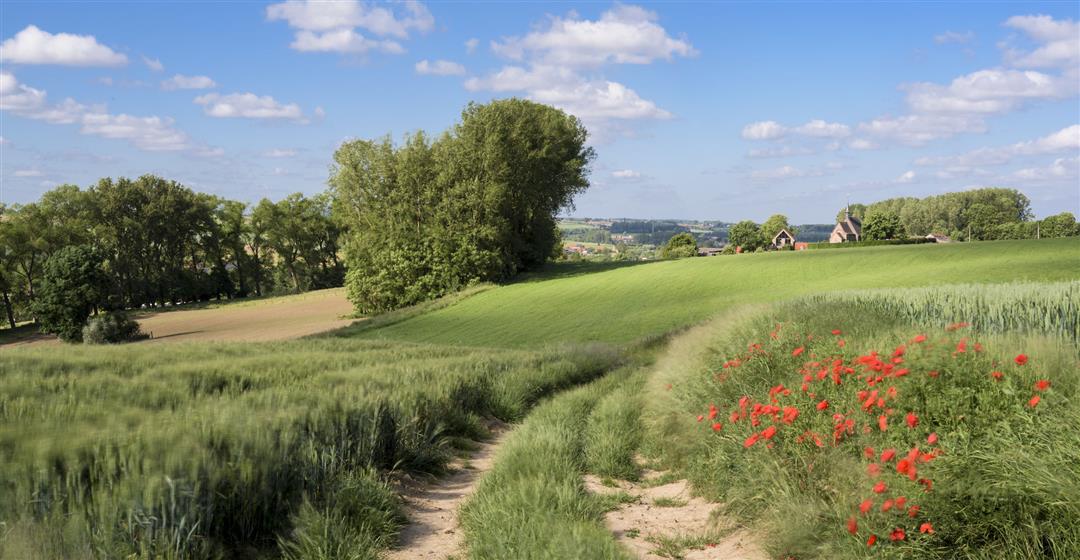
The Flemish Ardennes has invested heavily in its hiking infrastructure and now has more than 850 kilometers of interconnected hiking trails. This hike introduces you to Flanders' Most Beautiful Landscape via our hiking nodes. You can choose to walk the full route or explore one of the shorter loops. Have fun!
TheAlong mountain and chapelis offered to you byRouten, an initiative of Tourism East Flanders.
automatic translation
 nodes to follow
0 km
1.9 km
2.9 km
3.5 km
4.7 km
7.1 km
7.5 km
8.6 km
10.6 km
11.2 km
12.3 km
Wednesday, September 18, 2024 by D.D.Hike started at large parking lot chapel Kerselaere.Plate with overview nodes for this hike should best be there (parking) I think.Nice hike but still a bit too many paved roads.Also very unfortunate stretch on busy N8 between nodes 57 and 56.On Wednesday not a single place to drink open along the entire route.
automatic translation
Monday, August 28, 2023 by V.V.I hiked them in reverse. Beautiful varied hike. Sometimes loud, sometimes quiet. Sometimes uphill, sometimes downhill.
automatic translation
Wednesday, November 9, 2022 by D.B.The hike is attractive, beautiful, lots of open scenery, vistas. We left at Den Obus. Good parking facilities. Attention 1: Den Obus is closed on Tuesdays and Wednesdays. Attention 2: At node 61 the markings of node 40 are missing. Turn right at 61. The street goes uphill. In the uphill comes the marking for 40 (to the left).
automatic translation
Friday, July 23, 2021 by K.B.Beautiful walk, yet many paved sections. We left at junction 55, at Café "Den Obus". There you can easily park and enjoy a beer and a pot of artisanal pâté with toast afterwards. From node 61 the signs are often hidden behind the greenery.
automatic translation
Sunday, May 9, 2021 by B.B.Beautiful hike with occasional tough climbs and unique views. Some parts are rather long and monotonous. Tip : Cafe Den Obus with nice terrace around hiking point 55 in Volkegem.
automatic translation
Sunday, April 25, 2021 by B.C.April 2021. Very nice walk in brilliant spring sunshine, very varied with not too much "busy" asphalt. Indeed the distance given is not correct. Spicy lake-distance. A good starting place (parking possibility) can be found in the center of Volkegem and not Steenbergstraat 1, as on print. Highly recommended !
automatic translation
Sunday, March 28, 2021 by S.D.Nice hike, took 3h, with a small break, found all the signs well.
automatic translation
Thursday, March 11, 2021 by Y.B.Very nice hike but signs are not always easy to see
automatic translation
Sunday, March 7, 2021 by Peter MayBeautiful route, from junction 61 to 51 we didn't pay attention and as a result made a nice detour along Etikhove. Back at the mill we followed Ladeuze and at the top left through the forest and we were back on track. 21km of hiking.
automatic translation
Saturday, February 13, 2021 by D.V.Very pleasant hike. The route was indeed 13km long, as the description indicated.
automatic translation
Monday, February 1, 2021 by C.C.The hike is beautiful and with lots of variety. However, it was 16.5 km instead of the specified 13 km.
automatic translation
Friday, December 25, 2020 by C.D.Very nice walk. From node 57 it can be very boggy.
automatic translation
Sunday, November 8, 2020 by Dominic DeschryverBeautiful route. Did shorten from point 55 directly to 56, passing through Volkegembos.
automatic translation
Sunday, August 2, 2020 by Koen Van DuyseWonderful hiking trail. Highly recommended.
And the refreshment and fortifying drink on the square in Mater comes at the right time, after three quarters of the hike.
automatic translation
Monday, June 1, 2020 by Marc Denormesublime hiking trail !
automatic translation


 Upgrade to Premium Plus
