 Hiking
 Login
Login
 More
More
 EN
EN
 Premium
Neigembos hiking trail
automatic translation
9.4 km • Ninove
 official route
10.55715 6 3.6/5
 Addresse starting point (approximate)
Bevingen 20, 9400 Ninove
 signage
The route is fully signposted with nodes.
 Description
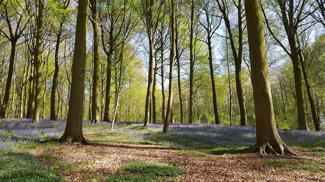
The Neigembos is a remnant of the ancient "Coal Forest" that in Roman times ran from Picardy to Brabant. The forest is characterized by its highly variable relief ranging from 20m to 90m. The deep hollow paths reveal the forest's long history. In spring, the forest turns purple with wood hyacinths, but the yellow and white of wild daffodils and wild garlic can also charm many.
TheNeigembos walking routeis offered byRoutenan initiative of Tourism East Flanders.
automatic translation
 nodes to follow
0 km
0.3 km
1.7 km
2.8 km
3.3 km
4.6 km
5.1 km
5.1 km
5.2 km
5.7 km
5.9 km
7.1 km
8.1 km
9.1 km
9.3 km
Sunday, June 14, 2026 by S.R.A lovely hike! Despite weeks of rain, it wasn’t overly muddy. There’s always a shortcut. The landscape varies between fields and forests. “Only” one-third of the route is unpaved, but never on busy roads. For those who like to take a break: there are several spots with benches offering beautiful views.
automatic translation
Friday, March 28, 2025 by Nadine GoossensWalk done 27/03/2025. Very nice hike, highly recommended. Good walkable trails and had no mud.
automatic translation
Thursday, December 24, 2020 by T.V.Nice hike, only regret that only 4 parking spaces are available and all the surrounding streets are currently subject to a traffic ban, even for local residents, without offering an alternative. Consequence fine of 58€ as was probably the case for several hikers.
automatic translation
Wednesday, November 25, 2020 by A.L.At chapel 5 parking spaces and in all surrounding streets parking is prohibited until 31/12/2020. We could park the car at the church of Neigem. What about the weekend? The hike starts promising, very nice first loop in the forest. Second part was a bit disappointing, signs sometimes obscured (from KP 11 to 10) or driven out and crossed 2x lane!
automatic translation
Sunday, November 8, 2020 by Kristof De PleckerNeigem forest is beautiful. Because of nice weather, it was quite crowded. In Covid 19 times, mouth mask was almost required. Second part definitely worthwhile too.
automatic translation
Thursday, May 21, 2020 by Rosita WimNice walk.....first nodes...13-14-16-15-14-13.....are well marked .... but when you then have to move on to....nodes....11-10-4-12-13...it is a bit of a search for the right poles.....our map came in handy there.....
automatic translation


 Upgrade to Premium Plus
