 Hiking
 Login
Login
 More
More
 EN
EN
 Premium
Around the Haaghoek hiking trail
automatic translation
11.3 km • Horebeke
 official route
5.2678 5 3.8/5
 Addresse starting point (approximate)
Kerkplein 1, 9667 Sint-Maria-Horebeke
 signage
The route is fully signposted with nodes.
 Description
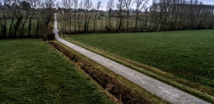
The Flemish Ardennes has invested heavily in its hiking infrastructure and now has more than 850 km of interconnected hiking trails. This hike introduces you to Flanders' Most Beautiful Landscape via our nodes. Have fun!
TheAround the Haaghoek hiking trailis offered to you byRouten, an initiative of Tourism East Flanders.
automatic translation
 nodes to follow
0 km
1 km
2.5 km
2.5 km
3.1 km
7.1 km
7.6 km
9.1 km
9.4 km
10.6 km
11.3 km
Thursday, February 12, 2026 by Johan De PauwBeautiful route, good variety of uphill/downhill, paved/unpaved. Despite the heavy rain in recent days, the unpaved sections are easily passable. Beautiful views!
automatic translation
Sunday, May 29, 2022 by C.R.At the start the little street 'Ketse' is temporarily closed, but a detour will get you there. Halfway the hike, in Zegelsem the pub 'Den drijhaard' is recommended. A nice hike !
automatic translation
Thursday, April 15, 2021 by R.D.Start is more likely to be found on Village Street, next to the church. Beautiful views through the fields, the walk seemed longer than it is due to the long stretches of paved roads, my preference is for small paths.
automatic translation
Sunday, January 10, 2021 by Louise-Marie MeysmanBeautiful route, though lots of muddy and boggy sections. Sturdy shoes are definitely recommended. This route is not suitable for baby carriages.
automatic translation
Wednesday, December 16, 2020 by F.L.very nice route with beautiful views, highly recommended! Attention: the address of the starting point according to the paper map is not correct, it is best to park at the church square!
automatic translation


 Upgrade to Premium Plus
