 Hiking
 Login
Login
 More
More
 EN
EN
 Premium
between Orval (BE) and Herbeuval (FR)
automatic translation
14 km • Florenville
2.2241 0 0/5

 Addresse starting point (approximate)
Orval 3, 6823 Florenville, BE
 signage
The route is not signposted. Use a GPS device or our app to follow the route.
 Description
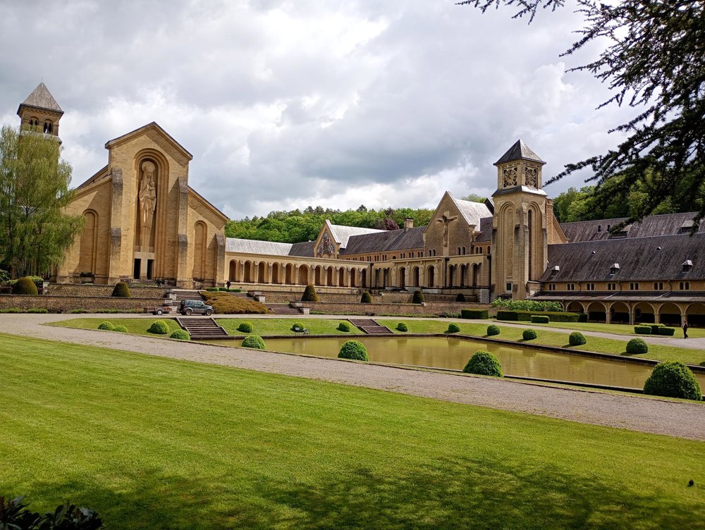
Departure: Orval Abbey - Orval 1 - 6823 Florenville
Only the old ruins of the former abbey, which were stormed and plundered in 1793 by French insurgents during the revolutionary years, are open to visitors. The new basilica, the monastery, and the gardens are not accessible to the public.
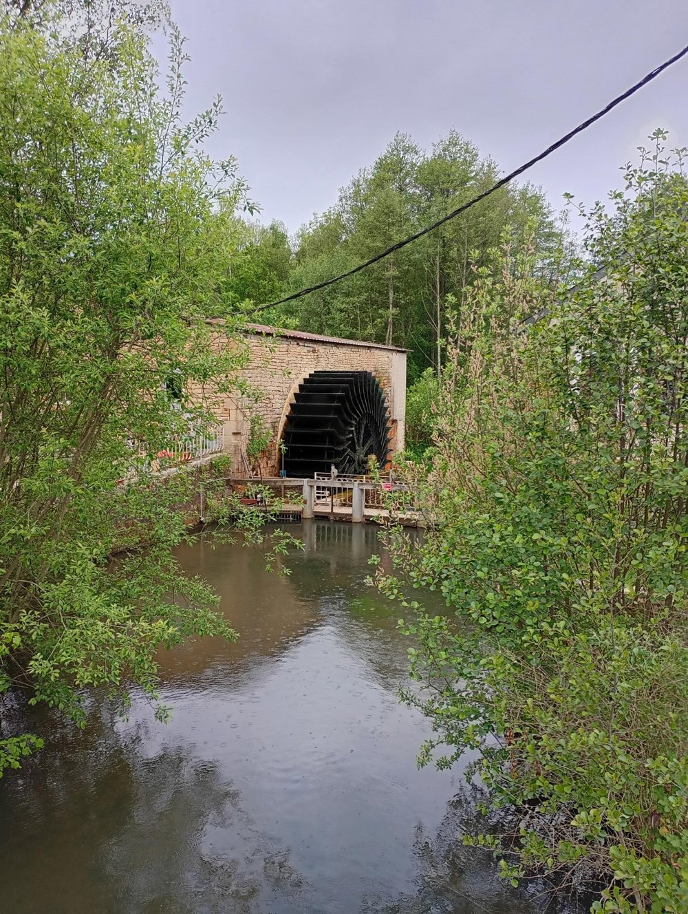
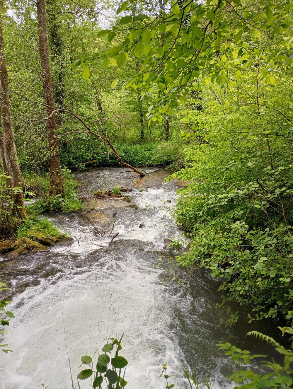
The walk starts through the woods towards France. After about 2 km, we pass the still-working watermill of Villers-devant-Orval, still just on Belgian territory. We then walk towards Herbeuval (FR). Forests and meadows alternate. We return via a beautiful waterfall along the Ruisseau des Courvées and re-enter Belgium.
The paths are easily passable and despite the altitude differences, walking sticks are not necessary. No catering along the way. Keep an eye on the hunting calendar between October and February: www.chasseurdefrance.com
automatic translation
 nodes to follow
0 km
0.4 km

2.5 km
4.6 km
7.2 km
9.6 km
12.6 km
12.7 km
13.1 km
13.4 km
13.7 km

14 km


 Upgrade to Premium Plus
