 Hiking
 Login
Login
 More
More
 EN
EN
 Premium
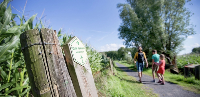
Old Valley Valley hiking trail loop 2
automatic translation
8.9 km • Lievegem
 official route
8.99922 8 4.3/5
 Addresse starting point (approximate)
Dorsweg 17, 9921 Vinderhoute
 signage
The route is fully signposted with thematic signs (no nodes).
 Description
Adventurous walks along the castle villages of Merendree, Vinderhoute and Lovendegem. One of the most beautiful hiking routes in the Meetjesland along the meandering Oude Kalebeek, rows of pollarded willows and lovely little farms. Discover a beautiful landscape just a stone's throw from Ghent. Strong strollers combine the two hiking loops into one big hiking adventure.
The Old Kalevallei walking route loop 2 is offered to you by Routen, an initiative of Tourism East Flanders.
automatic translation
Sunday, November 9, 2025 by ivan huysVery nice hike,we were able to go around along the Mill Lakes with a nice view of the Zuurhoek
For us a 5 star hike done on 9/11/2025
automatic translation
Monday, September 8, 2025 by Fadwa BoutiebiVery nice route!
automatic translation
Friday, August 1, 2025 by Herman Van den ReeckA wonderful walk that I would normally give five stars but the last part was blocked with no detour indicated with the result that we had to find an alternative along the canal which made our walk much longer and less beautiful.
automatic translation
Thursday, August 1, 2024 by K.P.Madly surprised by this hike! Usually we go hiking along Oudenaarde but since I was in a no driving mood I wanted to try closer. The variety of nature and the beautiful houses nearby was just great. A coctail in t'city finished the day. 🙂↕️
automatic translation
Monday, August 23, 2021 by Dirk CalsynIn spite of the drizzling rain got acquainted with the cozy Vinderhoute. Beautiful walk among the corn and along the Old Bald. Quiet, green. Enjoyed tMeetjesland.
automatic translation
Sunday, November 15, 2020 by Yuri De bockThis is indeed a fine nice hiking trail this is definitely recommended on a sunny day but not too hot, nice through the valley and through the meadows.
automatic translation
Thursday, July 23, 2020 by Audrey AucoinThis was a really super fun hike. Very quiet, among the fields with only frogs and dragonflies around you! Definitely highly recommended!
automatic translation
Wednesday, May 13, 2020 by Paul De PraeterA beautiful nature walk that gives a soothing feeling and one can just lick one's fingers at that.
automatic translation


 Upgrade to Premium Plus
