 Hiking
 Login
Login
 More
More
 EN
EN
 Premium
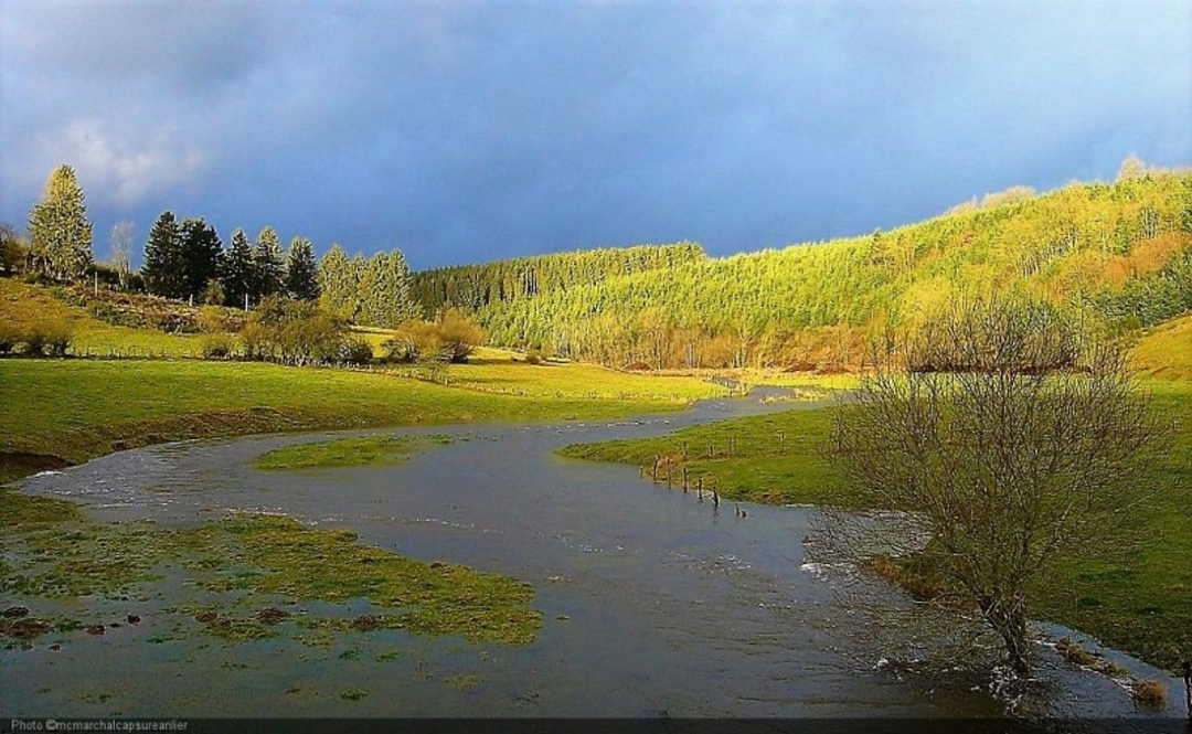
A walk in the heart of a nature reserve
automatic translation
11 km • Louftémont
 official route
3812 0 0/5
 Addresse starting point (approximate)
11 Rue Albert 1er , 6860 Léglise
 signage
The route is fully signposted with nodes.
 Description
Beautiful mosaic of habitats: remnants of raised bogs, moors, wet meadows, etc. This nature reserve is home to over 160 plant species.
Discover ancient hay meadows and peaty areas in the valleys of the Arlune and Tordu Ruisseau rivers. Inhabitants of neighboring villages used to extract peat for their domestic needs. Some areas, which are much less wet, have probably never been exploited by man.
The site contains a number of plants that are rare in the southern Ardennes: Sanguisorba officinalis, Menyanthes trifoliata, Vaccinium oxycoccos and others. In addition, the site has a number of groupings found nowhere else in the Southern Ardennes: sphagnum moss patches with cranberries, cottongrass raised bogs, characteristic plant seeps, molina, narda and Arnica patches.
The nature reserve is home to some 30 species of birds, including the red-backed warbler, spotted locustelle and reed bunting. Birds of prey, both diurnal and nocturnal, are well represented: buzzard, sparrowhawk, harrier, kestrel, barn owl, tawny owl and long-eared owl.
The site's location between deciduous forest and grazed meadows, and its composition, make it an excellent nesting biotope for many birds.
There's no doubt you'll appreciate all the diversity this walk has to offer.
automatic translation


 Upgrade to Premium Plus
