 Hiking
 Login
Login
 More
More
 EN
EN
 Premium
Wittimont-Gennevaux walk
automatic translation
9.4 km • Léglise
 official route
390 0 0/5
 Addresse starting point (approximate)
46 Rue de Luxembourg , 6860 Léglise
 signage
The route is fully signposted with nodes.
 Description
Rural walk through the villages of the former Léglise commune, passing through Narcimont and the former convent cemetery.
Departing from the Tourist Office, this walk will take you through the rural landscapes of the villages making up the former commune of Léglise, whose historic settlement was mainly made up of farms. The "Moustier de Léglise" will be your beacon throughout the walk.
The hamlet of Xaimont is your first stop, where you'll discover the old mill and the more modern lagoon facilities. Next, you'll cross Wittimont to reach Narcimont.
En route, we invite you to turn off the road and visit the cemetery of the former convent, with its atmosphere conducive to meditation.
The site once belonged to the convent of Narcimont. But as you can see, during the First World War, some of Léglise's parishioners were buried in this private cemetery.
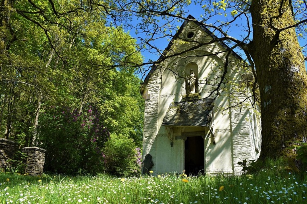
Gennevaux also features a number of older farmhouses, notably from the 18th century, as well as a neoclassical chapel from the late 19th century.
Finally, on the way back, after skirting the site of the Gohimont necropolis, excavated between 1974 and 1984, and walking in the shade of a hornbeam hedge, let yourself be surprised by the Chapelle de l'Espérance and its fresco by Brother Joseph du Bua and his pupil Alain Brahy.
automatic translation


 Upgrade to Premium Plus
