 Hiking
 Login
Login
 More
More
 EN
EN
 Premium
Kravaal forest hiking trail
automatic translation
7.8 km • Aalst
 official route
12.54524 6 4.5/5
 Addresse starting point (approximate)
Putstraat 116, 9310 Meldert
 signage
The route is fully signposted with nodes.
 Description
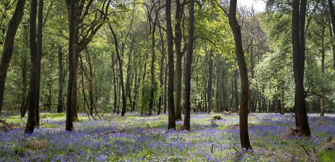
The Kravaal Forest is somewhat hidden on the border of two provinces, which is why it remained under the radar for a long time. Today, that is at once the greatest asset of this ecologically valuable forest, where wood hyacinths provide a colorful spectacle in spring.
The Kravaalbos hiking trailis offered to you byRoutenan initiative of Tourism East Flanders.
automatic translation
 nodes to follow
0 km
0.7 km
1.8 km
3.3 km
3.7 km
4.1 km
4.4 km
4.4 km
4.7 km
4.9 km
5.5 km
6.7 km
6.8 km
7.9 km
Thursday, June 19, 2025 by J.D.Beautiful hike, very good signage. Few paved roads. Very doable in warm weather.
automatic translation
Wednesday, April 21, 2021 by GILBERTE DE BLOCKBeautiful walk in the meadows and the Kravaal forest. We started at the chapel in the Putstraat, instead of at Stinne, a bit further on. There were not many hikers today, so it was great hiking and the sun was out. The pity was, that on our walk in the forest, we did not spot any animals.
automatic translation
Saturday, March 6, 2021 by Patrick ScheerdykBeautiful walk, great stretch in the forest. Also able to enjoy the silence.
automatic translation
Sunday, January 31, 2021 by Michel VMNice walk in nature reserve (+/- 75% in Kravaal forest). Today a lot of mud Very well marked. According to my GPS,a little over 8 km.
automatic translation
Sunday, October 18, 2020 by A.R.Very nice hike almost entirely on unpaved trails. Beautiful metal those warm autumn colors! A hike we will definitely do again, and more than once!
automatic translation
Monday, June 1, 2020 by P.D.Sublime walk in nature and quiet
automatic translation


 Upgrade to Premium Plus
