 Hiking
 Login
Login
 More
More
 EN
EN
 Premium
Vault forest hiking trail
automatic translation
6.3 km • Kluisbergen
 official route
13.17526 7 4.9/5
 Addresse starting point (approximate)
Torendreef, 9690 Ruien
 signage
The route is fully signposted with nodes.
 Description
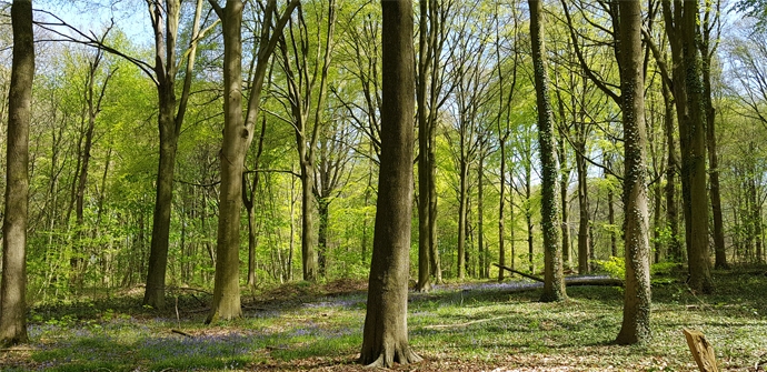
The route goes mostly through the 300-hectare Kluisbos, on top of the Kluisberg (141 m). Numerous paths lead through this stately beech forest past, among other places, the former "court" De Vierschaar, the hamlet of Pensemont and the artists' village of Kwaremont. Ideal for those seeking peace and quiet.
TheKluisbos hiking trailis offered to you byRouten, an initiative of Tourism East Flanders.
automatic translation
 nodes to follow
0 km
0.9 km
1.6 km
1.8 km
2.9 km
4.3 km
5.2 km
5.7 km
5.9 km
6.3 km
Sunday, May 24, 2026 by L.S.The path between junction 60 and junction 39 is either completely overgrown in some places or lined on both sides with tall grass and nettles. For now, it’s best to skip that section and go from junction 53 to 39.
automatic translation
Saturday, July 26, 2025 by Kimberley Versmessepretty fun and sometimes sturdy climbs.
automatic translation
Sunday, March 30, 2025 by J.V.Beautiful walk, through forest and meadow. Lots of different flora along the way. Towards the end a lot of paved road, but the detour via 40-36-28-30 breaks through this and is definitely worth doing. Generally a blissfully quiet route, provided no other hikers or families are doing the same hike :D
automatic translation
Monday, April 12, 2021 by Myriam De WinterVery nice hike, mostly unpaved paths. In wet weather, good walking shoes are absolutely necessary owing to mud. The panoramic views, narrow paths through the fields and the vaulted forest (nice play forest!) are a perfect variation. Some 'climbing' though. We also added Junctions 40-36-28-30 and ended up with 8.1 km. NICE RUST!
automatic translation
Friday, January 1, 2021 by Caroline De CockNice walk, mostly through the forest or on paved trails. Do need sturdy walking shoes as it can be swampy. Clear signage, only the pole in the forest to go to junction 8 is a bit far placed so we were first on the mountain bike route.
automatic translation
Sunday, November 29, 2020 by johan van lanckerTopper simply SCARY !!!
automatic translation
Sunday, August 23, 2020 by G.M.A tough gut-biter for the hiker with some fitness with beautiful views as a reward. Sturdy/solid walking shoes are recommended. Well signposted. Almost completely car-free. Junction 39 transition to junction 37 hangs quite high on a power pole.
automatic translation


 Upgrade to Premium Plus
