 Hiking
 Login
Login
 More
More
 EN
EN
 Premium
Tongerlo: along the abbey, castle, farm, and mill
automatic translation
15.2 km • Westerlo
2.6496 0 0/5

 Addresse starting point (approximate)
Abdijstraat 40,40A, 2260 Westerlo, BE
 signage
The route is fully signposted with nodes.
 Description
Park for free at the abbey or sports center.
Via a varied surface of forest, earth, gravel, village paths and quieter asphalt roads, you explore the surroundings of Tongerlo.
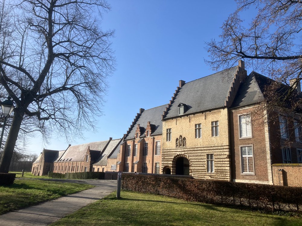
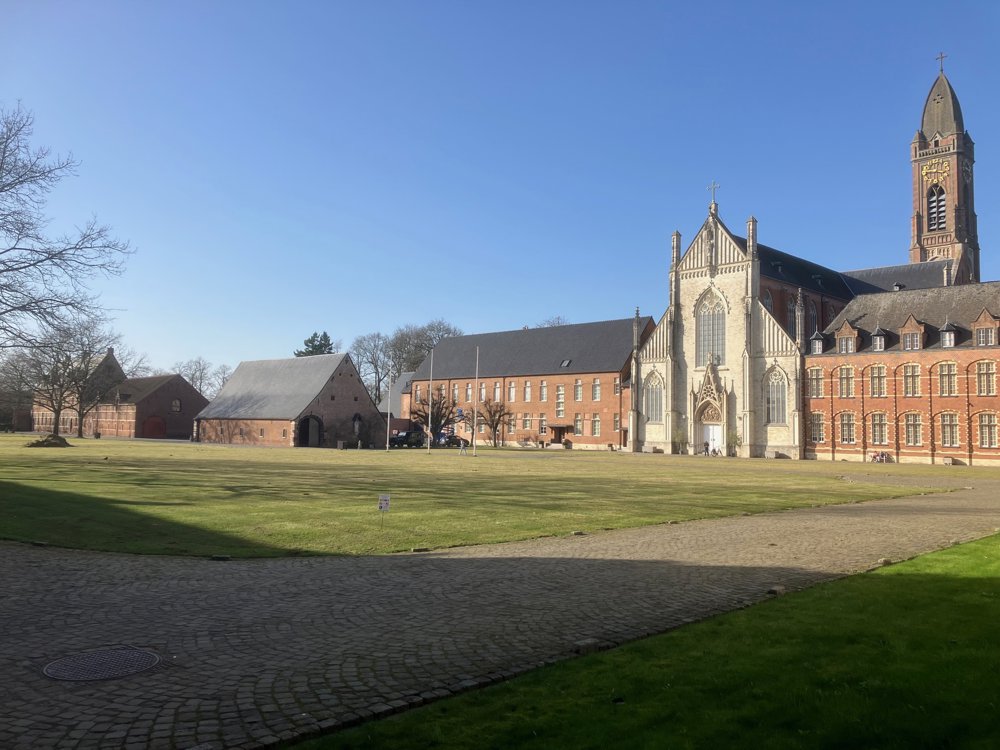
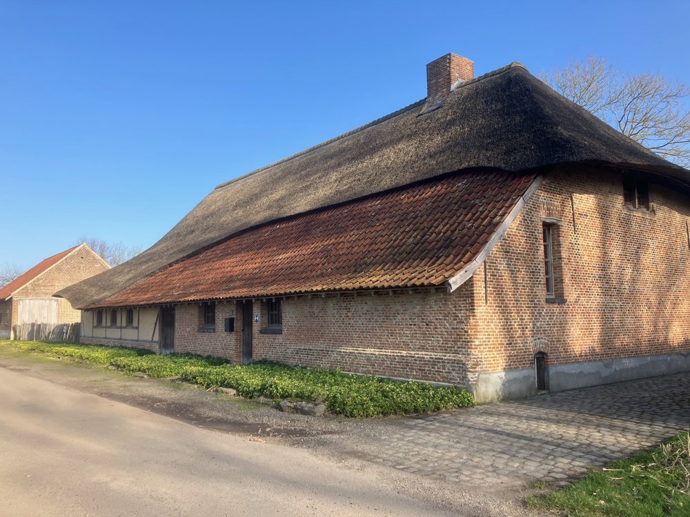
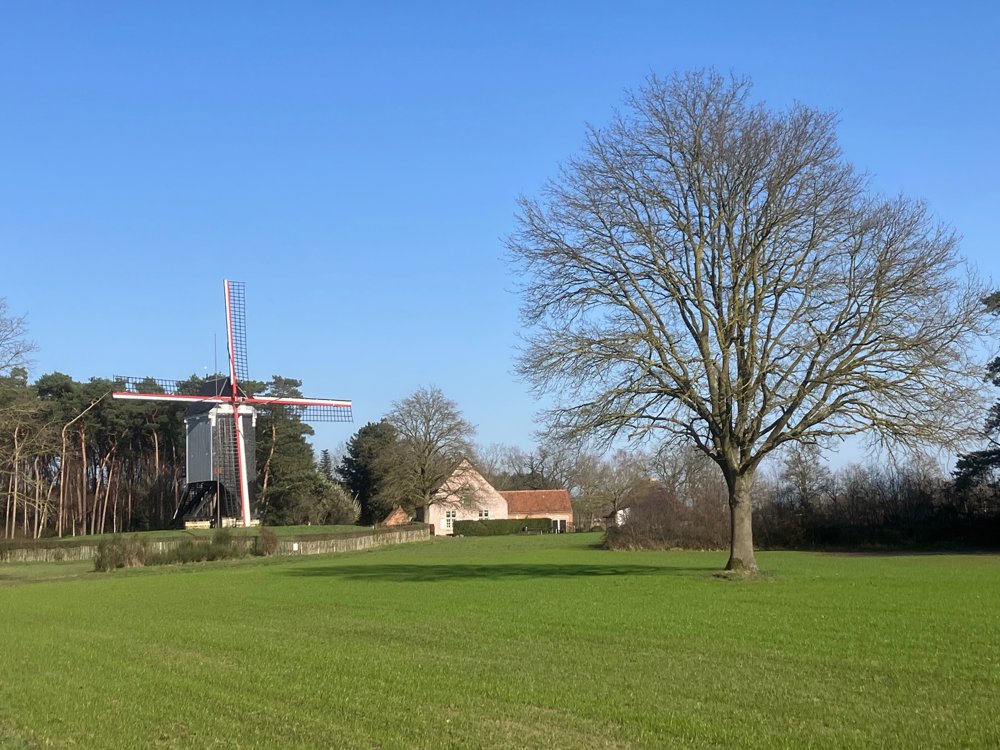
You start at the monumental inner courtyard of the Norbertine abbey. With its freely accessible church, shop, and tithe barn with a permanent exhibition, you get to know a lot. Via the park on Oevelse Dreef and village streets, you pass the classified Chapel of Our Lady ten Eik before heading into the field/woods towards point 348. There, left, 200m in De Brandstee, stands the beautifully restored Ambrosius farm from 1696 (protected monument!). Go back and continue your path along the typical Kempen Beddermolen with bakehouse. Past Park Noels (snowdrops!), you have a view on the left of the private Hof ter Bruelen, pass the Forester’s House (catering) and the Castle of Countess Jeanne de Merode (Westerlo town hall) before ending via the drives of De Beeltjens.
Dogs on a leash.
High hiking boots in wet periods.
automatic translation
 nodes to follow
0 km
0.3 km
0.4 km
0.6 km
0.8 km
1.2 km
1.8 km
3.7 km
4.8 km
6.2 km
6.3 km
8.3 km
9.7 km
9.8 km
10.6 km
10.9 km
11.1 km
11.8 km
12.3 km
13.3 km
13.6 km
14.7 km
15 km
15.2 km


 Upgrade to Premium Plus
