 Hiking
 Login
Login
 More
More
 EN
EN
 Premium
Wandering light hiking trail
automatic translation
17.7 km • Maarkedal
 official route
7.39621 16 4.4/5
 Addresse starting point (approximate)
Essestraat 1, 9688 Schorisse
 signage
The route is fully signposted with nodes.
 Description
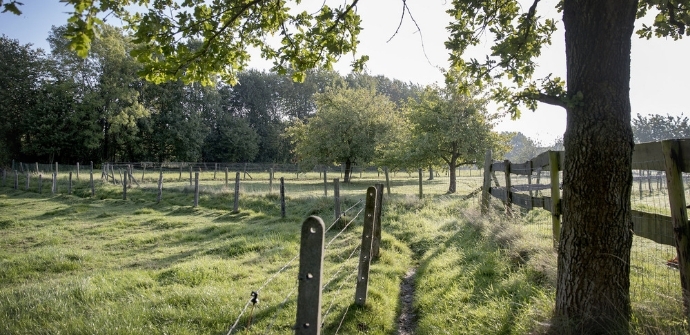
Once across the language border, you almost immediately find yourself in the Brakelbos on the flank of Mont de Rhode or Modderode. Today the Bos-ter-Rijst is an elongated strip with a footpath in the middle, but three hundred years ago it was part of a dense and extensive forest.
TheWandering Light hiking trailis brought to you byRouten, an initiative of Tourism East Flanders.
automatic translation
 nodes to follow
0 km
0.1 km
0.7 km
2.3 km
2.5 km
3.3 km
3.8 km
4.2 km
7.1 km
7.2 km
8.3 km
10.6 km
12.1 km
12.9 km
17.7 km
Friday, March 27, 2026 by Marcello AccorsiAfter reading the reviews, I thought to myself: this hike must be wonderful, and as a nature guide, I’m always on the lookout for new trails. I was very disappointed. There’s nothing interesting about the scenery or the natural environment. There’s a lot of asphalt. For half the hike, you’re exposed to noise from the main roads. It’s really not interesting at all.
automatic translation
Friday, May 2, 2025 by luc maes19,4 km (340 hm) from church Schorisse : pleasant varied route with woods, paved paths and many views. Chance to drink at 3 places, first time after 9 km at la Houppe. And if it is dry, urgent rain.
automatic translation
Sunday, May 21, 2023 by J.D.from node 51 towards 6, and nothing else?
automatic translation
Saturday, October 23, 2021 by D.D.very nice nature hike with at least 10km/16.6km offroad trails runs through brakel forest and bos ter rice but spicy.
automatic translation
Monday, September 6, 2021 by P.P.It is not sign 4 that is missing and written on the pole, but 14
automatic translation
Monday, September 6, 2021 by P.P.Beautiful hike, lots of unpaved, especially from the moment you get to Brakel forest until the end point! Recommended starting at the church of Schorisse, somewhere halfway between nodes 22 and 14.
automatic translation
Monday, July 5, 2021 by J.V.Spicy beautiful hike highly recommended.
automatic translation
Monday, April 5, 2021 by werner knoppretty nice course but some distance and descent/climbing experience is still recommended. Especially the Brakelbos section is beautiful. In some places beautiful views and crossing sporting cyclists who have to stand up to the sloping course of this region. Beautiful but also tough. The small part of the Walloon border is also nice.
automatic translation
Monday, November 23, 2020 by C.V.Beautiful walk through nature with beautiful views, (node 4 the sign is gone but written on the post). Beautiful field roads and fields, unpaved roads, through forests. Few paved roads. A topper! I will definitely go back again.
automatic translation
Sunday, November 8, 2020 by Dominic DeschryverBeautiful autumn walk.
automatic translation
Sunday, October 25, 2020 by F.V.Beautiful walk
automatic translation
Thursday, July 23, 2020 by Dirk DelenAbsolutely recommended, a beauty of a walk !!!!!!! The chance to quench your thirst at km 10 is a relief and gives this hike something extra...... just do it !!!
automatic translation
Wednesday, July 22, 2020 by Johan YsewijnNice day hike, about 70% unpaved. Be careful though, occasionally a direction change is rather "hidden". Just after halfway (junction 6) plenty of opportunities for a drink. Beautiful forest area (Brakelbos, forest Ter Rijst).
automatic translation
Monday, July 20, 2020 by Caroline Van Parys A Very Beautiful Hike , highly recommended !!!!
automatic translation
Thursday, June 25, 2020 by N.D.Very nice rural walk, many unpaved paths and country roads, through forest, along fields and meadows, beautiful views, definitely recommended and the thirsty can be quenched along the way.
automatic translation
Sunday, May 24, 2020 by Jonathan VannesteVery nice hike through the Flemish Ardennes on mostly unpaved roads. One crossing of a busy road, between nodes 6 and 52, but for the rest almost continuously in nature, both meadows and forests.
automatic translation


 Upgrade to Premium Plus
