 Hiking
 Login
Login
 More
More
 EN
EN
 Premium
Laarne Meersen and small village centers
automatic translation
11.3 km • Laarne
3.3554 1 4/5

 Addresse starting point (approximate)
Achterdreef 38B, 9270 Laarne, BE
 signage
The route is not signposted. Use a GPS device or our app to follow the route.
 Description
Departure: cemetery parking - Achterstraat 6 - Laarne
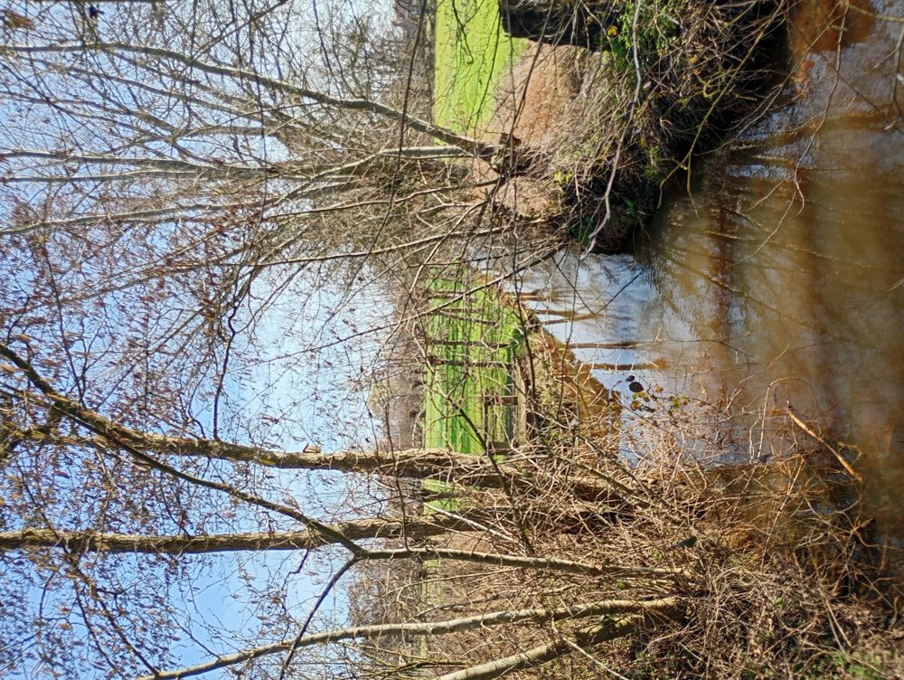
This area is very prone to flooding and water problems, which is clearly visible from the many streams and watercourses that cross this municipality. As a result, this area is not fully built up and there are still beautiful pieces of nature to discover. The region has many greenhouses for the ornamental cultivation of (indoor) plants and ornamental grasses.
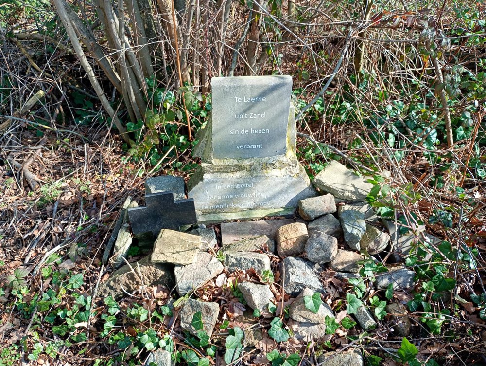
We pass through the Meersen to eventually arrive at the Witches' Path. On this path, there is a small monument to commemorate the four women who were burned here in 1607 because of an alleged witches' sabbath meeting.
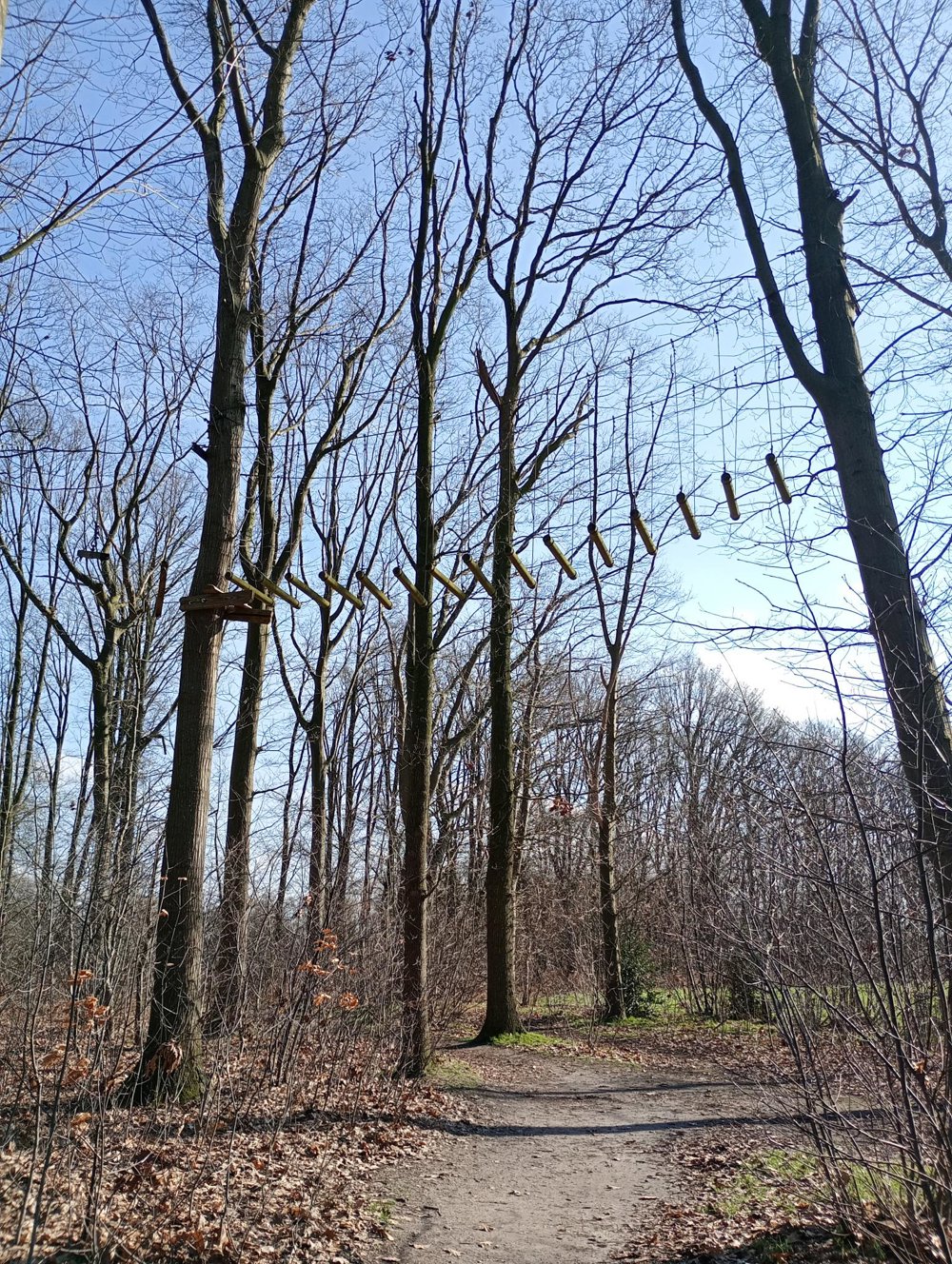
At the end of the walk, we arrive at the Prullenbos, a fishing pond with an inn (open only on Sundays). It has a large playground and a permanent circus tent. There is also the Boskabanne - a green nature house with group accommodation, teambuilding events, and a climbing forest with wobbly bridges high up in the trees.
No hospitality along the way, and only one bench at the OLV van Troost chapel.
automatic translation


 Upgrade to Premium Plus
