 Hiking
 Login
Login
 More
More
 EN
EN
 Premium
Through the forests of Maria-Aalter hiking trail
automatic translation
5 km • Aalter
 official route
5.60310 12 4.2/5
 Addresse starting point (approximate)
Stratem 77, 9880 Aalter
 signage
The route is fully signposted with nodes.
 Description
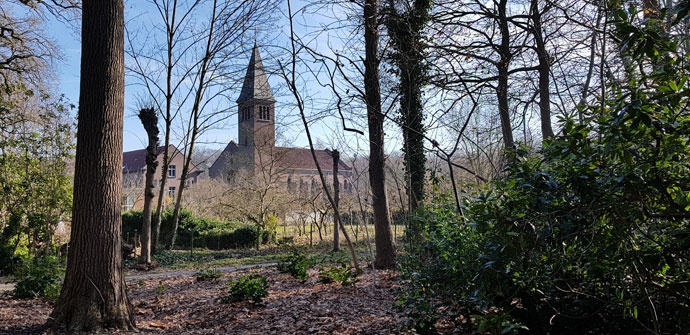
Venture out along the Bulskampveld hiking network, a largely West Flemish network that, around Aalter, also runs for a bit on East Flemish soil. The Bulskampveld, referring to the area that used to stretch between Bruges and Ghent, was once the largest heathland area in the county of Flanders. You walk through woods and open fields via numerous avenues and car-free roads.
TheThrough the woods of Maria-Aalter hiking trailis offered to you byRouten, an initiative of Tourism East Flanders.
automatic translation
 nodes to follow
0 km
0.4 km
1.5 km
2.4 km
3.1 km
3.3 km
4.2 km
5 km
Thursday, June 27, 2024 by Greta CoolsI regularly spend time in the woods and I already walk beside the junctions. in september you can already mushroom hunt, you see the heather bloom. a deer passing by there, in the rain the forest smells delicious, in winter quiet, blanket of leaves, silence, nothing ... the button REALLY on 0. the forest shows how we season at its best
automatic translation
Sunday, March 6, 2022 by Brigitte NotteBeautiful walk. Although we followed the hexagonal signs described on the site of westtoer. This one is 9.5 km and tremendously beautiful. Through the forest, plank paths, heath. At the castle at the start a beautiful garden, a herb garden. End of the walk super nice tavern with terrace and nice view to eat or drink something. Easy parking.
automatic translation
Sunday, March 6, 2022 by B.N.Wonderful walk. Although we followed the hexagonal signs described on the site of errors. This one is 9.5 km and tremendously beautiful. Through the forest, decking paths, Heath. At the castle at the start a beautiful garden, an herb garden. End of the walk super nice tavern with terrace and nice view to eat or drink something. Easy parking.
automatic translation
Sunday, February 6, 2022 by R.K.Done this route a few days ago, not recommended in this season. Nothing but nothing to see.
automatic translation
Friday, November 12, 2021 by L.D.Walk 1/3 track but the other 2/3 is very nice with mostly forest....
automatic translation
Monday, November 2, 2020 by L.V.Very nice route, especially worth doing in autumn. Very peaceful hiking, perfect for getting back on your feet after a corona stress week.
automatic translation
Tuesday, October 27, 2020 by A.E.Super hike, especially in the fall ! Beautiful fall colors and lots of mushrooms along the way. Many benches along the way. Only a long stretch of asphalt road, but fortunately not much traffic on it....
automatic translation
Thursday, September 3, 2020 by E.O.Nice quiet walk, easy to follow
automatic translation
Sunday, August 2, 2020 by Francois BaeleNice,quiet hike.Lots of forest and rest benches in the woods.Very easy to follow.
automatic translation
Sunday, August 2, 2020 by F.B.Nice hike lots of forest,quiet,and also rest benches in nature.Very well marked and at the end a French fry shop the green edge....
automatic translation
Thursday, June 11, 2020 by Romaan Van CanneytThis hike is very nice already two stepped .One drawback no rest stops on this route .
automatic translation
Tuesday, June 9, 2020 by G.V.Very beautiful and varied route.
Also pleasant for children.
automatic translation


 Upgrade to Premium Plus
