 Hiking
 Login
Login
 More
More
 EN
EN
 Premium
Den Dotter hiking trail
automatic translation
9.2 km • Erpe-Mere
 official route
9.09311 7 4.1/5
 Addresse starting point (approximate)
Aaigemdorp, 9420 Aaigem
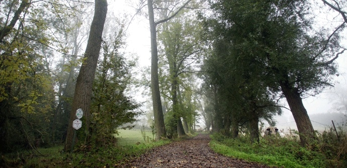
 signage
The route is fully signposted with thematic signs (no nodes).
 Description
Explore the authentic rurality southwest of Aalst. Stroll through the 250-acre nature reserve "Den Dotter," past 3 water mills.
TheDen Dotter walking routeis offered to you byRouten, an initiative of Tourism East Flanders.
automatic translation
Tuesday, August 5, 2025 by alain van nieuwenhuyzenice hike, but those signposts are all gone. so only doable with gps.
automatic translation
Monday, May 6, 2024 by Luc JanssensBeautiful hike, lots of beautiful nature. We did it at a totally wrong time. Half of the hike was drowned, lots of water and mud on the paths and in some places almost impossible to get through. Here and there parts of paths disappeared. Overgrown or neglected.
automatic translation
Monday, June 27, 2022 by pascal de maesschalckNice varied hike that is almost 100% on paved roads. Also nice that you can stop along the way and at the end to have a drink or go to the toilet.
automatic translation
Sunday, April 10, 2022 by Hilde Vanthuyne hildewe did the this one and is beautiful but this one from nature point which is also called den dotter and is a variant , is even more beautiful and with more unpaved , nice cafe on aaigemdries "big luck "
automatic translation
Sunday, January 30, 2022 by Y.M.Great hike - beautiful views - beautiful nature - good roads - great signage. Highly recommended !
automatic translation
Sunday, October 17, 2021 by S.W.Beautiful hike! Well marked and 90% paved surface. Parking at the church. Recommended!
automatic translation
Sunday, February 28, 2021 by Bart BriesenPleasant walk through beautiful natural area. Generally paved paths. Everything perfectly marked.
automatic translation


 Upgrade to Premium Plus
