 Hiking
 Login
Login
 More
More
 EN
EN
 Premium
Bugwood forest hiking trail
automatic translation
7.9 km • Buggenhout
 official route
7.65221 6 3.6/5
 Addresse starting point (approximate)
Kasteelstraat, 9255 Buggenhout
 signage
The route is fully signposted with nodes.
 Description
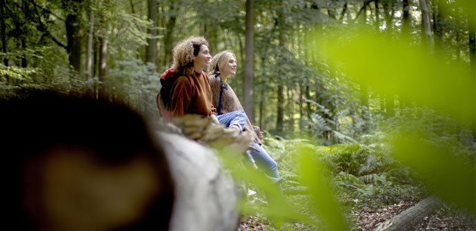
Beautiful walk through the 190-acre Buggenhout forest. Walk through huge beech and sessile oak stands and an arboretum with 50 planted tree and shrub species. Highly recommended for nature lovers!
The Buggenhout forest hiking trailis offered to you byRouten, an initiative of Tourism East Flanders.
automatic translation
 nodes to follow
0 km
0.4 km
0.6 km
0.8 km
1.4 km
1.8 km
2.1 km
2.4 km
3.5 km
4.6 km
4.8 km
5.6 km
7.1 km
7.3 km
7.8 km
Saturday, November 1, 2025 by Barbara VanherckA indeed somewhat monotonous walk through the forest, but with the watery autumn sunshine and the beautiful colors of the leaves, still very nice to walk and look around. Barely any benches along the route to rest and have a drink, though. Convenient and safe parking, right at junction 60 (just cross the street).
automatic translation
Saturday, November 9, 2024 by Herman Van den ReeckNice walk, mostly through forest, but the bit outside the forest is also nice because of the views. Did not encounter any difficulties between kn.53 and kn.58, is a narrow (dirt) road though. First thought we were on private property, but road runs next to the Bosranch.
automatic translation
Wednesday, May 1, 2024 by G.W.Beautiful wooded route starting in the fields. Slightly muddy in heavy rain so appropriate footwear recommended.
automatic translation
Thursday, January 28, 2021 by M.V.Beautiful walk in the Buggenhout forest . 90% of the hike in the forest. Well marked; started via the parking lot (61,62,63,etc...).
automatic translation
Wednesday, January 20, 2021 by J.D.If you like a walk in the woods you will be fine , I personally find this one a bit monotonous. At sign nr53 something goes wrong, you should go left according to the sign while the map says right, we went right and followed immediately to the next nr , nr 58 so
automatic translation
Monday, December 7, 2020 by S.C.The Buggenhout forest is beautiful, but unfortunately this walk between points 56 and 59 leads you out of the forest to the other side and you have to walk on macadam between fields. Fortunately, from point 66 we were back in the forest we actually came for.
automatic translation
Wednesday, July 16, 2025 by L.T.You probably went wrong somewhere.... it is indeed paved from 56 to just past 54, but then at the Forest Ranch you turn right onto another unpaved path (which can be very muddy in wetter periods)
automatic translation


 Upgrade to Premium Plus
