 Hiking
 Login
Login
 More
More
 EN
EN
 Premium
Over Bosberg and Molenheide: long version (train?)
automatic translation
14.1 km • Aarschot
2.9453 0 0/5

 Addresse starting point (approximate)
Gijmelsesteenweg 375, 3201 Homberg, BE
 signage
The route is fully signposted with nodes.
 Description
Free parking at Gijmel church
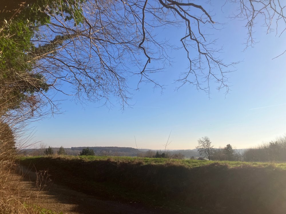
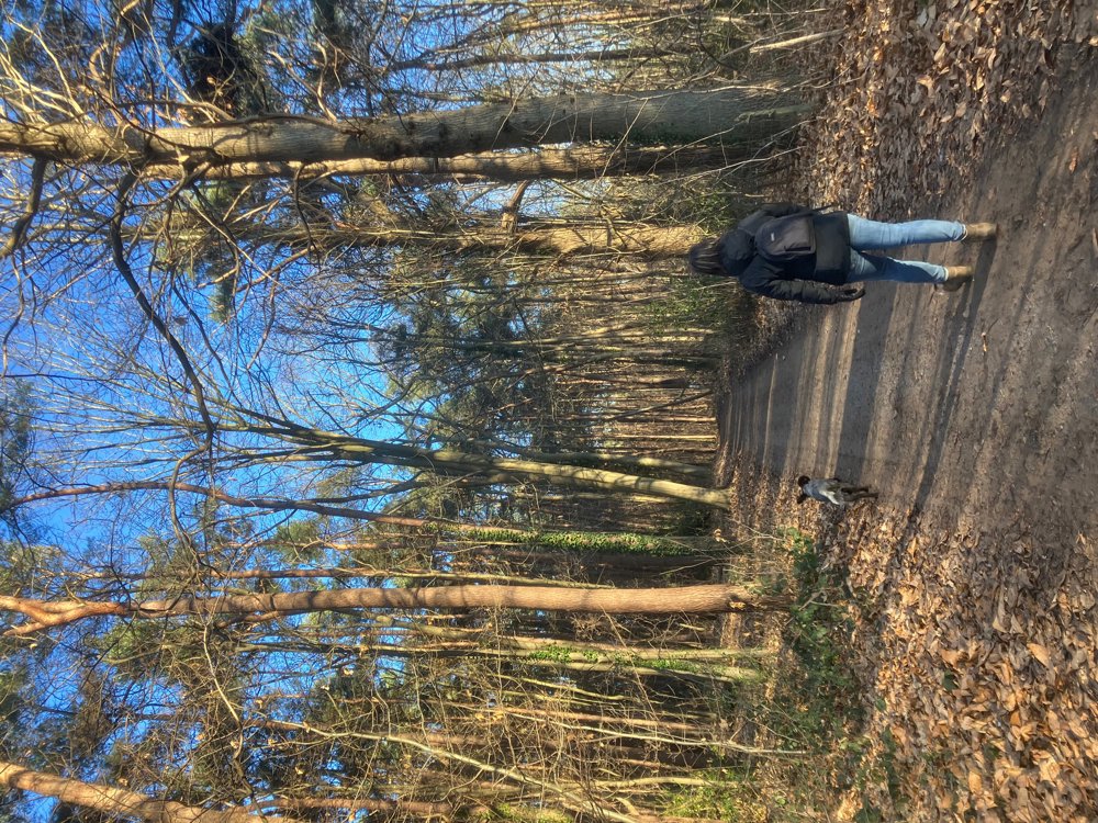
Walk through varying terrains
You start with the longest stretch of asphalt. Once past that, you become fully immersed in the Langdorp forests that grow even over the entire Bosberg. The route ascends and descends over the witness hill Bosberg. Sometimes, you can catch a glimpse of the Aarschot Demer Valley. This is also a beloved area for mountain bikers, so keep your four-legged friend on a leash.
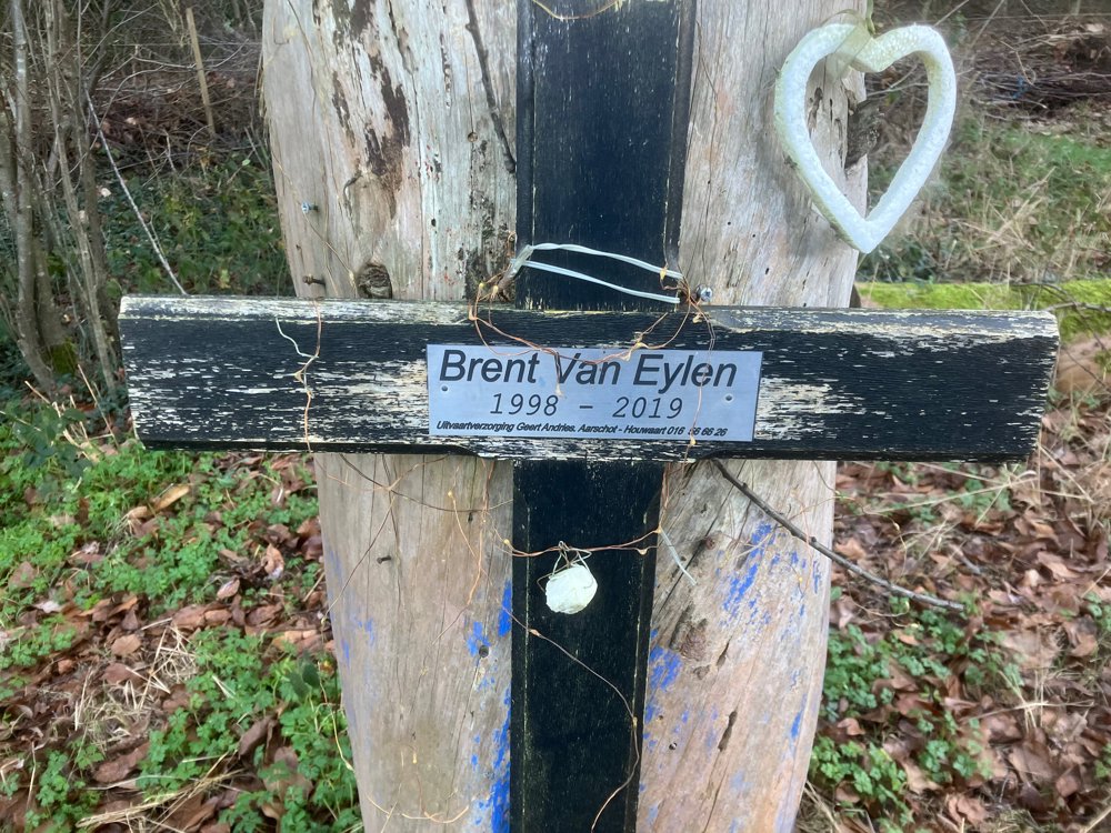
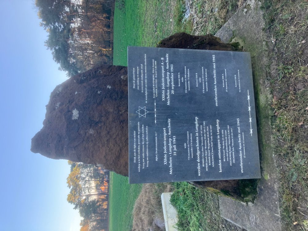
Along the way, you pass two special memorials. The first is a remembrance of the tragic death of 20-year-old Brent Van Eylen, who despite an open railway crossing was struck by a train and lost his life on June 20, 2019. A bit further is a plaque commemorating the 21st and 22nd Jewish transports Mechelen - Langdorp - Auschwitz.
You pass the Heimolen, which since 1662 has dominated the view of Den Ouden Stok. A totally different piece of nature.
Dining options at point 719 Irish Pub Dubh-Linn, at point 153 brasserie 't Sant, at Gijmel church café 't Hoekske.
(Hiking) boots recommended.
automatic translation
 nodes to follow
0 km
1.7 km
2.4 km
2.5 km
4 km
5.4 km
7.9 km
9.5 km
11.1 km
11.6 km
12.4 km
14.1 km


 Upgrade to Premium Plus
