 Hiking
 Login
Login
 More
More
 EN
EN
 Premium
Is Mjorrebeek still Little Brussels?
automatic translation
11.9 km • Hulshout
2.5742 0 0/5

 Addresse starting point (approximate)
Probastraat 5, 2235 Westmeerbeek, BE
 signage
The route is partially signposted with nodes. Use a GPS device or our app to follow the route.
 Description
Park for free at the business/shopping center "La Corbeille" (1) on the former site of the canning factory.
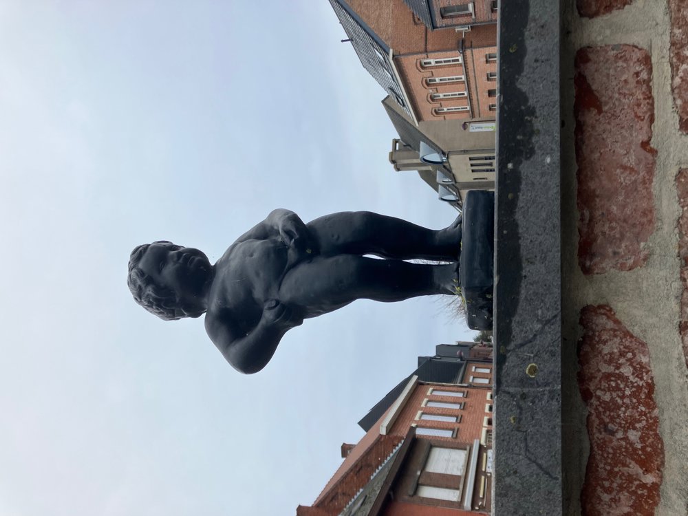
Westmeerbeek (Mjorrebeek = dialect) was derisively called Little Brussels by neighboring villages in the second half of the 19th century due to its urbanized character and the identical coat of arms with Brussels. Therefore, the residents of Hoogzand created their own "Manneke Pis" (2).
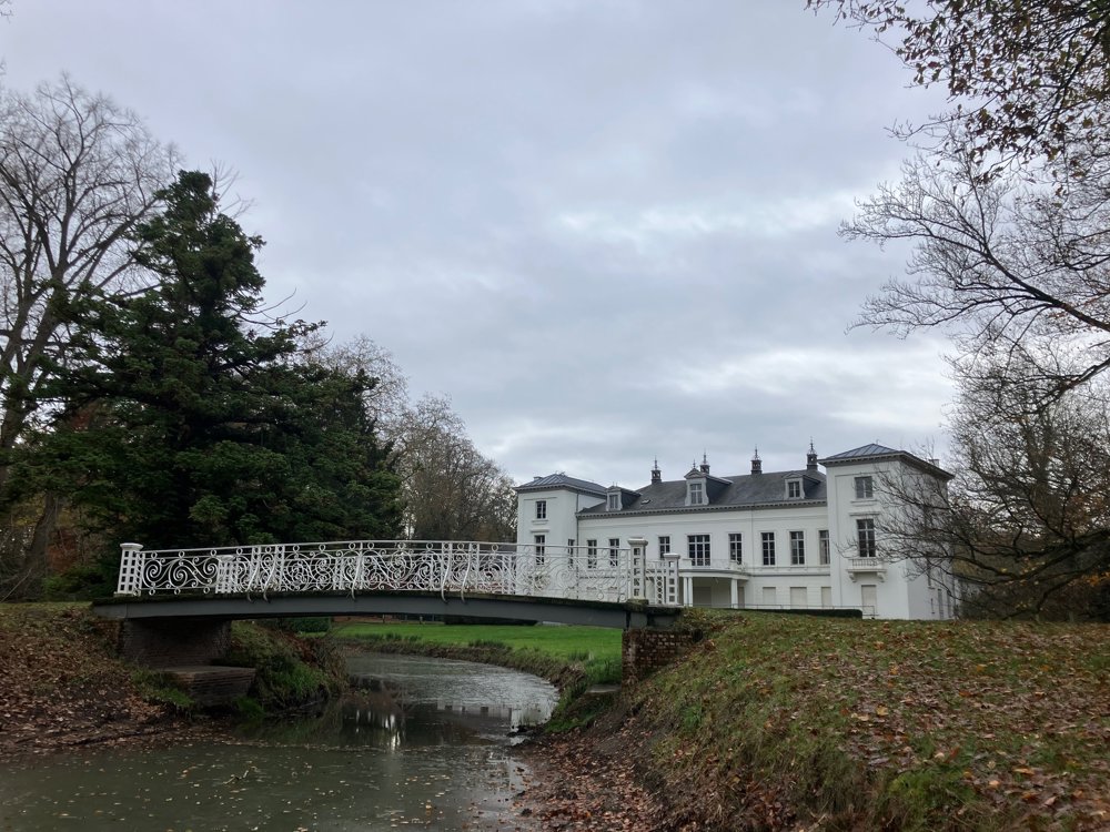
Additionally, they have the Grote Nete, a watercourse with the adjacent Hof ter Borght estate from the late 18th century, which contains more than 200 monumental veteran trees in its beautiful park forest (3).
Furthermore, more and more apartment buildings (4) are being constructed in the center.
Judge for yourself whether these four elements are enough for the comparison! In my opinion, the question is whether Brussels also has such a unique natural area as the limestone-rich Goor-Asbroek... or such a large tree and plant nursery as Arbor?
Dogs on leash
High hiking boots
Dining on the parking lot and in the center
automatic translation
 nodes to follow
0 km
0.6 km

0.7 km
0.9 km
1.1 km
1.3 km
1.8 km
2.3 km
3.4 km
3.8 km
4.5 km
4.6 km
5.2 km
5.8 km
6.2 km
7.2 km
7.9 km
8.6 km
8.9 km
9.5 km
11.3 km
11.6 km
11.9 km


 Upgrade to Premium Plus
