 Hiking
 Login
Login
 More
More
 EN
EN
 Premium
Zennewandeling
4.8 km • Beersel
 official route
4.5726 2 4.5/5
route offered by
 Addresse starting point (approximate)
Herman Teirlinckplein, 1650 Beersel
 signage
The route is signposted with thematic signs (no nodes). You can use a GPS device or our app to follow the route through the virtual nodes.
 Description
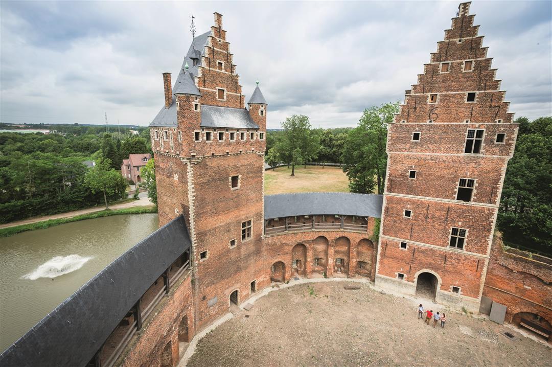
The green Zenne Valley brings you to the gate of the beautiful castle of Beersel, the eye-catcher of this hike. The castle still stands as it did at the end of the 15th century. You'll travel as it were five centuries back in time. Enjoy the wide views over the Zenne Valley and the southwestern part of Brussels. Near the church is Brewery 3 Fountains where craft lambic beer has been brewed for decades. This hike is signposted with a 6-sided sign called the Zennewandeling.
automatic translation
 nodes to follow
0 km
1.1 km
3.3 km
3.9 km
4.5 km
4.6 km
4.8 km
Sunday, February 1, 2026 by C.S.nice little walk
automatic translation
Saturday, June 12, 2021 by M.D.Provided you can focus your mind on something else than the sounds of the highway in the background, this is a very nice and relaxing hike with a magnificent variety of landscape that sometimes resembles paintings by Breughel. Very well signposted with a passage at Beersel Castle. Recommended
automatic translation


 Upgrade to Premium Plus
