Loading...

Mullerthal - extra tour A

automatic translation

22.8 km • Vallée de l'Ernz

1.1792 0 0/5

22.8 km 0.0 km 0.0 km

route offered by

Claudia Pierreux

Icon starting point Addresse starting point (approximate)

Rue de Savelborn 22C, 7660 Vallée de l'Ernz, LU

Icon type signage of route signage

The route is fully signposted with thematic signs (no nodes).

5m 5m 5m 5m
Atmosphere image 1 of route Mullerthal - extra tour A Atmosphere image 2 of route Mullerthal - extra tour A Atmosphere image 3 of route Mullerthal - extra tour A
© Claudia Pierreux

Icon description route Description

Parking spaces sufficient in the center of Medernach.

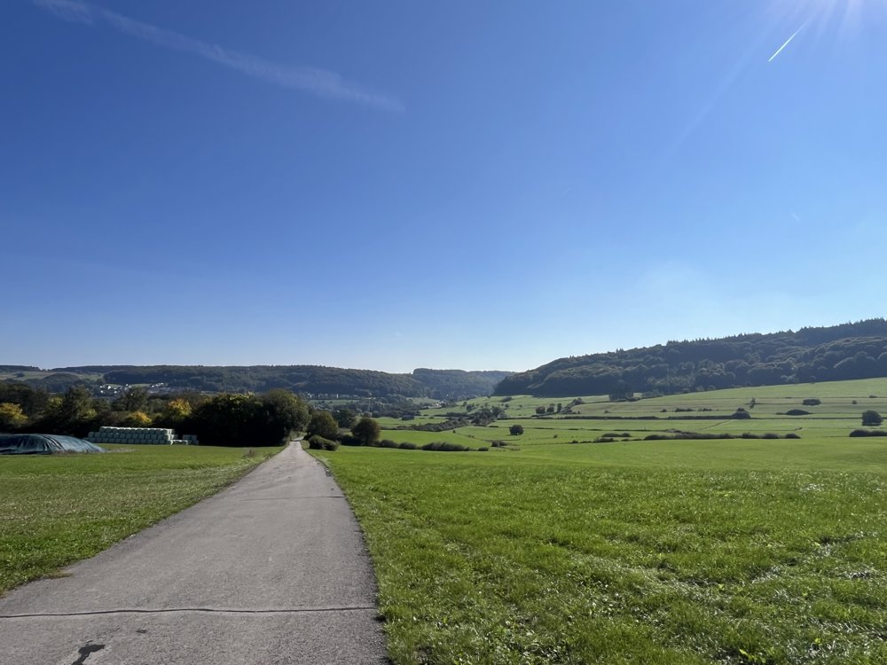
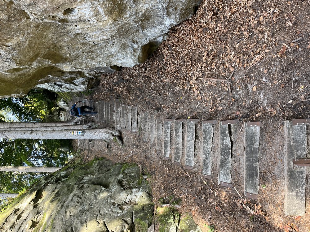
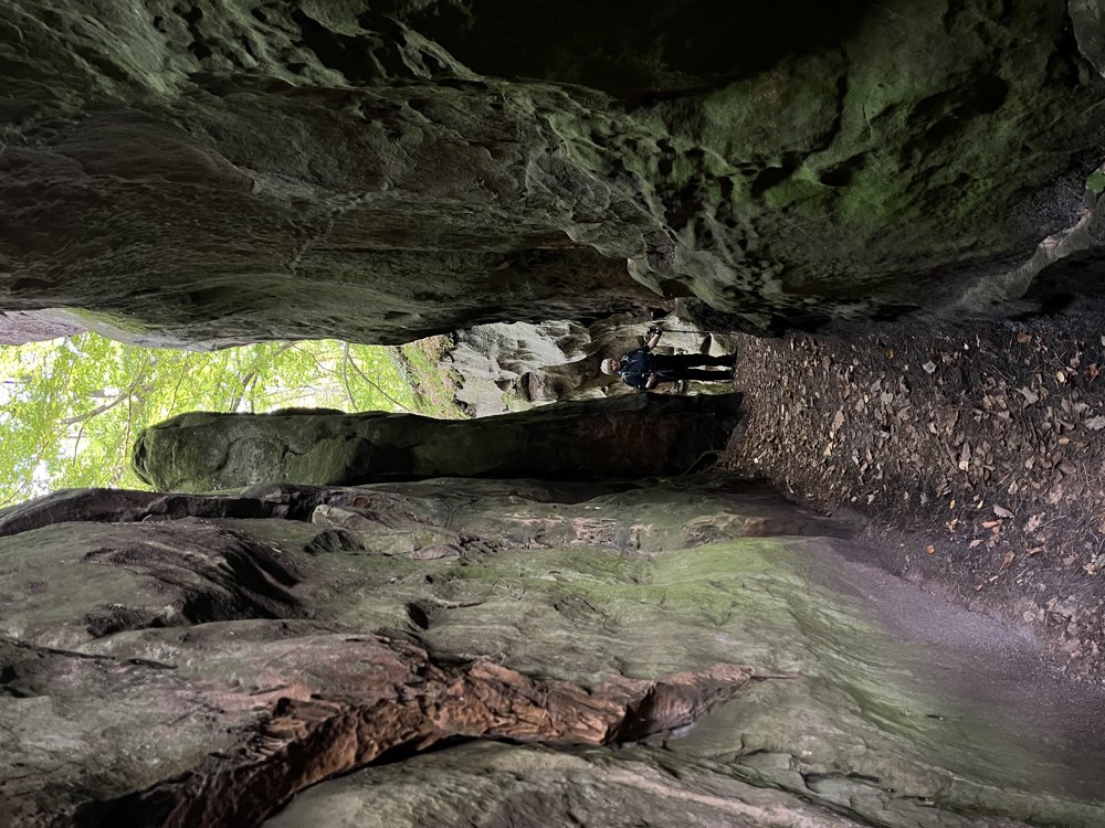
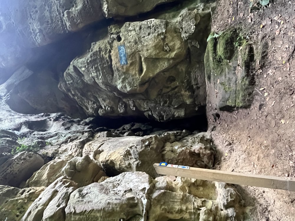
A very varied walk: flat parts on a plateau between the meadows, easy forest paths, but also very difficult sections with steep and narrow passages through the rocks.

Walk entirely from the Mullerthal map, marked with a light-colored "M".

Recorded with Strava - we reached 28.30 km.

automatic translation

This route does not have any reviews yet. Be the first!
Rate route!

Which POI do you want to show on the map?

Experimental hiking network
Unsigned icon

The route you have chosen runs (partly) along an experimental virtual hiking node network (the blue-coloured nodes and sections on the map).

You must be logged in to plan routes here.

Experimental hiking network
Unsigned icon

The route you have chosen runs (partly) along an experimental virtual hiking node network (the blue-coloured nodes and sections on the map).

These routes are not controlled in the field. Before you start hiking here, take a minute to read what an experimental hiking node network is and what rules you should follow when hiking here.