Loading...

Gors hike

automatic translation

13.9 km • Tienen

Icon official route official route

2.6297 0 0/5

13.9 km 0.0 km 0.0 km

route offered by

Badge of official route

more info

Icon starting point Addresse starting point (approximate)

Vierde Lansierslaan 84

Icon type signage of route signage

The route is not signposted. Use a GPS device or our app to follow the route.
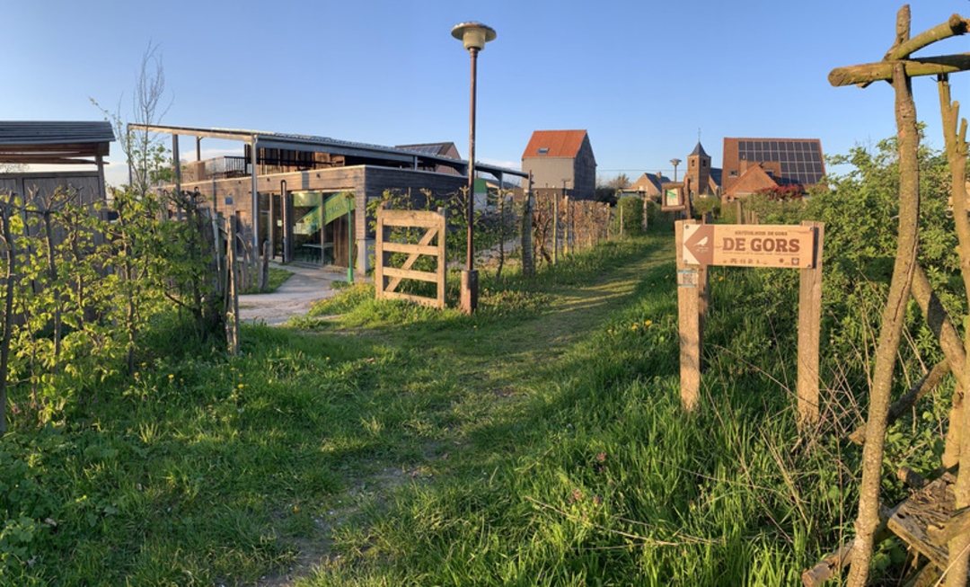
5m 5m 5m 5m
© Luc Nagels

Icon description route Description

Among other things, you will walk past the city park and the Grote Markt, cross the two beautiful valleys the Muizenbeemd and the Rozendaalbeek valley, have the view of the city's two church towers and you will be able to take a break at our Natuur.huis De Gors.

Lots of chances you will see or hear the buzzard flying overhead.

Along old Roman hollow roads over the 'Kopkens' and the skyline of Tienen, you finish back at your starting point.

Time to start now. Lots of hiking fun!

automatic translation

Icon nodes to follow nodes to follow

Icon start route
0 km
Icon deviation route
0.7 km
Icon deviation route
0.8 km
Icon deviation route
1.1 km
Icon deviation route
1.4 km
Icon deviation route
1.5 km
Icon deviation route
1.7 km
Icon deviation route
1.7 km
Icon deviation route
2.1 km
Icon deviation route
2.5 km
Icon deviation route
2.7 km
Icon deviation route
2.9 km
Icon deviation route
3.1 km
Icon deviation route
3.3 km
Icon deviation route
3.4 km
Icon deviation route
3.6 km
Icon deviation route
3.8 km
Icon deviation route
4 km
Icon deviation route
4 km
Image node 23
4.4 km
Image node 282
4.8 km
Image node 283
5 km
Image node 284
5.8 km
Image node 284
5.8 km
Image node 285
6.9 km
Image node 278
7.6 km
Image node 277
8.7 km
Image node 286
9.1 km
Image node 289
10.2 km
Image node 288
10.3 km
Image node 287
10.8 km
Icon deviation route
11.5 km
Icon deviation route
11.8 km
Icon deviation route
12.6 km
Icon deviation route
13 km
Icon deviation route
13.2 km
Icon deviation route
13.5 km
Icon deviation route
13.7 km
Icon deviation route
13.8 km
Icon stop route
13.8 km
This route does not have any reviews yet. Be the first!
Rate route!

Which POI do you want to show on the map?

Experimental hiking network
Unsigned icon

The route you have chosen runs (partly) along an experimental virtual hiking node network (the blue-coloured nodes and sections on the map).

You must be logged in to plan routes here.

Experimental hiking network
Unsigned icon

The route you have chosen runs (partly) along an experimental virtual hiking node network (the blue-coloured nodes and sections on the map).

These routes are not controlled in the field. Before you start hiking here, take a minute to read what an experimental hiking node network is and what rules you should follow when hiking here.