 Hiking
 Login
Login More
More EN
EN Premium
Ice walk
automatic translation
8.4 km • Huldenberg
 official route
1.2580 8 4.4/5
route offered by
 Addresse starting point (approximate)
Gemeenteplein, 3040 Huldenberg
 signage
The route is fully signposted with nodes.
 Description
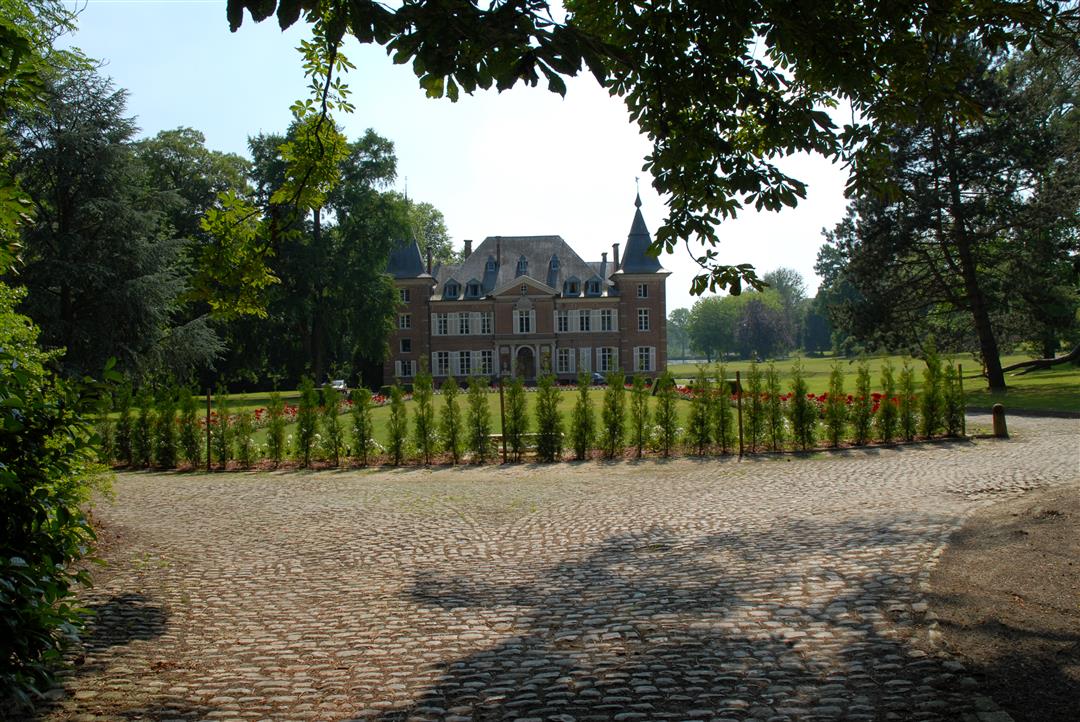
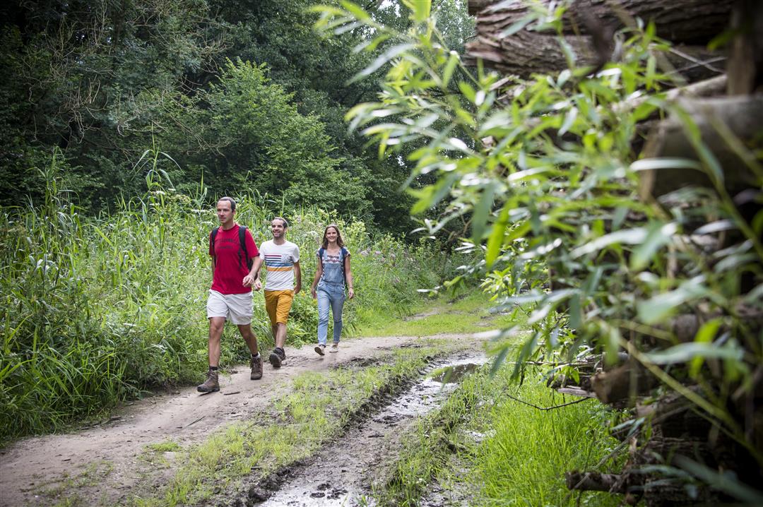
Explore the countryside and forests between Huldenberg and Loonbeek. Step past the castle grounds of Huldenberg. In the greenhouses of the castle, gardener Felix Sohie grew the first real greenhouse grapes. A bronze plaque at the entrance gate commemorates this visionary gardener. From the western slope of the IJsevallei, you have a beautiful panorama. Enter the Margijsbos where you walk along the IJse over the steep slopes of the IJsevallei.
This hike is offered by Tourism Flemish Brabant.
automatic translation
 nodes to follow
0 km
1 km
1.3 km
1.6 km
3.1 km
3.7 km
4.6 km
5.1 km
5.2 km
5.9 km
6.9 km
7.4 km
8.2 km
8.3 km
Saturday, September 3, 2022 by Yasmin VdCGreat hike! You are almost immediately in peace and nature. Few stimuli along the way which can be nice for owners and animals. Sometimes a bit monotonous because of the many straight, semi-paved roads. Streams at the end. Parking without problems. Ice bar as reward right across parking lot = highly recommended!
automatic translation
Saturday, May 29, 2021 by A.T.Top hike in a beautiful rolling landscape. Good and clear signage. Highly recommended!
automatic translation
Sunday, May 16, 2021 by Michel VMVery nice hike almost 100% in natural area. Starts with a steep climb! Even with a lot of rain it remains passable. Well marked. Definitely in my top 5.
automatic translation
Sunday, May 2, 2021 by P.B.Very nice walk in greenery. Beautiful views. Almost no streets. Is in my top 3
automatic translation
Sunday, April 25, 2021 by A.L.Very nice walk !
automatic translation
Thursday, April 8, 2021 by Danny Van cauwenbergheVery nice walk in beautiful region, where you always walk in nature only a small piece of track. Good to do even in rainy weather. Sign 23 is back there! Slope in the beginning is not too bad.
automatic translation
Sunday, February 14, 2021 by A.S.Very nice hike with fantastic views. Only junction 23 was difficult to find (according to me is sign gone?). Lots of variation in landscapes. Wear good footwear. Super!
automatic translation
Monday, January 18, 2021 by herman verheirstraetenDid a few weeks ago. Particularly beautiful! Starts with steep climb, which is why I would do the hike in reverse. The climb is then gradual. Particularly nice long stretch at the top of the hill. Reasonably easy to walk in wet weather also with low footwear. Easy parking at the start.
automatic translation


 Upgrade to Premium Plus
