Loading...

A new section of hiking network in the Heuvelland!

automatic translation

21.2 km • Heuvelland

3.0618 1 5/5

21.2 km 0.0 km 0.0 km

route offered by

Ingrid Tiersen

Icon starting point Addresse starting point (approximate)

Kapelaniestraat 5, 8953 Heuvelland, BE

Icon type signage of route signage

The route is fully signposted with nodes.

5m 5m 5m 5m
© Ingrid Tiersen

Icon description route Description

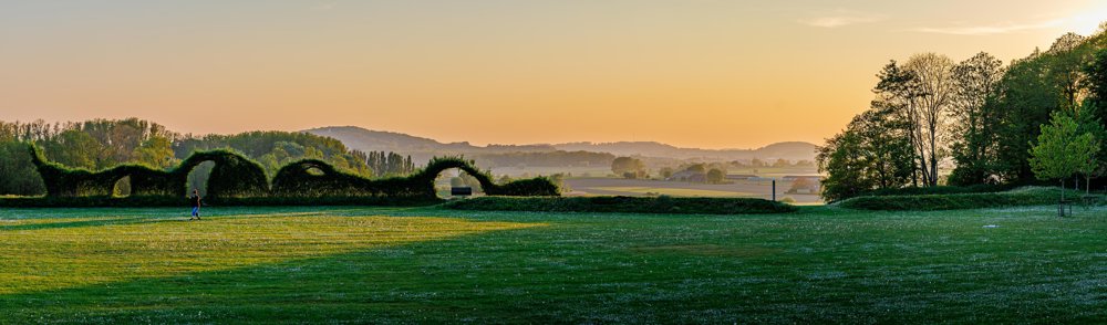
Hiking along a new part of the walking network! Wijtschate, neighboring municipality of Kemmel.

A mix of rural roads, through a forest, with historical sites along the way and challenging elevations.

✅ Choose the full route or split the route into a loop of 14 km and a loop of 7.3 km.

✅ The second loop takes you past an impressive crater and two cemeteries that are UNESCO World Heritage sites.

✅ Lots of elevations!

automatic translation

Icon nodes to follow nodes to follow

Image node 34
0 km
Image node 32
0.5 km
Image node 31
1.1 km
Image node 29
1.4 km
Image node 30
2.5 km
Image node 77
4.6 km
Image node 1
7.9 km
Image node 2
8.1 km
Image node 3
8.5 km
Image node 79
8.8 km
Image node 5
9.1 km
Image node 76
9.6 km
Image node 34
13.6 km
Image node 35
14.5 km
Image node 50
15.7 km
Image node 38
16.1 km
Image node 38
16.1 km
Image node 38
16.1 km
Image node 36
16.6 km
Image node 37
17 km
Image node 23
17.1 km
Image node 24
17.6 km
Image node 25
18.2 km
Image node 26
19.4 km
Image node 27
19.7 km
Image node 28
20.2 km
Image node 33
20.3 km
Image node 32
20.7 km
Image node 34
21.2 km
This route has 1 review(s).
Rate route!

Friday, May 8, 2026 by Nathalie PEEREA bit unclear at point 31
There are a few sections with tall grass, so wear pants! It stings 😉
automatic translation

Which POI do you want to show on the map?

Experimental hiking network
Unsigned icon

The route you have chosen runs (partly) along an experimental virtual hiking node network (the blue-coloured nodes and sections on the map).

You must be logged in to plan routes here.

Experimental hiking network
Unsigned icon

The route you have chosen runs (partly) along an experimental virtual hiking node network (the blue-coloured nodes and sections on the map).

These routes are not controlled in the field. Before you start hiking here, take a minute to read what an experimental hiking node network is and what rules you should follow when hiking here.