 Hiking
 Login
Login
 More
More
 EN
EN
 Premium
The Buddies
automatic translation
7 km • 2920 Kalmthout
 official route
2.3036 3 4.3/5
 Addresse starting point (approximate)
Hanneke Wiewau (Parking Visvijver De Maatjes)
 signage
The route is fully signposted with nodes.
 Description
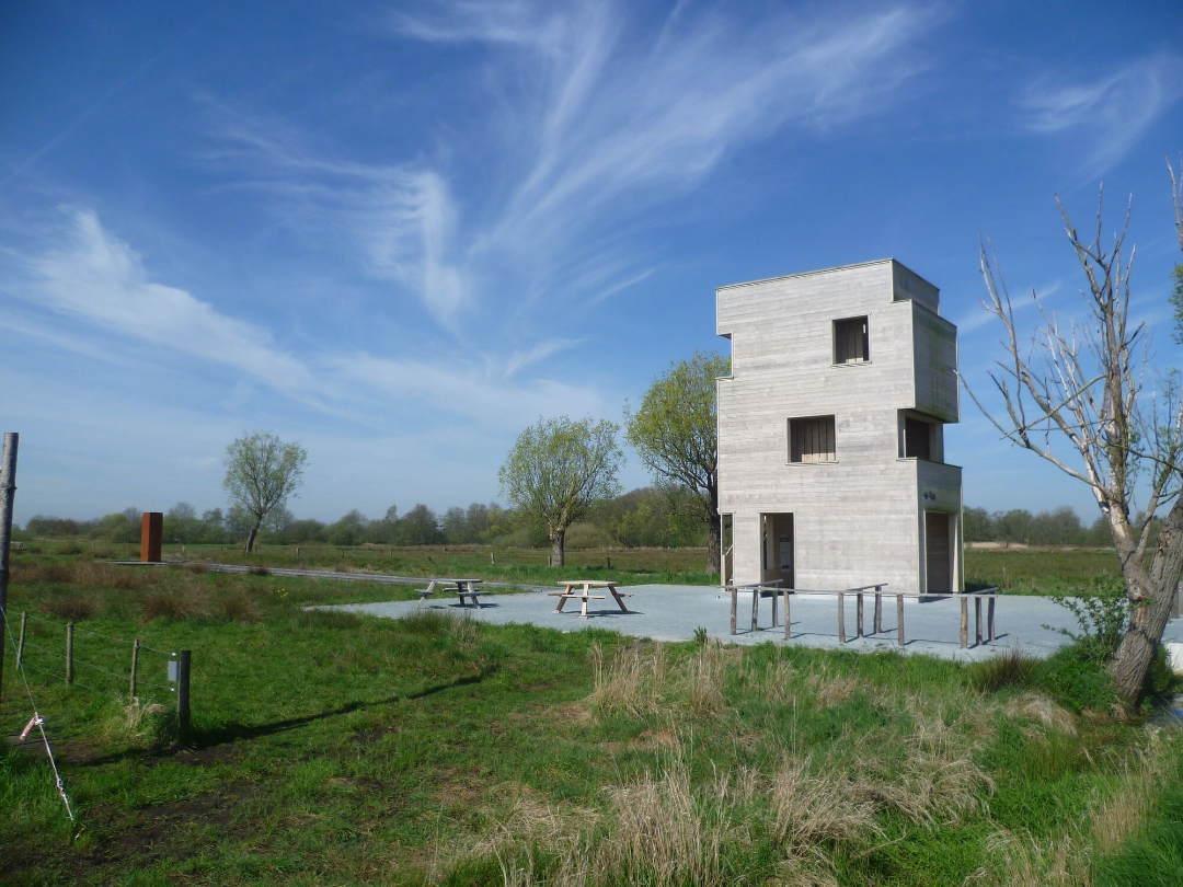
Discover this unique nature reserve with reed beds, pocket forests and wet meadows. The reed bed De Maatjes encompasses Nieuwmoer and Wuustwezel as well as Dutch territory. Rare reed and meadow birds have their nesting place here. Be sure to step inside the watchtower 'De Klot'. Here you can also learn more about the history of the peat, which is very characteristic of this region.
automatic translation
 nodes to follow
0 km
0.1 km
0.5 km
2.3 km
3.4 km
4.3 km
5.3 km
6.2 km
6.3 km
6.9 km
Tuesday, January 20, 2026 by G.K.I walk in the opposite direction and come across a No Entry sign between 37 and 36. Halfway there is a pole with two arrows pointing towards 36. One straight ahead and one turning left (!)...duh. I searched but gave up, walking back from 37 to 38 and home. Too bad, I wanted to do the whole trip.
automatic translation
Tuesday, November 11, 2025 by T.V.Very nice hike!
Do need to mention that it is not suitable for buggies or wheelchairs due to the narrow high gates between the meadows.
automatic translation
Friday, September 12, 2025 by Anonieme GebruikerBeautiful route in a very valuable natural area.
automatic translation


 Upgrade to Premium Plus
