 Hiking
 Login
Login
 More
More
 EN
EN
 Premium
Blackwater & Snepkens Pond
automatic translation
8.2 km • 2200 Herentals
 official route
6.29120 4 3.4/5
route offered by
 Addresse starting point (approximate)
Lichtaartseweg 111 (Begraafplaats Herentals Bosbergen)
 signage
The route is fully signposted with nodes.
 Description
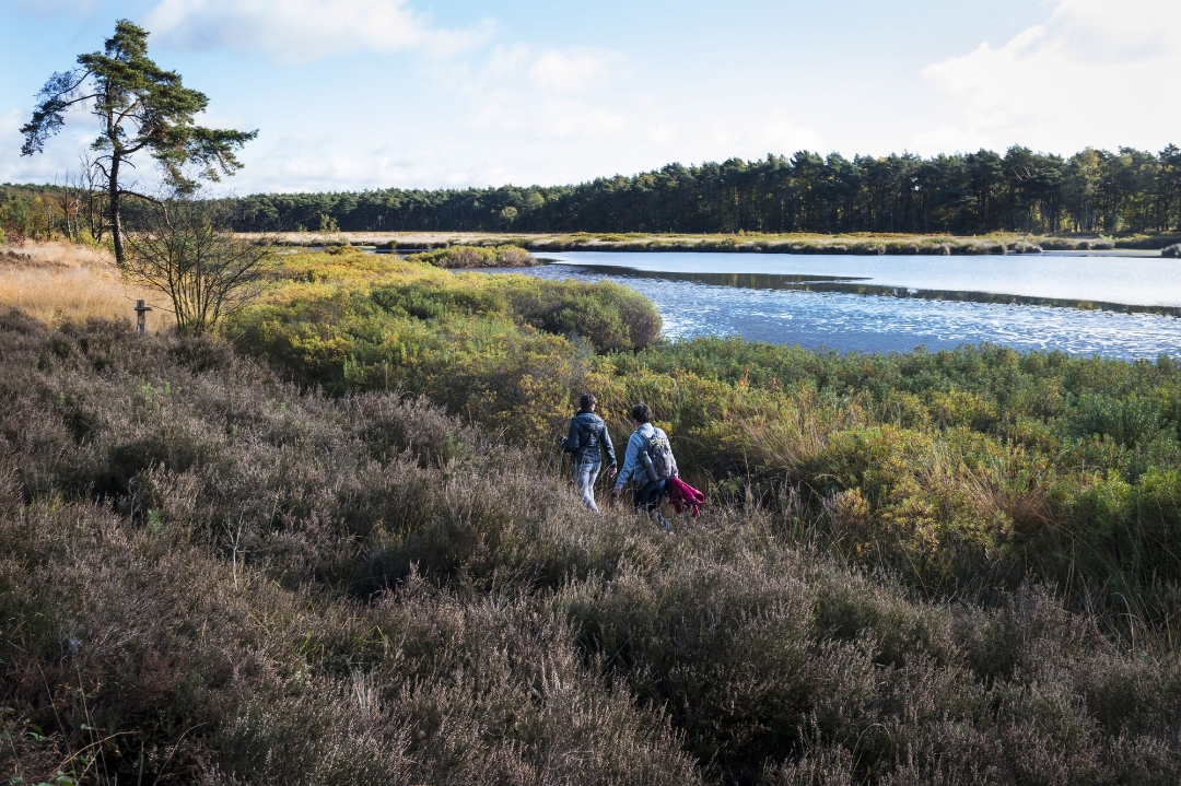
Need to clear your head and discover a beautiful piece of Kempen nature? Then put on your walking shoes for this invigorating hike along marshes, woods and heathland. Your route includes the Zwart Water nature reserve, a typical Kempen pond where bird watchers can indulge themselves. Further on, the Snepkensvijver invites you for a welcome break, one of the last wet moors in the Kempen.
This hike takes you past many other beautiful and unique places:
- The oldest Stations of the Cross in the country
- The wooden Tourist Tower at the highest point of Herentals, offering a magnificent view of the Heuvelrug
- The Chapel of Our Lady of the Sand
Thirsty?
Treat yourself to a delicious Tower Keeper on the terrace at the foot of the Tourist Tower.
automatic translation
 nodes to follow
0 km
0.3 km
1.7 km
3.5 km
4.1 km
5 km
5.2 km
6.4 km
6.8 km
7.7 km
8.1 km
Thursday, April 9, 2026 by Jeroen VinkA very pleasant walk with varied scenery
automatic translation
Sunday, November 23, 2025 by T.V.I followed the link in the De Kempen hiking magazine for this route. However, in the magazine there are more nodes in the route. The route as shown here on the website does not go past Black Water and Snepkensvijver at all, why were nodes removed? After node 16, go to 20, then 81 and 16 again for the original route.
automatic translation
Monday, November 3, 2025 by raymond gorremansNice forest hike with slight sand hills, but easily doable. Too bad black water area is not marked? Or did I miss it
automatic translation
Sunday, August 24, 2025 by Inge Liessenice walk especially after you cross the railroad the first time
automatic translation


 Upgrade to Premium Plus
