 Hiking
 Login
Login
 More
More
 EN
EN
 Premium
Chabaud Latour
automatic translation
13.1 km • Nord
3.9136 0 0/5

 Addresse starting point (approximate)
Rue Richelieu 9, 59163 Condé-sur-l'Escaut, FR
 signage
The route is not signposted. Use a GPS device or our app to follow the route.
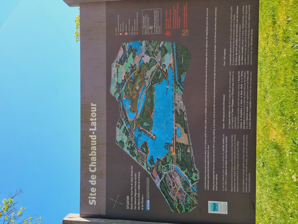

 Description
Beautiful walk!
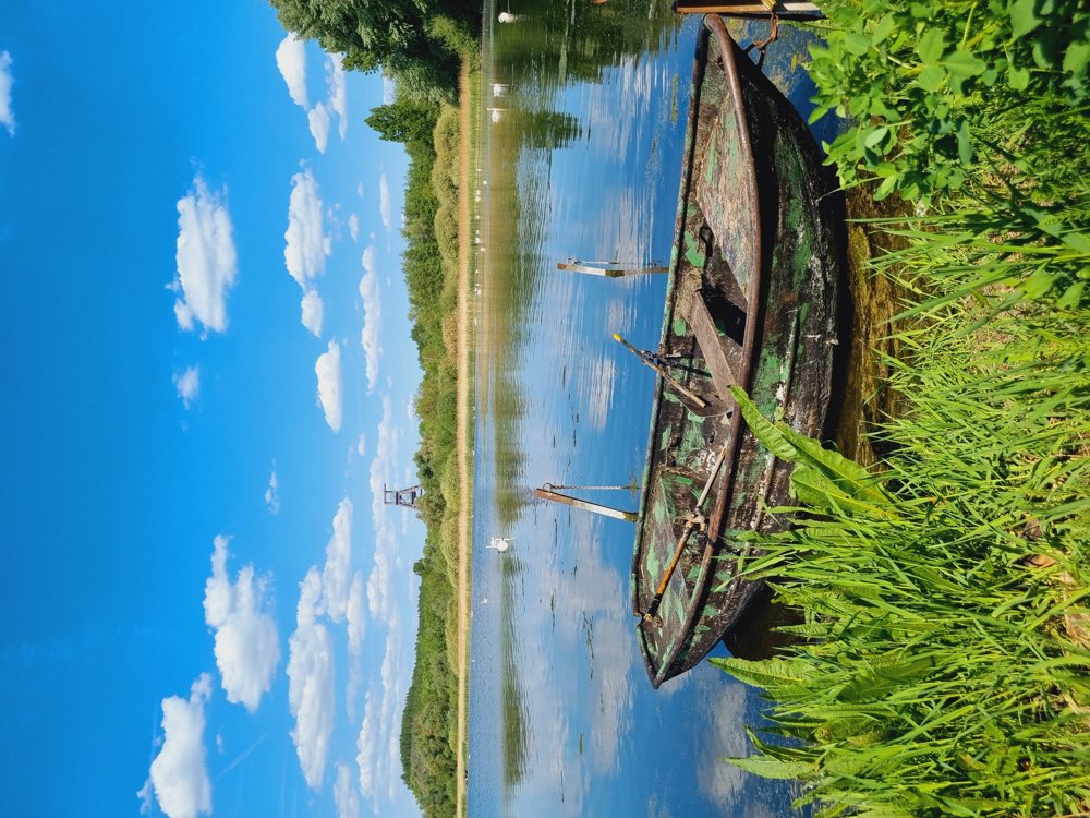
A small copy of Terhills in Maasmechelen. Unknown and less touristy. Only 1h20 from Bruges, just across the border with West Flanders.
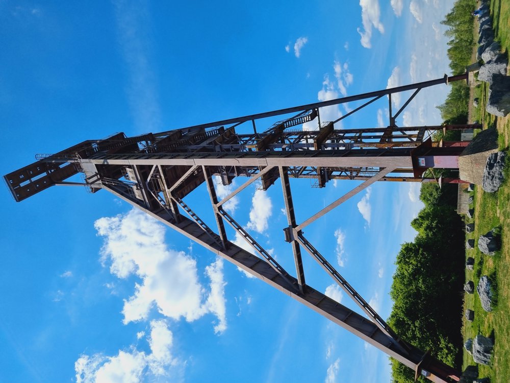
⛰️ Climb the slag heap for a panoramic view and further enjoy the beautiful view of the Chabaud-Latour pond.
ℹ️ Info: Not signposted, GPX file
📏 10.8 km of which 62% unpaved
👩🏫 My rating: 8/10
🐾 Dogs allowed on a leash
👶🏻 Not buggy-proof
☕️ La Guinette du Lac
🅿️ Rue Richelieu, Condé-sur-l'Escaut (free)
Hauts-de-France
Tip: Being early is the key ☺️
Have fun 🙋♀️
automatic translation


 Upgrade to Premium Plus
