 Hiking
 Login
Login
 More
More
 EN
EN
 Premium
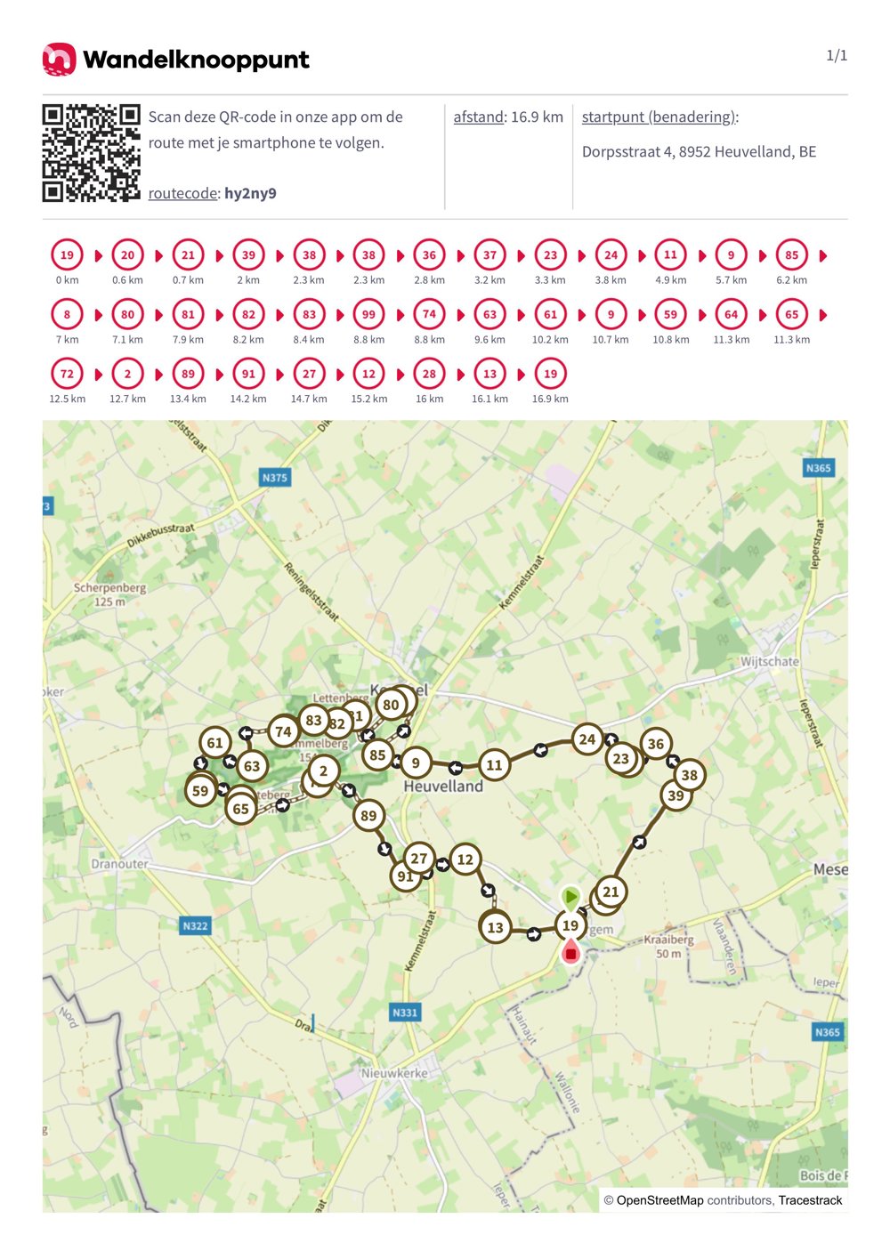
Four Heuvelland villages in one route
automatic translation
16.9 km • Heuvelland
2.8996 0 0/5
16.9 km
0.0 km
0.0 km

 Addresse starting point (approximate)
Dorpsstraat 4, 8952 Heuvelland, BE
 signage
The route is fully signposted with nodes.
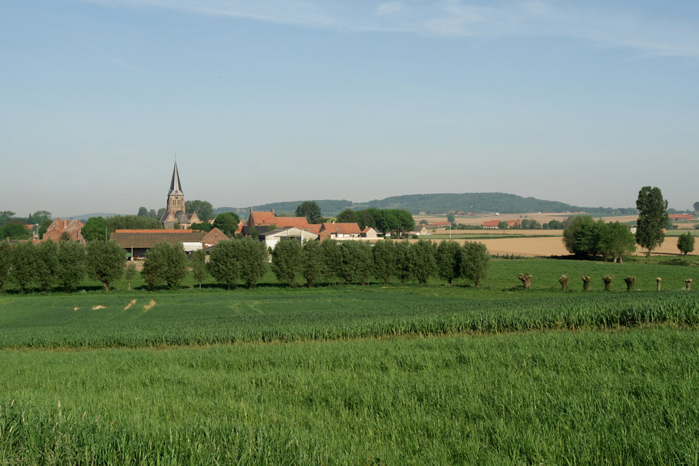
© Ingrid Tiersen
 Description
This is a route for both the leisurely and the brisk walkers.
Ten km of paved roads from village to village + 7 km along paths up the hills, including the Kemmelberg!
Further along breathtaking views and… through vineyards (yes, tasting is allowed...afterwards!).
automatic translation
 nodes to follow
0 km
0.6 km
0.7 km
2 km
2.3 km
2.3 km
2.8 km
3.2 km
3.3 km
3.8 km
4.9 km
5.7 km
6.2 km
7 km
7.1 km
7.9 km
8.2 km
8.4 km
8.8 km
8.8 km
9.6 km
10.2 km
10.7 km
10.8 km
11.3 km
11.3 km
12.5 km
12.7 km
13.4 km
14.2 km
14.7 km
15.2 km
16 km
16.1 km
16.9 km


 Upgrade to Premium Plus
