 Hiking
 Login
Login
 More
More
 EN
EN
 Premium
A Speculowandeling
6.1 km • Kortenaken
 official route
1.6450 2 2/5
route offered by
 Addresse starting point (approximate)
Kerk Onze-Lieve-Vrouw van de Rozenkrans, Dorpsstraat, 3470 Ransberg (Kortenaken)
 signage
The route is signposted with thematic signs (no nodes). You can use a GPS device or our app to follow the route through the virtual nodes.
 Description
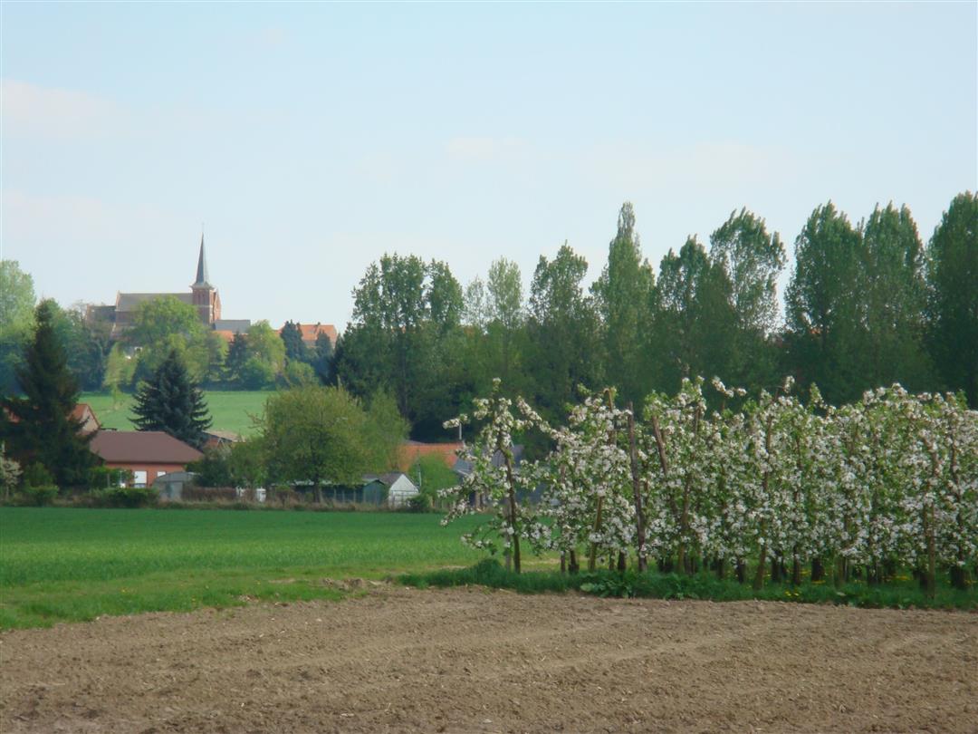
At the top of the Ransberg, a magnificent view of vast fruit orchards, meadows, and forests awaits you. On one side, you look out over the Velpe Valley; on the other, the equally beautiful Gethe Valley. The hiking trail takes you past the neo-Gothic castle of A Speculo, the water tower, and the parish church of Our Lady of the Rosary. Want to take a break to enjoy the scenery? Then sit down on the bench next to the fruit-themed artwork “Shelter.”
Before you set out:
This is a walk on a virtual hiking network. The junctions are not marked on the ground. Follow the hexagonal red-and-white signs bearing the name of the walk.
automatic translation
 nodes to follow
0 km
0.1 km
0.2 km
0.9 km
2.2 km
3.1 km
4.4 km
4.6 km
5.9 km
6.1 km
Sunday, September 20, 2020 by G.M.Beginning and end of the hike are worthwhile. Otherwise paved field (concrete) roads.
automatic translation
Monday, December 30, 2019 by Freddy HoutmeyersDec 30, 2019 did this hike.
Felt disappointing mss it was not the right time of year...but as in the info to this hike is written that you walk around the castle of A Speculo we did not see a castle...Also we did not like the part on paved roads.
Conclusion : boring hike....
automatic translation


 Upgrade to Premium Plus
