 Hiking
 Login
Login More
More EN
EN Premium
Heirbaan walk
automatic translation
9.7 km • Glabbeek
 official route
1.0691 2 3.8/5
route offered by
 Addresse starting point (approximate)
Sint-Antoniuskerk, Solveldweg, 3384 Attenrode-Wever (Glabbeek)
 signage
The route is signposted with thematic signs (no nodes). You can use a GPS device or our app to follow the route through the virtual nodes.
 Description
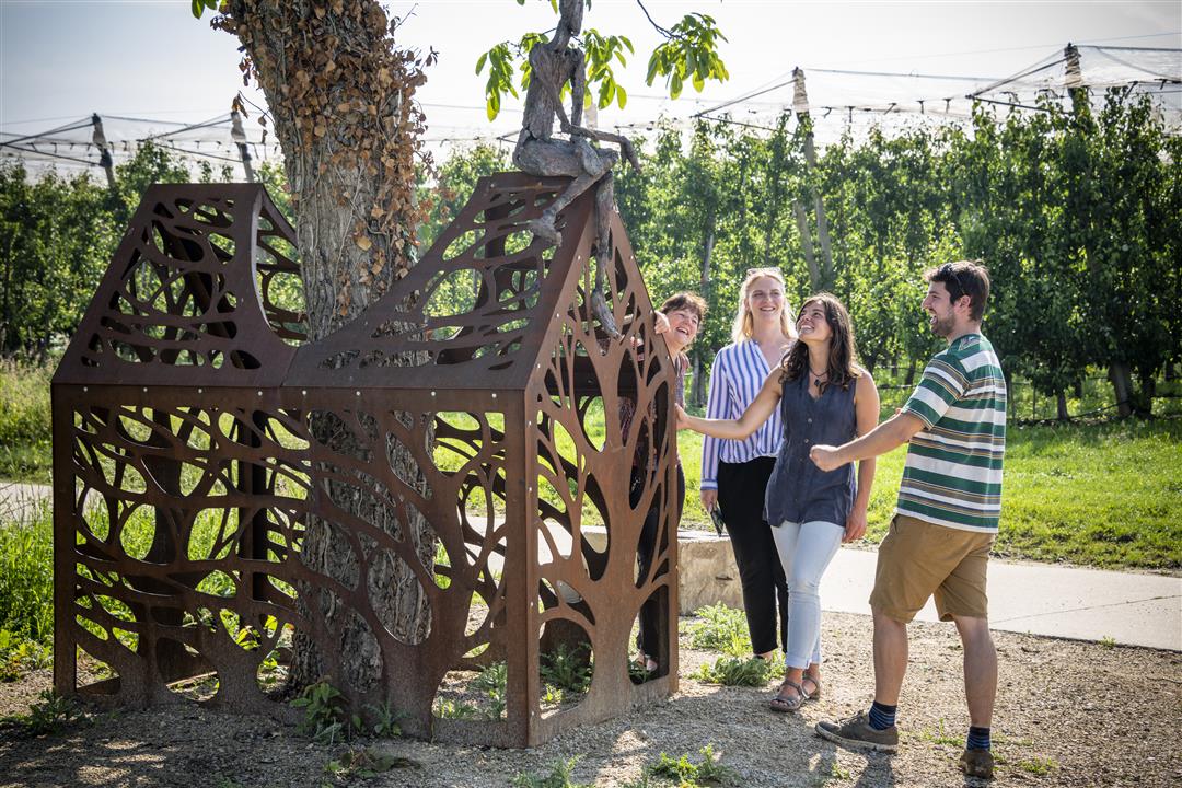
The Heirbaan hike takes you along roads that were built by the Romans. Enjoy the tranquility and wide vistas over the Velpe Valley. You walk past the magnificent castle de l'Escaille Attenrode and the Heinskensberg chapel, which is famous in the stitching. Along the way you will come across the fruit sculpture "Symbiosis", where you have a beautiful view over the valley of the Zeyp.
NOTE: This is a walk on a virtual walking network. The nodes are not signposted on the property. Follow the 6-sided red and white signs with the name of the hike.
This hike is offered by Tourism Flemish Brabant.
automatic translation
 nodes to follow
0 km
0.2 km
3.4 km
4.7 km
6.3 km
8.2 km
9.3 km
9.7 km
Saturday, September 5, 2020 by Guy Van dammeDespite the fact that there are many asphalt and concrete roads, we give this hike 4 stars because it was so quiet and peaceful. It is hilly. You can enjoy the quiet and wide views. Also historically interesting. You discover it while hiking. Take your time for this. A nice walk and highly recommended.
automatic translation
Wednesday, July 22, 2020 by Verschueren EefNice walk, both on dirt roads and just on streets. Definitely quiet and beautiful nature.
automatic translation


 Upgrade to Premium Plus
