 Hiking
 Login
Login
 More
More
 EN
EN
 Premium
Summit Tour Heuvelland over three 'mountains'
automatic translation
11.4 km • Heuvelland
3.13714 4 5/5

 Addresse starting point (approximate)
Poperingestraat 34, 8954 Heuvelland, BE
 signage
The route is fully signposted with nodes.
 Description
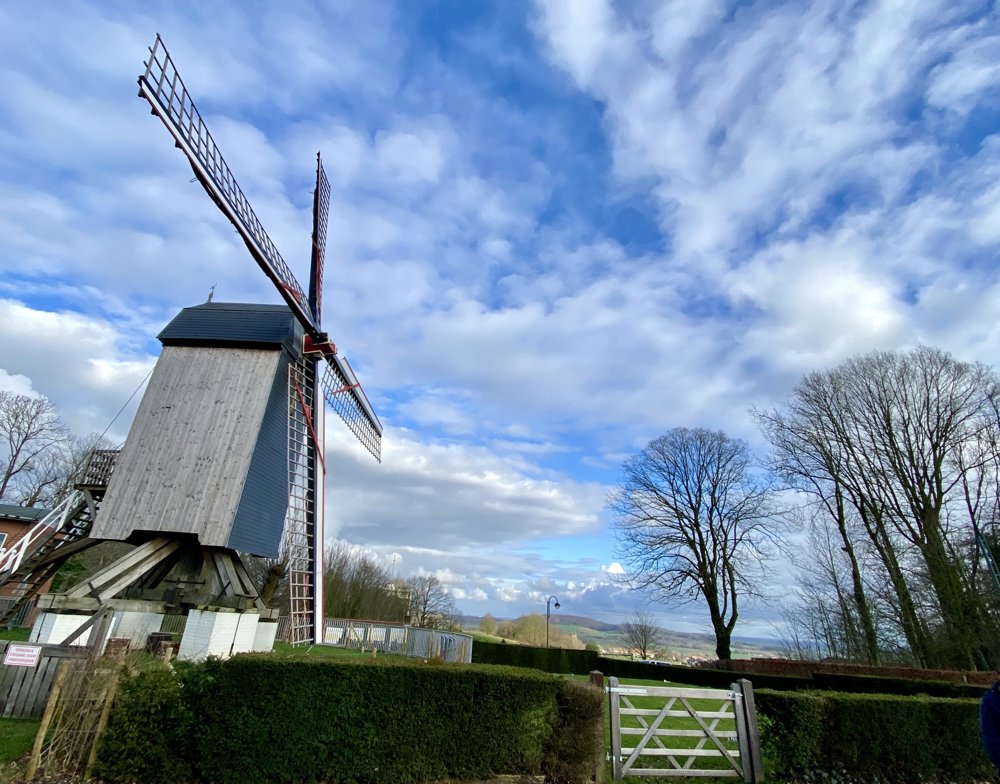
Over the Sulberg, Scherpenberg and Rodeberg.
Highest point 137 meters, lowest point 41.6 meters above sea level.
Climbing, descending, and enjoying beautiful vistas. You also walk past the Lijstermolen. A good training for 'mountain walking'!
automatic translation
 nodes to follow
0 km
0.1 km
0.8 km
1.2 km
1.4 km
1.7 km
1.9 km
2.4 km
2.5 km
3.7 km
3.8 km
4.3 km
4.3 km
6.2 km
6.4 km
7.6 km
8 km
8.2 km
8.3 km
8.9 km
8.9 km
9 km
9.4 km
9.5 km
9.7 km
9.8 km
9.9 km
10.2 km
10.3 km
10.7 km
11 km
11.4 km
Wednesday, October 8, 2025 by Werner De VisWonderful hike. For repetition.
automatic translation
Sunday, August 3, 2025 by T.D.Very nice hike, well worth it!
automatic translation
Saturday, July 26, 2025 by Petra AmezVery nice walk, forest interspersed with vast fields. Really enjoy nature
automatic translation
Tuesday, June 17, 2025 by Jos VeelenVery nice, varied route. Forest and views, quiet paths. Highly recommended
automatic translation
Wednesday, July 23, 2025 by Ingrid TiersenThank you Jos!
automatic translation


 Upgrade to Premium Plus
