
 Hiking
 Login
Login
 More
More
 EN
EN
 Premium
Klein Zwitserlandwandeling
11.9 km • Boutersem
 official route
4.62210 9 3.2/5
route offered by

 Addresse starting point (approximate)
Boerenzaal, Malendriesstraat 51, 3370 Kerkom (Boutersem)
 signage
The route is signposted with thematic signs (no nodes). You can use a GPS device or our app to follow the route through the virtual nodes.
 Description
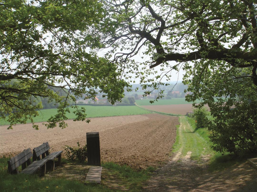
The headwaters of the Winge and the Molenbeek in Kerkom have been dubbed “Little Switzerland of the North.” As you stroll through the picturesque Velpe Valley, you’ll quickly see why. On this walk, you’ll enjoy stunning views and wander along the banks of the Velpe. During wet periods, boots are a must here. Admire the Hof van Kerkom across from the church; this farmstead dates back to the 13th century.
Before you set out: This is a walk on a virtual hiking network. The junctions are not marked on the ground. Follow the hexagonal red-and-white signs bearing the name of the walk.
automatic translation
 nodes to follow
0 km
1.8 km
2.2 km
3 km
4.9 km
5.3 km
5.5 km
6 km
6.1 km
6.9 km
7.8 km
9.2 km
9.7 km
11.3 km
11.8 km
Thursday, July 23, 2026 by L.D.I find the name a bit of a stretch because it didn’t feel like “Switzerland” at all, not even in a small way. A peaceful walk with some beautiful views here and there. Very rural, very varied. I found all the signposts, but somewhere halfway through you have to follow them in reverse order and then, after a while, back to the normal order.
automatic translation
Sunday, November 30, 2025 by E.D.Nice, quiet hike. Especially southern loop past Velpe can be very wet and soggy. All signs of signage are present and clear.
automatic translation
Friday, August 1, 2025 by Filip WinderickxVery nice quiet walk full of variety of fields, streams, forests, small village centers and beautiful views. Indeed not Switzerland, but Hagelands hilly. Highly recommended. The hexagonal white-red pointer signs are sometimes missing, and the path of the northern loop towards Breisem sometimes walking through tall grass. Some maintenance is needed there.
automatic translation
Saturday, July 23, 2022 by Tamara NotaertsBeautiful walk . Especially along quiet field and forest roads. Only when you are almost at the end we missed? Or did a sign disappear.... Followed slow road and ended up back at a sign after turning around at the intersection ;) Absolutely recommended
automatic translation
Friday, February 19, 2021 by M.V.Except for an unpleasantly too long stretch along Kerkom Street, this is still a nice walk
automatic translation
Saturday, February 6, 2021 by Ingrid VandijckNice walk except for the last quarter when you walk along a busy lane with no passable shoulder for quite some time.
automatic translation
Sunday, September 20, 2020 by G.M.Surely the name of this hike is misleading. >Mini-mini-mini Switzerland hike. The number of beautiful views during this hike is not that numerous
automatic translation
Saturday, October 26, 2019 by M.S.indeed, many signposts have disappeared....
Too bad
automatic translation
Thursday, October 17, 2019 by M.D.Beautiful hike, but. In the upper loop, almost all the signposts have disappeared (or we didn't find them). Unpaved roads have since been asphalted and vistas are hidden behind new villas.... This was a bit disappointing.
automatic translation



 Upgrade to Premium Plus


