Loading...

Hobos: The Great Garden

automatic translation

9.9 km • Pelt

8633 1 4/5

9.9 km 0.0 km 0.0 km

route offered by

Eddy & Rita

Icon starting point Addresse starting point (approximate)

Witherendreef 1, 3900 Overpelt, BE
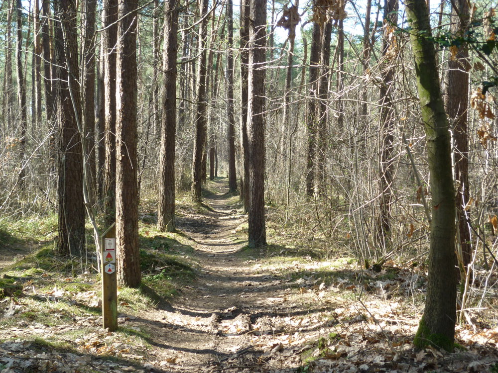
Icon type signage of route signage

The route is fully signposted with nodes.

5m 5m 5m 5m
Atmosphere image 1 of route Hobos: The Great Garden Atmosphere image 2 of route Hobos: The Great Garden Atmosphere image 3 of route Hobos: The Great Garden
© Eddy & Rita

Icon description route Description

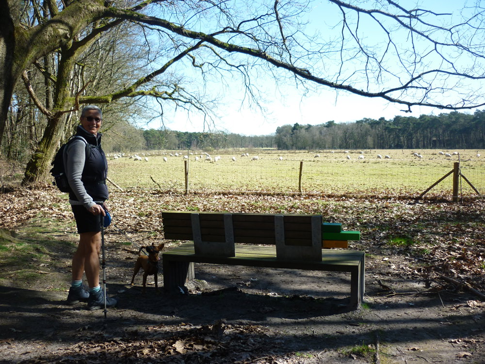
We did this walk on 18/03/2025 (12,269 steps).

This route is signposted in both directions with a red triangle and with junction nodes.

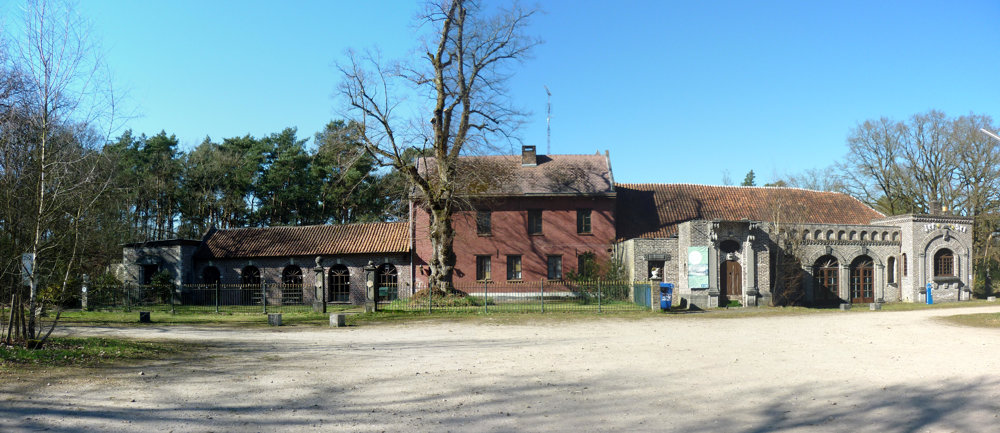
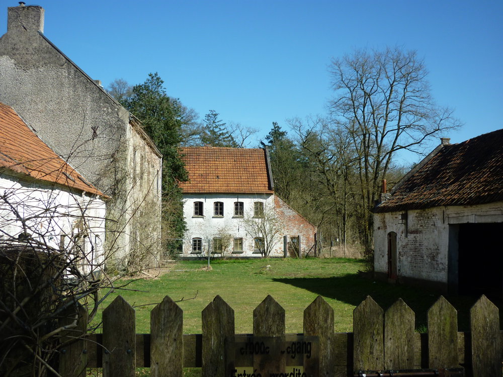
The Grote Hof - Hobos walking area takes you on a journey through the beautiful landscape in which the buildings De Grote Hof and Hobos are located. With each their remarkable history, both buildings and their inhabitants have influenced the vast surroundings.

Along the way, there are information boards that tell more about the history, myths, and legends.

More info: https://www.nationaalparkbosland.be/ontdek/wandelen/grote-hof-hobos/69/

More photos of this walk: https://photos.app.goo.gl/vMGSJQno33BCd9nR7

Happy walking,
Eddy, Rita, and Prinske

automatic translation

Icon nodes to follow nodes to follow

Image node TP
0 km
Image node 405
0.3 km
Image node 410
0.6 km
Image node 225
1.9 km
Image node 223
3.1 km
Image node 403
4.4 km
Image node 420
4.6 km
Image node 430
5.9 km
Image node 444
6.4 km
Image node 404
6.8 km
Image node 409
8.3 km
Image node 406
8.9 km
Image node TP
9.9 km
This route has 1 review(s).
Rate route!

Saturday, August 16, 2025 by R.L.Beautiful walk through the peaceful forests 👍
automatic translation

Saturday, August 16, 2025 by Eddy & RitaThanks for your response. Have a great time hiking!
automatic translation

Which POI do you want to show on the map?

Experimental hiking network
Unsigned icon

The route you have chosen runs (partly) along an experimental virtual hiking node network (the blue-coloured nodes and sections on the map).

You must be logged in to plan routes here.

Experimental hiking network
Unsigned icon

The route you have chosen runs (partly) along an experimental virtual hiking node network (the blue-coloured nodes and sections on the map).

These routes are not controlled in the field. Before you start hiking here, take a minute to read what an experimental hiking node network is and what rules you should follow when hiking here.