
 Hiking
 Login
Login
 More
More
 EN
EN
 Premium
Mene- en Jordaanwandeling
9 km • Hoegaarden
 official route
4.60311 7 4.4/5
route offered by

 Addresse starting point (approximate)
Sint-Ermelindiskerk, Sint-Laurentiusstraat 4, 3320 Meldert (Hoegaarden)
 signage
The route is signposted with thematic signs (no nodes). You can use a GPS device or our app to follow the route through the virtual nodes.
 Description
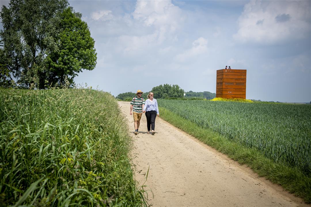
You’ll connect the villages of Meldert and Hoksem and pass through the beautiful nature reserve of the Mene and Jordaan valleys. The Mene and Jordaan are tributaries of the Grote Gete. Expect golden grain fields, rolling hills, and rich limestone and loam soils. The best view is from the Pallox, an artistic observation tower. Don’t forget your boots—it can get marshy here. You’ll pass the keep of the Lords of Meldert, once the seat of a manor.
Before you set out: This is a walk on a virtual hiking network. The junctions are not marked on the ground. Follow the hexagonal red-and-white signs bearing the name of the walk.
automatic translation
 nodes to follow
0 km
2.7 km
3.7 km
4.4 km
4.6 km
4.7 km
5.5 km
6.2 km
6.3 km
7.6 km
9 km
Sunday, July 19, 2026 by V.V.A nice walk.
automatic translation
Saturday, July 12, 2025 by Kristien Mytenhighly recommended, beautiful at the edge of the forest and fields, hardly any concrete
automatic translation
Saturday, April 26, 2025 by Hilde NijsTop hike! Do almost every year, but not after a long rain 😉
automatic translation
Tuesday, April 6, 2021 by C.P.Beautiful hike. At times you are so surrounded by nature that it seems there is no inhabited world. It was still a bit early for the blossoms of the fruit trees. The sloping landscape gives beautiful views. Signage was mostly ok, at 2 junctions a sign was missing, so recommended to follow via gps.
automatic translation
Tuesday, September 15, 2020 by Dirk VercoutereFortunately, the old signpost is still there, but nothing to be found of the numbers nodes. At two points, the old signs are gone.
automatic translation
Wednesday, July 29, 2020 by H.T.Beautiful hike, mostly "hiking trails." The trails are perfectly walkable, the roadsides "trimmed/cleaned". Kudos to the green service.
Signage: perfect.
automatic translation
Wednesday, May 20, 2020 by Birgit MelchiorNice variety, very quiet between the fields, in the valley, along the fields under the trees, and through quiet villages. Only disadvantage is that hoksem, although it is a beautiful quiet little village, 40 years ago they got the brilliant idea to run the E40 next to it. So one hears in hoksem noise from the E40 but in the village itself almost no cars. Recommended hike
automatic translation



 Upgrade to Premium Plus


