 Hiking
 Login
Login More
More EN
EN Premium
Margijs Walk
8.4 km • Huldenberg
 official route
1.4940 9 4.3/5
route offered by
 Addresse starting point (approximate)
Kasteel Loonbeek, Sint-Jansbergsesteenweg, 3040 Loonbeek (Huldenberg)
 signage
The route is fully signposted with nodes.
 Description
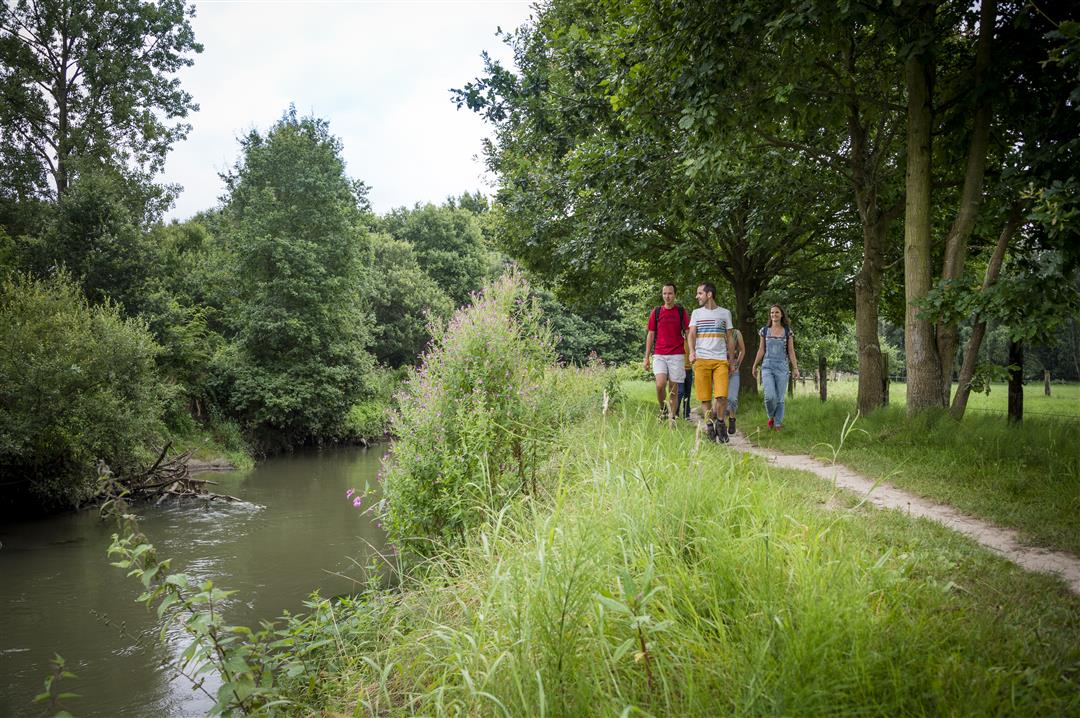
This hike takes you through the valley landscape of Dijle and Ijse, a mosaic of small fields and pocket forests, rough and reed beds, ponds and canals. Climb up to the Margijsbos, where in spring some slopes are colored blue by forest hyacinths. The Doode Bemde is one of the most beautiful green pearls in the Dijle Valley. Don't forget appropriate footwear because the trail can be swampy at times. At the end of your hike, you can enjoy a beer in brewery De Kroon.
This hike is offered by Tourism Flemish Brabant.
automatic translation
 nodes to follow
0 km
0.2 km
0.7 km
1.6 km
2.5 km
3.4 km
4 km
5 km
5.8 km
6.1 km
6.6 km
7 km
8.2 km
8.3 km
Sunday, October 30, 2022 by Luc WullaertVery beautiful and pleasant hike. The Doode Bemde is a beautiful piece of nature. Then alternate fields and woods and continue along the IJse. A nasty stretch along the road on the bike path (104 - 221) Nevertheless recommended !
automatic translation
Saturday, August 20, 2022 by Yasmin VdCFine walk. Too bad about the long stretch of bike path in the middle. Might recommend some replanning of your own for this? Beautiful surroundings. Had no problems with signage.
automatic translation
Saturday, May 15, 2021 by A.T.Great hiking trail. Especially the part through the Doode Bemde is wonderful. Too bad about the part KP104 - KP221 where you step on a busy bicycle path (crossing and walking against the direction of the traffic is safer). I combined this hike with the Ganspoel hike via KP217 and enjoyed the beautiful rolling landscapes for about 20 km.
automatic translation
Thursday, April 22, 2021 by Jan TheunisNice hike with some nice views. Only between knp 104 and 221 it's boring along the asphalt road. For the wood hyacinths you should not do this hike we have seen 1 yes one wood hyacinth.
automatic translation
Monday, January 18, 2021 by herman verheirstraetenDid them last week. Agree with all that has been written positively! But do put on high footwear when wet, because can be difficult especially in hollow roads. Then baby carriage is out of the question.
automatic translation
Saturday, July 25, 2020 by K.V.Simply sublime!
automatic translation
Sunday, June 7, 2020 by Christine VerschuerenSuper nice walk
automatic translation
Sunday, March 29, 2020 by D.C.very nice walk
automatic translation
Tuesday, November 5, 2019 by sonja Vanderstappensimply beautiful. Best to do them in reverse than described here, then you have first climbing through beautiful hollow roads to the fairytale Margijsbos (brilliant colors) and then descending to the flat Doode Bemde, because of possible wet feet :)
automatic translation


 Upgrade to Premium Plus
