 Hiking
 Login
Login
 More
More
 EN
EN
 Premium
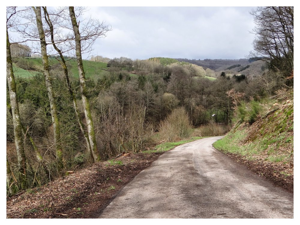
Fouhren: fully paved
automatic translation
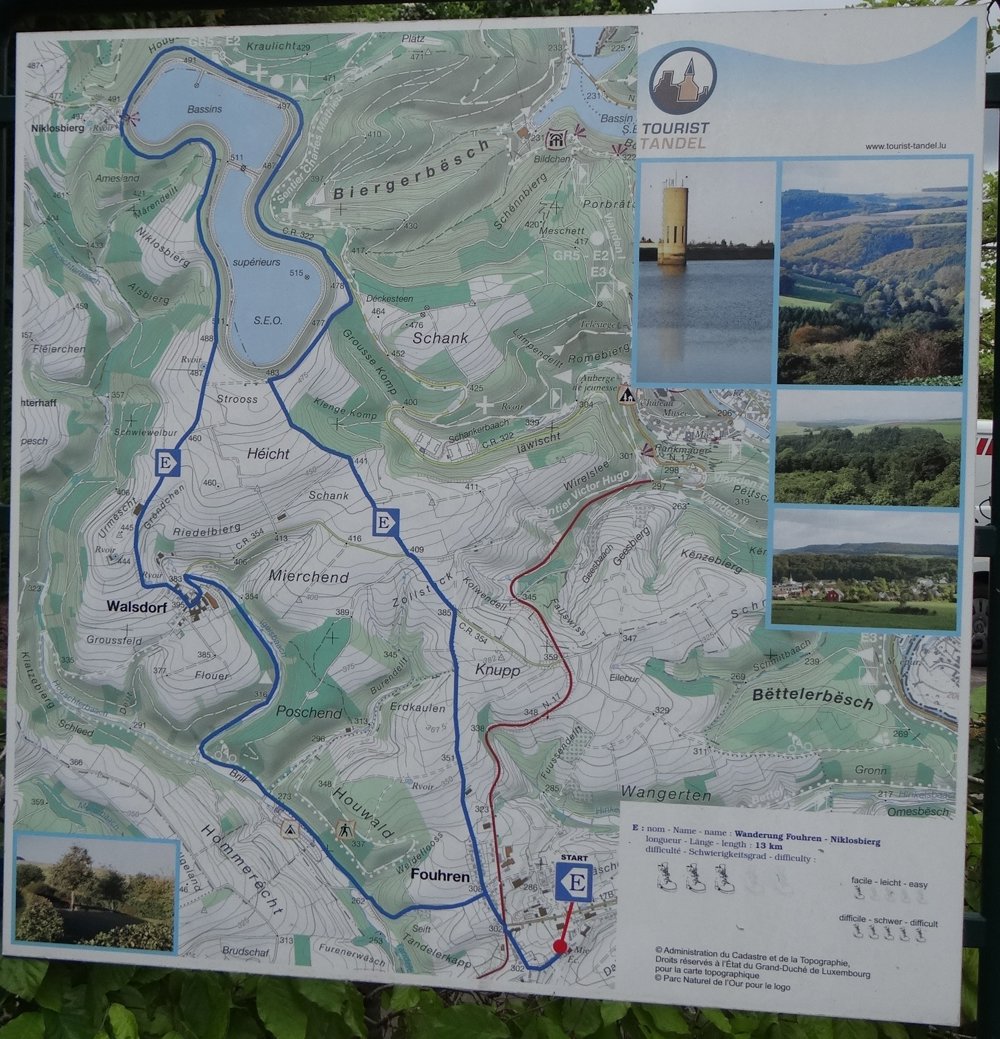
12.7 km • Tandel
2160 0 0/5

 Addresse starting point (approximate)
Jean-Baptiste-Zewenstrooss 6, 9454 Tandel, LU
 signage
The route is not signposted. Use a GPS device or our app to follow the route.


 Description
This walk, which starts at the town hall of 'Fouhren', runs entirely on paved roads. It seems easy, but do not be mistaken, as there is quite a bit of uphill work involved. Marking "E".
'Fouhren' is located in the 'Luxembourg Ardennes'. When you say 'Ardennes', you immediately think of beautiful vistas, and indeed, they are abundant. Furthermore, we also get to see the upper reservoir of the 'Vianden' hydroelectric power plant.
The walk goes through the small but beautiful village of 'Walsdorf'. If you want to do this walk with a stroller, it is best to prepare your muscles.
More photos: https://photos.app.goo.gl/N8Z8N59PviyBobfv5
Happy hiking,
Eddy, Rita and Prinske
automatic translation


 Upgrade to Premium Plus
