 Hiking
 Login
Login More
More EN
EN Premium
Graves Forest Walk
automatic translation
6.1 km • Grimbergen
 official route
route offered by
 Addresse starting point (approximate)
Lourdesgrot, Westvaartdijk 16-68, 1860 Grimbergen
 signage
The route is partially signposted with nodes. Use a GPS device or our app to follow the route through virtual nodes.
 Description
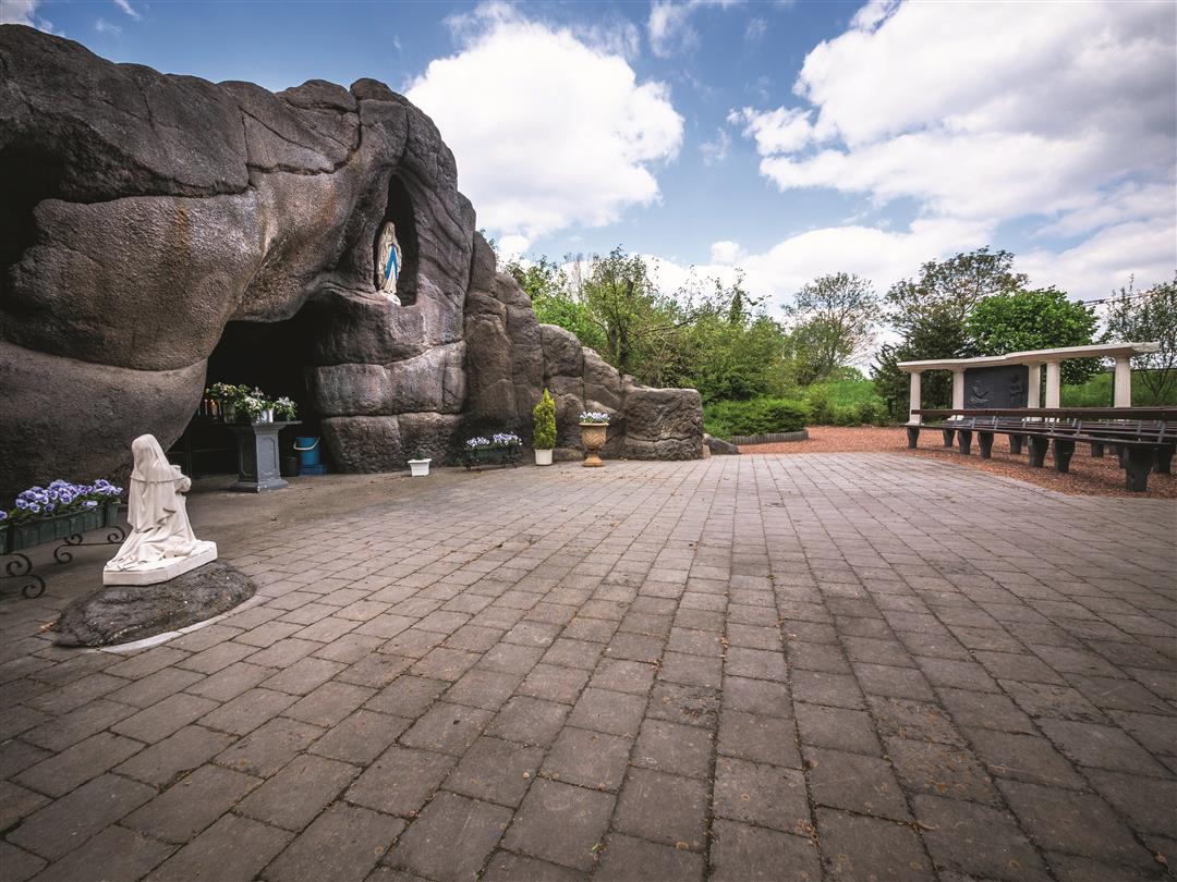
The Gravenbos walk starts at the Lourdes grotto built in 1952 by 12 members of the KAJ youth movement. Monsignor Cardijn came to inaugurate the grotto in 1954. People still come there to contemplate or pray in peace. Stroll past the Castle of the Counts, grand, ornate and surrounded by water and an 80-acre estate. The Gravenbos surrounding the castle is a protected nature reserve with a population of crested newts important to the region.
NOTE: This is a walk on a virtual walking network. The nodes are not signposted on the site.
This walk is offered by Tourism Flemish Brabant.
automatic translation
 nodes to follow
0 km
0.4 km
1.4 km
3.3 km
4.2 km
5 km
6.1 km
Monday, February 1, 2021 by Raf HinderdaelThis hike is not signposted at all (neither nodes nor separate signs). Based on the expressed plan, it is a quest. On top of that, a large part runs along busy lanes. Absolutely not recommended.
automatic translation
Thursday, January 14, 2021 by C.T.If it has rained days before, it is best to put on "groin boots. Some sections are barely passable/wadeable in deep mud and no way to swerve or grab onto something. Some sections, in my opinion, have to dry for weeks to be passable. Route is very beautiful and in dry weather definitely recommended.
automatic translation


 Upgrade to Premium Plus
