 Hiking
 Login
Login
 More
More
 EN
EN
 Premium
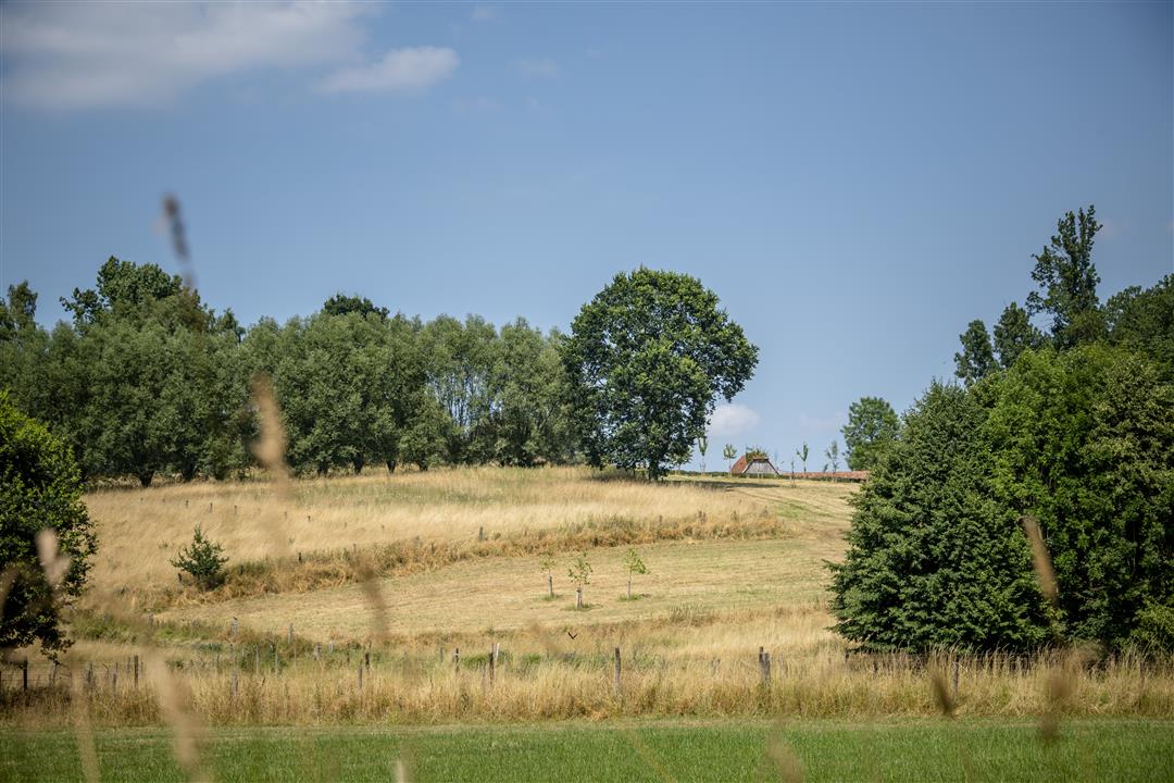
Adembenemend Asbeekwandeling
11.4 km • Asse
 official route
4.8754 12 3.8/5
route offered by
 Addresse starting point (approximate)
Heilige Familiekerk, Kespier 20, 1730 Asse
 signage
The route is fully signposted with nodes.
 Description
Discover the most beautiful spots in Asbeek on the Breathtaking Asbeek Walk. Let yourself be guided along winding streams through the region’s rolling countryside. Along the way, you’ll pass ancient forests, ponds, and fruit trees. In the spring months, you can enjoy the blossoms.
Before you set out: This walk is offered by Regionaal Landschap Brabantse Kouters in collaboration with the municipality.
automatic translation
 nodes to follow
0 km
0.3 km
0.5 km
1.3 km
2.4 km
5.4 km
5.8 km
6.2 km
8.3 km
8.7 km
9.5 km
10 km
10.5 km
11.1 km
11.4 km
Sunday, May 25, 2025 by Peter De beukelaernice varied walk
automatic translation
Saturday, March 29, 2025 by H.R.Fantastic walk on March 29, 2025 There are some damp places where you can get wet feet but not today Beautiful unknown places discovered 10 km from my front door What a landscape Blessed
automatic translation
Sunday, August 13, 2023 by S.L.Nothing breathtaking about this hike. Very occasionally a nice passage but otherwise nothing much.
automatic translation
Saturday, May 29, 2021 by Martine De WolfVery nice hike! Very nice landscapes and views. However, not 8.6 km as indicated here (the junction app says 10.8 km by the way), but in reality with me just over 11 km.
automatic translation
Sunday, April 4, 2021 by M.V.We did not find the hike particularly "breathtaking. There was, especially in the beginning of the hike, a lot of paved road. Although there were some nice stretches you also pass a lot of stables, hangars, warehouses, coteries, backyards with garbage.... so not really the most charming things.
automatic translation
Sunday, February 21, 2021 by Hilde VdVVery nice walk on this first beautiful Sunday through fields and bushes with the typical country air that is so pleasant these days. Because it stayed dry for several days, this trail is muddy in only a few places. Bottles were desirable. We deliberately did not do the loop of 23 and 22 and were just 2h on the road.
automatic translation
Sunday, January 17, 2021 by Walter MombaertsVery nice but this time very muddy walk which also has its charms. The dogs loved it. The walk is 12.19 km and not 8.6 as stated. Definitely recommended.
automatic translation
Sunday, November 8, 2020 by Kristof De PleckerBeautiful hike. Do not utilize all the scenic trails, but therefore accessible in any weather.
automatic translation
Thursday, May 28, 2020 by M.E.Nice walk but almost 11 km instead of 8.6 km.
automatic translation
Sunday, May 17, 2020 by B.V.Very nice walk,very good directions, fun. To be repeated.
automatic translation
Friday, April 10, 2020 by Willem Van SeverenVery nice route with many unpaved sections.
automatic translation
Thursday, April 9, 2020 by P.D.nice tour, but noise pollution
automatic translation


 Upgrade to Premium Plus
