 Hiking
 Login
Login
 More
More
 EN
EN
 Premium
Don't just think 'sea' at Vrouwenpolder
automatic translation
24.9 km • Veere
2.1386 2 5/5

 Addresse starting point (approximate)
Koningin Wilhelminalaan 38, 4354BC Veere, NL
 signage
The route is fully signposted with nodes.
 Description
Park in the free parking lot in Vrouwenpolder at the Monnikendijk (near the large fish stand!).
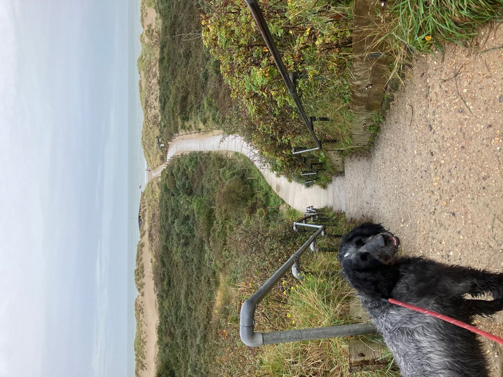
From bike path to dune path, beach to forest, sea to lake, field to country road... everything is covered in this varied walk. In the summer months, some parts can be quite busy, especially by the sea, but outside the peak season, it is surprisingly quiet here.
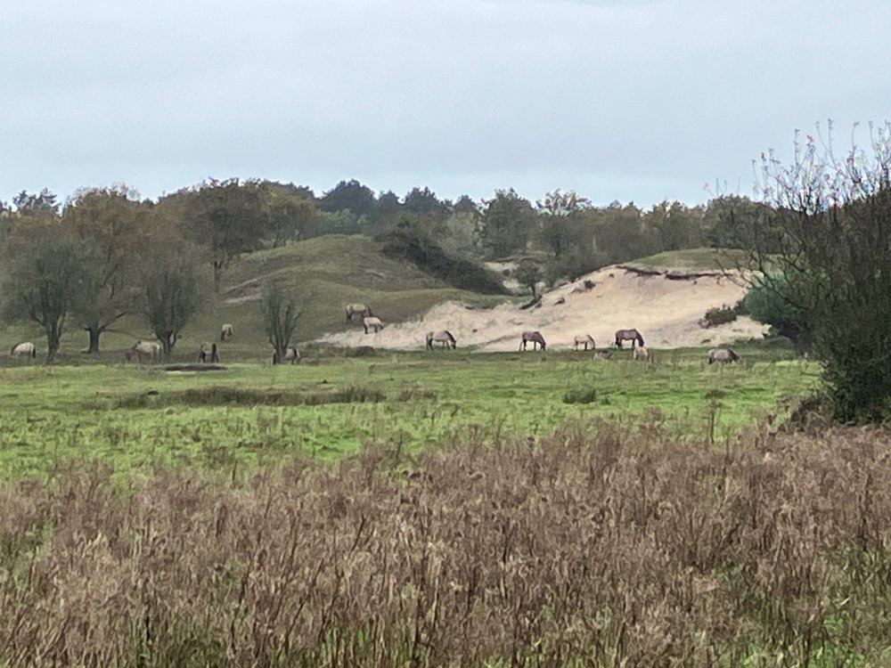
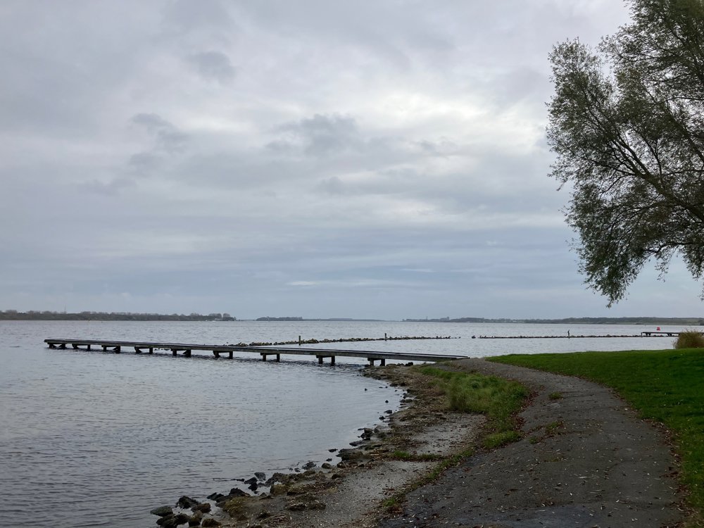
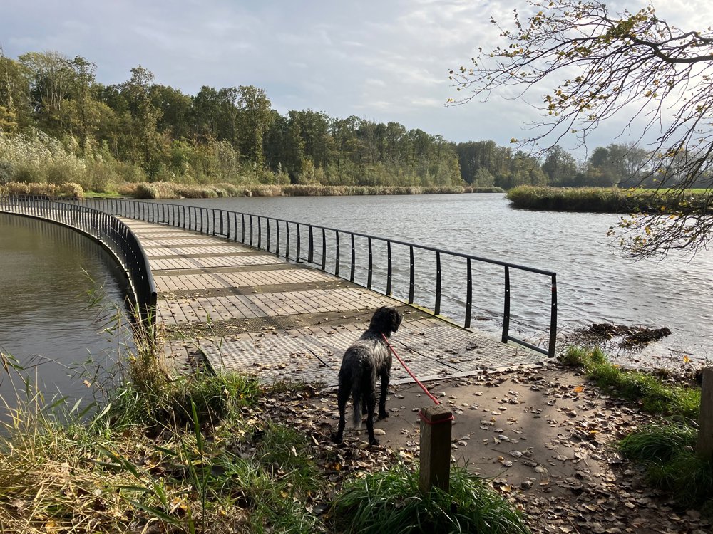
Start at the Oranjezon nature reserve, where you pass freely grazing Konik horses as you cross the dune belt towards the beach. After that, you leave the sea and the dike behind and the large Veerse Meer with its water sports enthusiasts and the diverse Veerse forests become your companions. At the end, you will have some farmland and quiet paths under your hiking boots.
There are drink and dining options near point 53, 58, Veere, and Vrouwenpolder. Dogs are allowed on a leash. In principle, not between point 56-55 and between 93-94, but you can easily avoid this. If you want to see the sunset at the sea, walk the other way around.
automatic translation
 nodes to follow
0 km
0.3 km
2.6 km
3 km
4.3 km
7.4 km
8.4 km
10.1 km
11.6 km
12.4 km
12.8 km
13.2 km
14.7 km
15 km
15.1 km
15.7 km
15.9 km
16.2 km
16.5 km
17.1 km
17.6 km
18.5 km
18.9 km
19.8 km
20.2 km
21.5 km
22.3 km
23.5 km
24.9 km
Sunday, May 24, 2026 by ste vermeirenWhat a beautiful route! I did it first toward the sea, then to Veere, and back to Vrouwenpolder... but I’d do it the other way around... that way, you’re off the asphalt and paved roads right from the start... it is pretty tough, especially in really hot weather... but sooooo beautiful... soooo peaceful... absolutely stunning
automatic translation
Sunday, March 8, 2026 by Raymond BosselaarFantastic! Go early and you can walk among the deer in Oranjezon. Be careful on the beach if you're walking in the fog. I walked along the water's edge but missed the tide, so I had to walk quite a way back. Stay on the dune side. The Veere loop is also very nice with its fortress, ferry, and footbridge. The trip is quite strenuous with the beach and dunes.
automatic translation
Sunday, May 24, 2026 by ste vermeirenThanks for the tip... I saw the deer
automatic translation


 Upgrade to Premium Plus
