 Hiking
 Login
Login
 More
More
 EN
EN
 Premium
Bosveldwandeling
6.7 km • Sint-Pieters-Leeuw
 official route
3.91910 1 4/5
route offered by
 Addresse starting point (approximate)
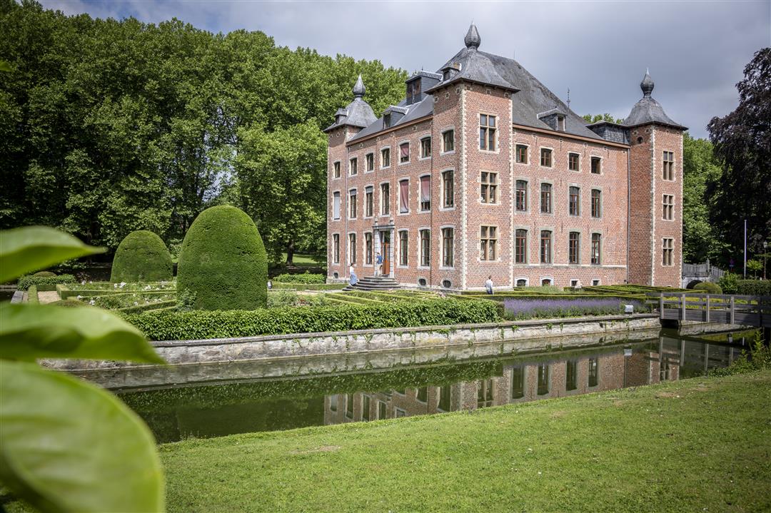
Domein Coloma, Joseph Depauwstraat 25, 1600 Sint-Pieters-Leeuw
 signage
The route is fully signposted with nodes.
 Description
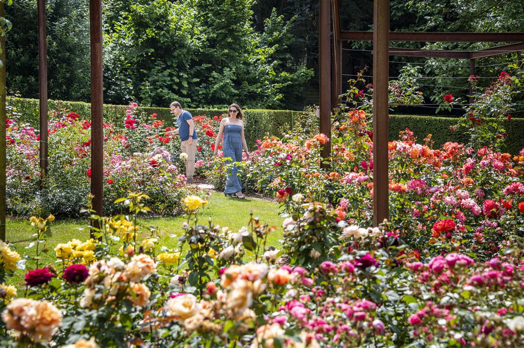
Your starting point is well worth a visit right away, because at the Coloma Castle estate you’ll be enchanted by the scent of a sea of roses, especially in June. There are more than 3,000 different varieties there, totaling as many as 300,000 roses. Made it there? Good, because a journey through the gently rolling fields and meadows of the Zuunbeek Valley—on the border between Sint-Pieters-Leeuw and Halle—awaits you. Your landmark is the 300-meter-high television tower that has dominated the landscape since 1996.
automatic translation
 nodes to follow
0 km

0.2 km
0.2 km
0.3 km
0.7 km
2.2 km
2.8 km
3.7 km
4.6 km
4.8 km
5.2 km
6.5 km

6.7 km
Sunday, May 17, 2020 by M.N.We took this charming walk in spring (May). The atmosphere at the starting point is very romantic (castle). Further, in the fields and meadows you would never say that the capital is so close, and however .... Many pleasant paths and roads . N.B. Between junction 77 and 78, you have to be more careful because there are occasional cars, and the cyclists drive quite fast, but the view is beautiful.
Martine
automatic translation


 Upgrade to Premium Plus
