 Hiking
 Login
Login
 More
More
 EN
EN
 Premium
Celtic land in Bérismenil
7.5 km • Bérisménil
 official route
7.34814 4 4.4/5
 Addresse starting point (approximate)
Church of Bérisménil, Bérisménil 6982 La Roche-en-Ardenne, BE
 signage
The route is signposted with thematic signs (no nodes). You can use a GPS device or our app to follow the route through the virtual nodes.
 Description
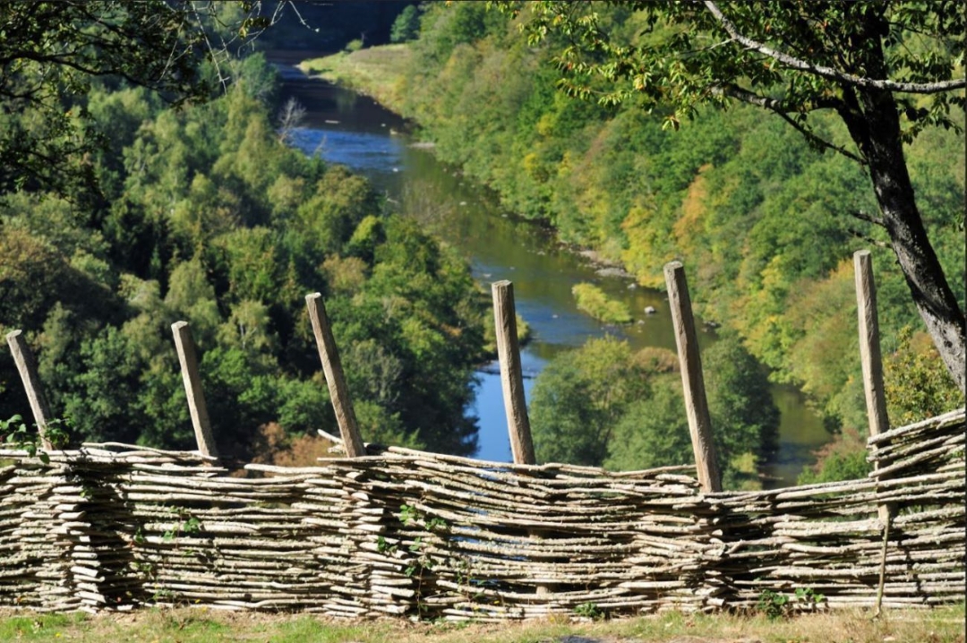
This rather sporty walk explores the wild side of the Ardenne, where the Ourthe river sculpted deep valleys and some of the most beautiful landscapes in Wallonia.
After going down towards the Ourthe, you will pass Cheslé, a natural fortress used by the Celts in the VIth century BC. Listed as exceptional cultural heritage, this site offers breath taking views.
 nodes to follow
0 km
0.3 km
1 km
1.9 km
2.2 km
3.7 km
5 km
5.4 km
5.5 km
7.3 km
7.4 km
Thursday, January 8, 2026 by Nara V. Van Den BroeckWalked today. With the snow and wet conditions, it was very challenging, with some sections barely passable. I had two poles with me and crampons under my hiking boots. I don't think I would have made it without those aids. Even so, I had to be very careful, and on the climb up, I had to stop occasionally to catch my breath.
automatic translation
Monday, July 28, 2025 by Lisa Hoogerwerfbeautiful route indeed. the part along the river Ourthe is definitely worthwhile. the tough parts before (first down) and after (back up) were tough on the body.
you walk this route according to signs / markings yellow 6 +.
automatic translation
Friday, May 23, 2025 by Fabienne Van canneytvery nice walk! arrived at the Ourthe you walk a long way along it, which is beautiful. suddenly we heard a 100m behind us very loud rhythmic splashing. there was a fairly large deer or fawn galloping across the Ourthe! a wonderful experience 😍! in addition, very many birdsong. the climb back is tough but doable.
automatic translation
Sunday, November 3, 2024 by Moniek BunkensIndeed a beautiful route. But tough in that it requires some climbing and scrambling. Scrambling over slippery rocks and having the Ourthe at the bottom as an alternative is effe hefty. But the satisfaction is great, and the reward of nature's splendor even greater.
automatic translation


 Upgrade to Premium Plus
