 Hiking
 Login
Login More
More EN
EN Premium
Gobbelsrode Walk
automatic translation
7.6 km • Holsbeek
 official route
route offered by
 Addresse starting point (approximate)
Sint-Catharinakerk, Dutselstraat, 3220 Kortrijk-Dutsel (Holsbeek)
 signage
The route is fully signposted with nodes.
 Description
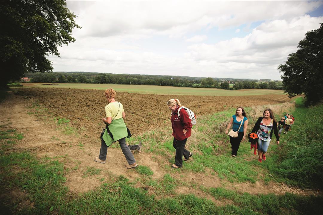
Welcome to a quiet and rural part of the Hageland. You start at St. Catherine's Church which dates back to the 11th century, supposedly the oldest church tower in the Hageland, built in the local rust-brown ironstone. Walk along numerous slow roads, step through hollow paths and field trails and traverse numerous fields. Enjoy the beautiful views of the region along the way.
This walk is offered by Tourism Flemish Brabant.
automatic translation
 nodes to follow
0 km
0.7 km
1.2 km
1.3 km
1.7 km
2.2 km
2.8 km
3.2 km
3.8 km
5.2 km
5.4 km
5.8 km
7 km
7.4 km
7.6 km
Sunday, May 15, 2022 by T.G.Very nice walk in open fields, with some hollow paths here and there between trees. On a summer day after a very dry period, all paths were well accessible. In wet periods be aware of swampy roads. Still best to use good walking shoes, many paths are really nice, but bumpy. Not recommended for children's carriages.
automatic translation
Tuesday, December 8, 2020 by Bart VandyckVery nice hike with beautiful views. Lots of unpaved road and yet not muddy. During the last kilometers the big road (Gobbelsrode?) with its ribbon development is quite in sight and that takes you a bit away from the enchantment of the past part. Highly recommended.
automatic translation
Saturday, December 5, 2020 by Peter WilsIt's not called the Hageland Hills for nothing. So this is a hike with ups and downs, literally then. But every climb up through the hollow roads is rewarded with stunning views! Sturdy shoes are definitely needed, here and there it is slippery. But don't let that deter you, this hike is definitely worth it !
automatic translation
Wednesday, October 14, 2020 by Luc WullaertPleasant walk through fields and along hollow roads and old footpaths. For lovers of vistas. No forest
automatic translation
Wednesday, September 30, 2020 by Guy Van dammeIt is a beautiful walk, very varied, hilly, with lots of hollow roads, rural, quiet and beautiful views.
It is highly recommended. We give this hike a rating of 9.5/10.
automatic translation
Sunday, March 24, 2019 by T.B.Very nice quiet walk. Along the way you will come across a bench where you can rest or have a cookie.
Lots of slow roads and if you bring a dog it can run loose a lot without you having to be afraid of busy roads (because you hardly encounter them).
automatic translation


 Upgrade to Premium Plus
