 Hiking
 Login
Login
 More
More
 EN
EN
 Premium
Farms, forest and mountain in Beerzel
automatic translation
7.3 km • Putte
3.50011 5 4/5

 Addresse starting point (approximate)
Bareelstraat 9,9A, 2580 Putte, BE
 signage
The route is not signposted. Use a GPS device or our app to follow the route.
 Description
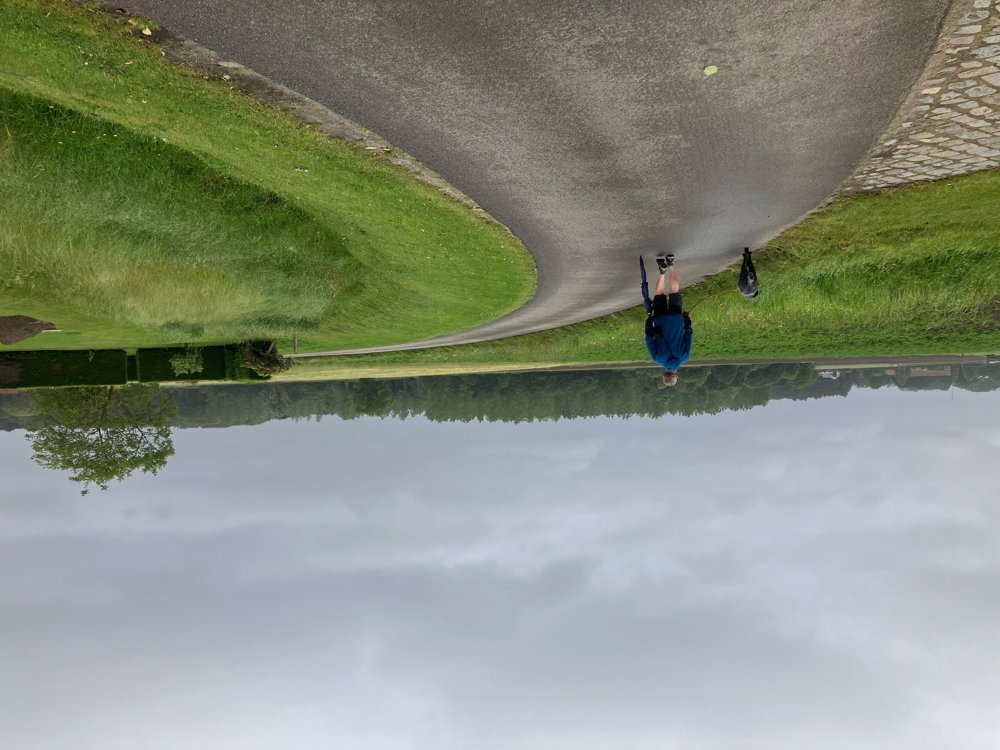
Park your car behind the church in Beerzel.
Immediately, you leave the lively center via a footpath. Along quiet roads, interspersed with paths, you pass by old and new farms of this rural village.
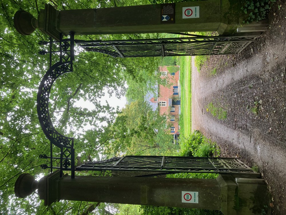
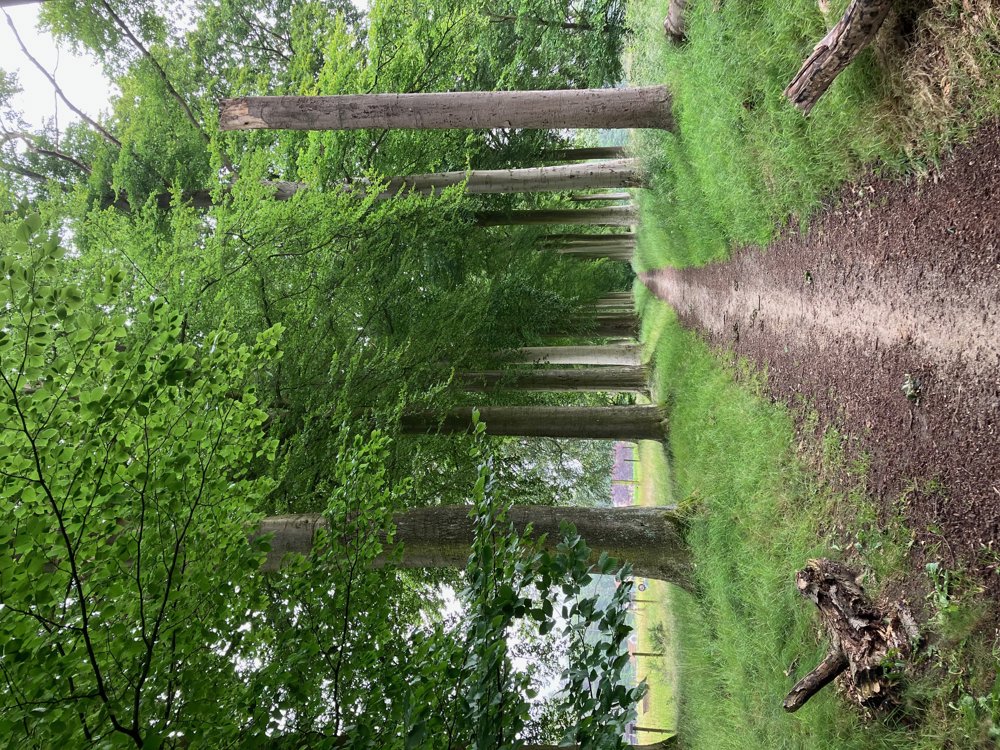
It doesn't take long before you enter the Kempens Landschap Speelbergenbos with the 14th-century Pelgrimhof.
The Pelgrimhof is a private landscape heritage domain where you can only walk along the beech avenue and the path along the moats. The name dates back to 1412, when a certain Pelgrim Tucbake held the estate in fief. The castle itself is 17th-century but was somewhat altered in the 20th century.
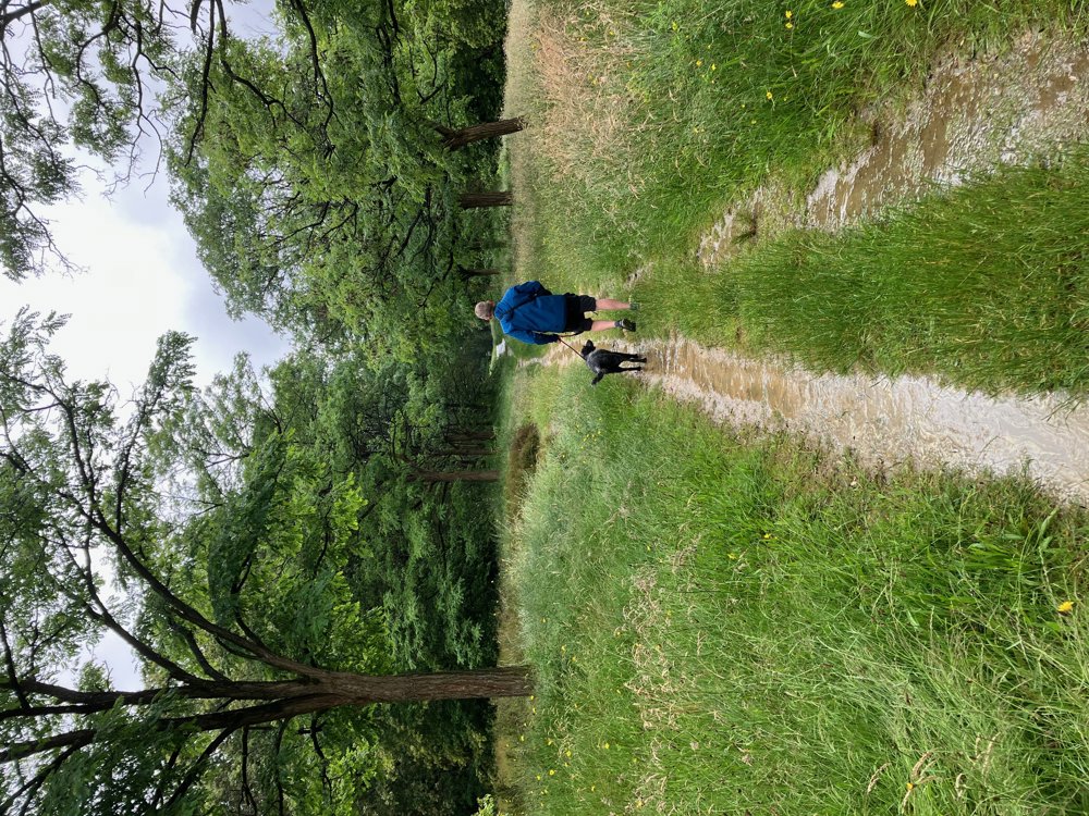
Via the Berglaan, you then slowly begin to ascend the highest natural hill of the province of Antwerp, at 51.60 m high, namely the witness hill Beerzelberg. Just before the nature reserve, you can first have a drink on the terrace of the tavern of the same name.
Along a narrow street, you find yourself back in the lively center near your car. Dogs are allowed on a leash.
automatic translation
Sunday, January 25, 2026 by Karlien Van Wonterghembeautiful walk in the rural Beersel
automatic translation
Saturday, January 24, 2026 by Elke Van KelstNice walk, even the streets you walk on are quiet!
automatic translation
Sunday, December 28, 2025 by K.W.pleasant walk
automatic translation
Monday, November 10, 2025 by Wendy Smetnice tour - only in the beginning when you have to go out of the 1st street - you have to go into a field - and it says private property - bit crazy that we had to go in there.
Otherwise very quiet and pleasant walk 👍
automatic translation
Tuesday, November 25, 2025 by W.L.That is not the intention. I will briefly check the route on site and adjust if necessary. Thanks for the feedback. In the meantime, the route has been adjusted.
automatic translation
Sunday, November 9, 2025 by Lesley S.it was a very nice walk.
automatic translation


 Upgrade to Premium Plus
