 Hiking
 Login
Login
 More
More
 EN
EN
 Premium
Bergbroekwandeling
12.2 km • Holsbeek
 official route
4.57412 21 4.3/5
route offered by
 Addresse starting point (approximate)
Sint-Mauruskerk, Gebr. Van Tiltstraat 1, 3220 Holsbeek
 signage
The route is fully signposted with nodes.
 Description
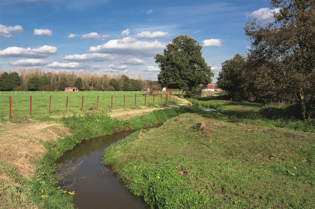
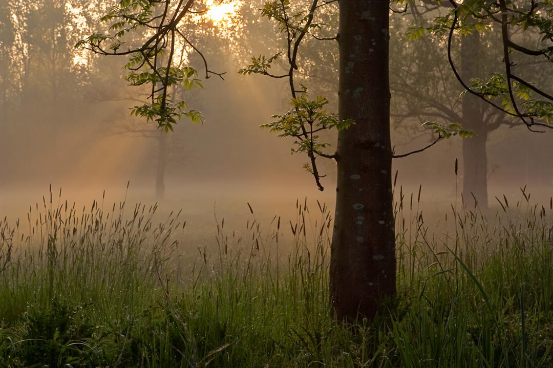
This hike takes you through the Hagelandse Vallei nature reserve and over the Chartreuzenberg. You’ll walk through fields, meadows, and poplar forests. Climb the steep slope to the top of the Ramselberg and enjoy a stunning panoramic view of the Wingevallei and the Bergbroek from the summit. Find complete peace and quiet in the natural oasis of Chartreuzenbos. Nature abounds, but there’s no shortage of beautiful historic buildings either, such as the Hof ter Winge and Heilige Geesthof farmsteads. Be sure to stop for a moment at the restored Uitemmolen; this watermill was part of the Rotselaar manor until 1573.
automatic translation
 nodes to follow
0 km
0.2 km
0.2 km
1.1 km
2.1 km
2.3 km
2.3 km
2.9 km
3 km
3.6 km
3.8 km
4.8 km
5.3 km
5.6 km
6.7 km
7.6 km
8.2 km
8.9 km
9.1 km
9.7 km
10.9 km
11.2 km
12 km
12 km
12.2 km
Sunday, November 24, 2024 by E.D.Beautiful and, in wet periods, adventurous hike. The section between point 16 and 104 was very wet today (several days of heavy rain behind us) (knee deep wading). Also between 113 and 109 very much mud. In wet periods I would therefore recommend doing the hike in reverse, or starting from point 104 (-105-...).
automatic translation
Saturday, April 23, 2022 by Yasmin VdCFine walk in 90% natural and agricultural area. Also very nice with my faithful four-legged friends (few barking peers). Well marked. Mostly overhard so beware in wet periods! Recommended for those who need some peace and nature.
automatic translation
Monday, February 22, 2021 by Mia VandersteenSuper nice hike, definitely worth repeating! The name of the hike gives away that you walk through a "pants = swampy area", so sturdy high hiking boots are a must. But it's enjoyment from start to finish, highly recommended.
automatic translation
Wednesday, December 30, 2020 by Roland WolfsFew on paved roads, which is a plus. But: the forest roads are broken up by mountain bikers, making it difficult for hikers to walk. Why not provide separate roads for both users?
automatic translation
Monday, December 28, 2020 by Christa BatensNice walk along quiet roads, both through meadows and woods. Only the part on the Chartreuzen mountain was crowded, but then it was sunny weather. The roads were muddy, but what do you want, the name of the hike already suggests moist ground. Definitely recommended!
automatic translation
Saturday, December 26, 2020 by Guido StiensBeautiful hike, waterproof hiking boots are absolutely necessary at this time of year though, very muddy but very beautiful, quiet, almost all unpaved, I will definitely do this one again in the spring as well.
automatic translation
Monday, December 21, 2020 by Cécile DE GREEFDear people. What a disappointment! Hiking trails so destroyed by cyclists that they simply become unusable. Hiking should remain a pleasure. Even in winter weather. But this is agony.
automatic translation
Tuesday, October 13, 2020 by Jan WaegemansIndeed a wonderful walk, through a beautiful natural area and with wonderful views.
automatic translation
Sunday, September 20, 2020 by Guy Van dammeOnce you leave the village you are immersed in a beautiful "wild" nature with lots of variety. Towards the end you climb the Chartreuzenberg (the summit of the Ramselberg ) before descending again to Holsbeek.
automatic translation
Saturday, May 16, 2020 by K.R.Nice hike, beautiful natural area. You walk along many meadows with horses and other animals and you hardly get on the road. Definitely recommended for those who fancy a slightly longer walk!
automatic translation
Monday, November 11, 2019 by E.V.Breathtakingly beautiful hike. You imagine yourself alone in full natural beauty. Very varied landscape. Definitely recommended for those who love the peace and beauty of nature. Do need good walking shoes or boots for the soggy mud sections.
automatic translation
Saturday, October 12, 2019 by H.V.Today on the program for the third time! Very pleasant walk, completely in the beautiful and peaceful nature. Highly recommended!
automatic translation
Saturday, September 28, 2019 by Christa SlevenBeautiful hike. Quiet, no people.
Saw many beautiful horses along the way.
automatic translation
Saturday, September 28, 2019 by philippe snauwaertHave already done this hike twice .Beautiful nature and tranquility.
In autumn and winter though recommended with boots or high shoes.
automatic translation
Friday, September 27, 2019 by F.V.Very nice walk
Definitely recommended
Once the village center out beautiful and peaceful nature and on arrival opportunity o something to eat in the barn (cafeteria sports hall ) I think
automatic translation
Monday, September 16, 2019 by G.S.Beautiful and peaceful hike, with still lots of forest and a punchy end.
Definitely do it again.
automatic translation
Sunday, September 15, 2019 by Lieve Lieve Van den BerghNice hike with still a lot of forest. The climb to Ramselberg is not too bad.
automatic translation
Sunday, September 15, 2019 by E.C.Beautiful hike with a punchy ending.
automatic translation
Friday, September 13, 2019 by M.V.nice proposal.
automatic translation
Saturday, May 11, 2019 by Mattias NolmansThe walk begins with beautiful animals along the way from residents. The hiking trail sends you through a mini sheep pasture who then come to greet you. There were lambs there so wow! Afterwards it is a nice flat walk along the forest. Eventually also a bit on the chartreuse mountain although this is very short.
Top of a hike.
automatic translation
Friday, February 22, 2019 by anja Van EykenVery nice hike, definitely recommended :-) beautiful nature
automatic translation


 Upgrade to Premium Plus
