 Hiking
 Login
Login
 More
More
 EN
EN
 Premium
's Hertogenheidewandeling
11.4 km • Aarschot
 official route
6.51517 10 3.7/5
route offered by
 Addresse starting point (approximate)
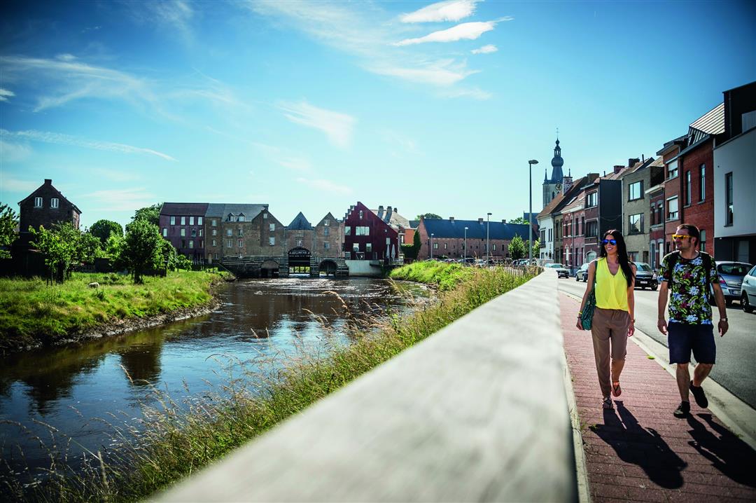
Statieplein, 3200 Aarschot
 signage
The route is fully signposted with nodes.
 Description
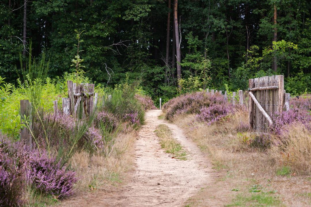
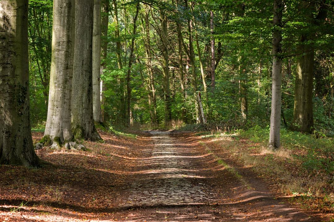
In the past, the people of Aarschot used to let their livestock graze on the heathland outside the city walls. Several cattle trails led there, such as to the ’s Hertogenheide nature reserve. This walk takes you along those same paths through the Aarschot countryside, to the banks of the Demer River and the Eikelberg, a typical Hageland hill made of iron sandstone. At the Orleanstoren, a spiral staircase leads you to a viewing platform offering a spectacular vista.
automatic translation
 nodes to follow
0 km
0.7 km
2.6 km
2.8 km
4 km
4.3 km
5.3 km
5.9 km
6.2 km
7 km
7.1 km
8.2 km
9.5 km
11.3 km
Tuesday, April 14, 2026 by Paul GordtsA pleasant, varied walk across the peaks of the Diest dunes, offering views of Aarschot and the surrounding area, through marshland and meandering along the Demer River.
automatic translation
Tuesday, February 28, 2023 by Werner LaeversBy far one of the most beautiful hikes I have done. Very varied. Forests , nice little residential areas, meadow landscapes. The eikelenberg at the top between Aarschot and Gelrode is a nice resting spot during the hike.
automatic translation
Sunday, June 13, 2021 by N.T.What a beautiful hike. 95% unpaved. Don't find much ! Very diverse in terms of environment. Conversely, I would not hike it.... Highly recommended to do! A big 9.5/10 for the trail builder!!!
automatic translation
Saturday, February 20, 2021 by Marleen DoyenIt was our first hike with this app. We took the train. So the train station was our starting point. We found the hike very successful. Varied, lots of dirt road, even rolling. Only a lot of airplanes. Fortunately a lot of wind. So not too much noise pollution.
automatic translation
Saturday, May 16, 2020 by E.E.Very beautiful! The stretch along the Demer is fairly long and monotonous, the Eikelberg and 's Hertogenheide on the other hand are beautiful!
automatic translation
Wednesday, May 13, 2020 by Jan WaegemansBeautiful hike with lots of variety.
automatic translation
Saturday, January 4, 2020 by L.V.4/1/20
One of the lesser routes we ever made.
Noisy due to surrounding city, poor walkability and that in dry weather. Only last part along Demerdijk feels like walking. Incomprehensible that a busy intersection has to be crossed after the start.
3 out of 10 and we are not really strict.
automatic translation
Sunday, December 29, 2019 by Johan GinkelsWe did them in reverse, plate at the top of the bridge over the railroad lacked. Otherwise a nice walk with lots of variety, forest, mountain, concrete and heath.
automatic translation
Thursday, October 17, 2019 by M.D.Wonderful walk. Didn't notice anything at 705. Everything ok. The towpath we had to follow was closed at one point though. We continued on the other bank and at the next bridge we could reconnect.
automatic translation
Monday, September 9, 2019 by Eddy VandenplasEnjoyed the hike, good directions from the beginning to hero street. Sign away (705) and no longer knowing which direction to continue.
Pity, lost time, found the right way after half an hour. Then it was back in the right direction. We are avid hikers and hope for those who are still going to hike the hike as unknown will observe the sign in the right place. Regards
automatic translation


 Upgrade to Premium Plus
