 Hiking
 Login
Login More
More EN
EN Premium
Lipse Walk
automatic translation
8.2 km • Haacht
 official route
route offered by
 Addresse starting point (approximate)
Dorpsstraat 30, 3150 Tildonk (Haacht)
 signage
The route is fully signposted with nodes.
 Description
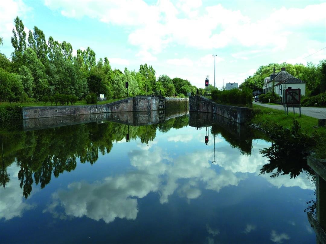
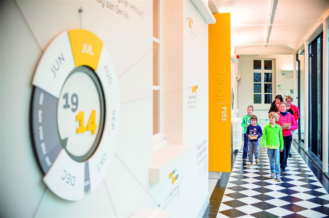
The Lipse Walk, named after the stream that you cross six times along the way, takes you past the most beautiful spots in Tildonk. From the center, which recalls the area's wartime past, you'll pass along the canal, through fields and the Plantsoenbos. Visit Experience Center '14-'18 in the former Ursuline Monastery, the ideal location to learn about life during the war in a fascinating and interactive way. Along the way, quench your thirst at café Maritime, located in the Sashuis that dates back to 1772, the lock in Tildonk dates back to 1763.
Park Engelenburcht is accessible from 7:30 a.m. to 5 p.m. Outside park opening hours, the route between node 526 and Kruineikestraat is not accessible. You can manage via the Vaartdijk and the Kruineikenstraat.
This walk is offered by Tourism Flemish Brabant.
automatic translation
 nodes to follow
0 km
0.8 km
1.5 km
2.4 km
3.2 km
4.1 km
5.7 km
8 km
8.2 km
Sunday, March 19, 2023 by B.D.Boring route, long stretches straight on asphalt, few scenic views, bit close along busy cobblestone road.
automatic translation
Wednesday, June 9, 2021 by Tine De MartelaerBeautiful walk along field roads and the water.
automatic translation
Saturday, November 7, 2020 by T.S.Fine walk of about 9km. Goes a bit through forest, along water, and open fields. Surface mostly paved.
automatic translation


 Upgrade to Premium Plus
