 Hiking
 Login
Login More
More EN
EN Premium
Meander Walk
automatic translation
7.4 km • Rotselaar
 official route
route offered by
 Addresse starting point (approximate)
Schoolstraat 56, 3110 Rotselaar
 signage
The route is fully signposted with nodes.
 Description
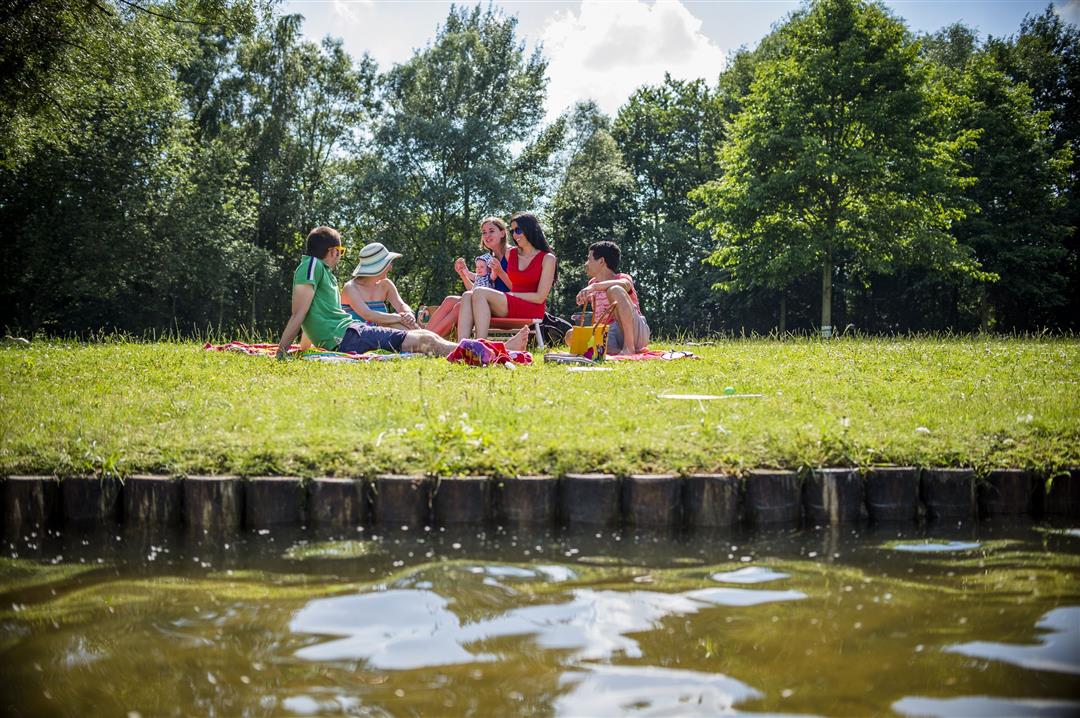
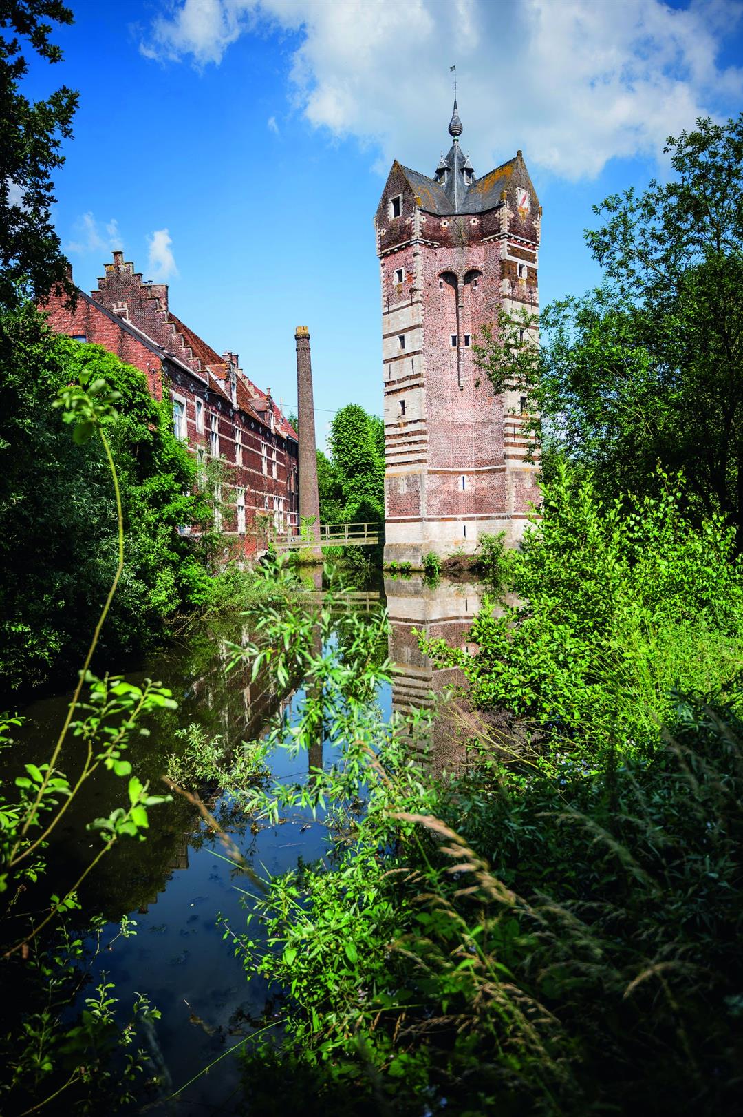
The Meander walk starts in the quiet, wooded, hamlet of Heikant. You head towards 'De Plas van Rotselaar' for a walk around the water. Here the walk leads you past the 14th-century Ter Heide tower. After the Demer straightened out, several meanders remained on the southern bank. You hike further along the wetlands that are a very valuable biotope for water and marsh plants.
This walk is offered by Tourism Flemish Brabant.
automatic translation
 nodes to follow
0 km
0.8 km
1.3 km
1.5 km
2.3 km
2.4 km
2.7 km
2.9 km
3.7 km
5.6 km
7.4 km
Wednesday, May 18, 2022 by J.V.TOP!!! Very nice, quiet nature walk, through field, forest along pond and Demer. Definitely don't be put off by the few negative reviews. Real hikers listen to the meteo and always adjust their attire, tourists better stay in around a city center ;)
automatic translation
Wednesday, February 17, 2021 by D.M.Nice hike to do again in other seasons. Attention: starting point cannot be reached by car!
automatic translation
Sunday, August 30, 2020 by D.D.Did this hike today, and well worth it. A lot through the forest, nice along the pond, and occasionally on the public road.You walk through a forest, so you can expect mud and water here and there which is a natural phenomenon.Enjoyed the peace a quiet in nature.
automatic translation
Friday, June 12, 2020 by Sonja VanderstappenConfirmation of previous opinions.Even now after brief drizzle some sections are greasy between 615 and 619. Uneven trails. Much in use by quads, moto? but the worst : The streams around point 619 and the Demer are open sewers!!! Lots of stinging flies etc.
That this is still possible......
automatic translation
Monday, June 8, 2020 by Koenraad MEEKERS Nice hike but there are indeed sections where it can be tricky in a really wet period...nevertheless worth doing in drier weather.
automatic translation
Thursday, May 28, 2020 by R.C.Did this hike in a dry period and then it was good to do.The beautiful lake of Rotselaar and the Heikantberg are certainly plus points on this trip.But also the forests with its distinctive nature are not to be despised.Be careful not to do this hike during or after a wet period because then it is certainly muddy.From me a 4
automatic translation
Saturday, February 1, 2020 by D.J.This hike should not exist. I do at least 1 hike between 5 and 15 kilometers every week and this one was the worst hike ever so far. Broken roads (thank you gentlemen disrespectful farmers) and barren drainage meant that over half of this hike turned into a dangerous affair. Regularly 30cm deep puddles over the entire width of the trail, swampy conditions, mud, mud and more mud, again and again for hundreds of meters. Extremely unpleasant to hike. Consequently, I hardly met any other hikers. Very logical in hindsight. You won't see me in Rotselaar anymore either.
automatic translation


 Upgrade to Premium Plus
