 Hiking
 Login
Login
 More
More
 EN
EN
 Premium
Aert van Beethovenwandeling
9.1 km • Kampenhout
 official route
2.7177 3 2.3/5
route offered by
 Addresse starting point (approximate)
Sint-Jozefkerk, Hutstraat, 1910 Relst
 signage
The route is fully signposted with nodes.
 Description
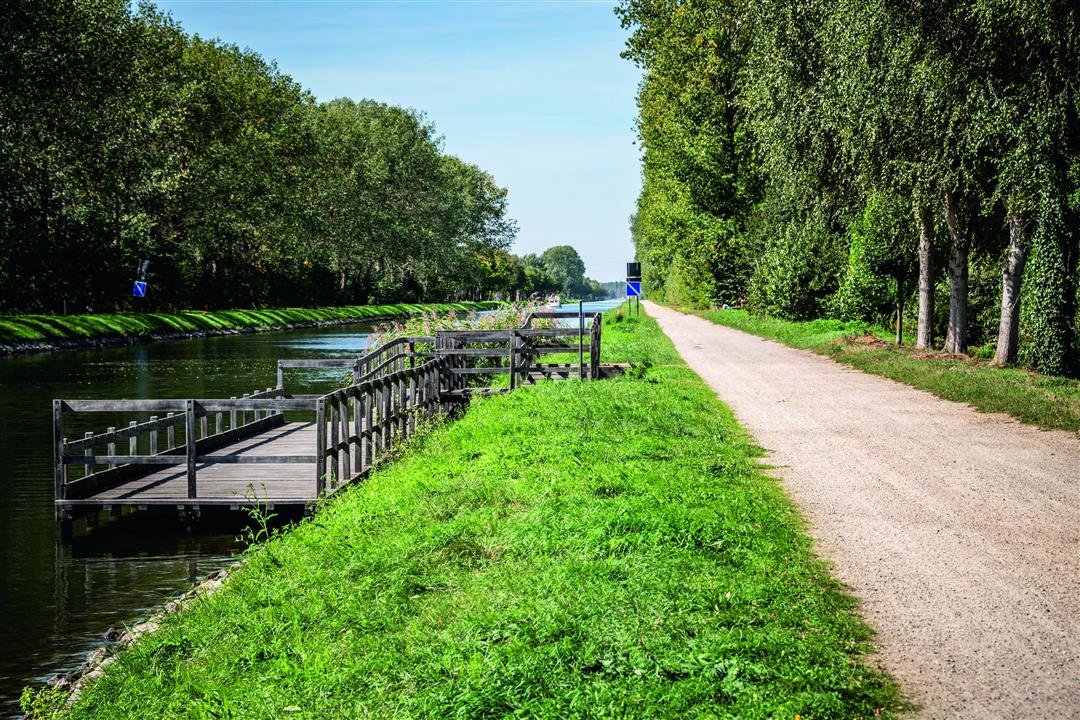
Follow Aert van Beethoven on one of his Sunday walks through Relst. Ludwig van Beethoven’s ancestor made his living here as a farmer five centuries ago. Even back then, the village boasted beautiful estates such as Ter Loonst Castle and Ten Opstal Castle. Aert’s own house is said to have stood just north of Ter Loonst Castle. You’ll walk for a while along the country’s second-oldest canal, the Leuven-Dijle Canal, which opened in 1752.
automatic translation
 nodes to follow
0 km
0.2 km
1.1 km
1.8 km
3.9 km
5.5 km
7.3 km
7.3 km
7.4 km
9 km
9.1 km
Wednesday, January 8, 2025 by R.V.Beautiful route that is about half on unpaved roads. Often between the fields but that sometimes provides wide views. Even in a wet period this walk is just doable. The low planes are typical for the region.
automatic translation
Sunday, December 26, 2021 by K.D.At no place is there a sign! Even at the church of Relst, where the hike starts, there's nothing.
The hike is something for when it hasn't rained for a long time because the small roads and field trails are far too wet in the winter and broken up by tractors and mountain bikers.
automatic translation
Thursday, August 29, 2019 by Eve RoseArticle (in French) about the hike : https://matrotteenclic.wordpress.com/2019/08/29/aert-van-beethovenwandeling-kampenhout/
automatic translation


 Upgrade to Premium Plus
